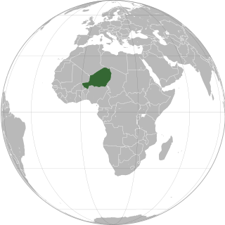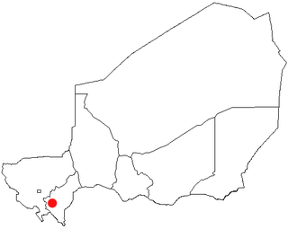
Niger or the Niger, officially the Republic of the Niger, is a country in West Africa. It is a unitary state bordered by Libya to the northeast, Chad to the east, Nigeria to the south, Benin and Burkina Faso to the southwest, Mali to the west, and Algeria to the northwest. It covers a land area of almost 1,270,000 km2 (490,000 sq mi), making it the largest landlocked country in West Africa and the second largest landlocked nation in Africa behind Chad. Over 80% of its land area lies in the Sahara. Its predominantly Muslim population of about 25 million lives mostly in clusters in the south and west of the country. The capital Niamey is located in Niger's southwest corner.

Zinder, formerly also spelled Sinder, is the third largest city in Niger, with a population of 235,605 as by the 2012 census. It is situated 861 km (535 mi) east of the capital Niamey and 240 km (150 mi) north of the Nigerian city of Kano.

Maradi is the second largest city in Niger and the administrative centre of Maradi Region. It is also the seat of the Maradi Department and an Urban Commune.

Tahoua is one of eight Regions of Niger. The capital of the region is the commune of Tahoua. The region covers 106,677 km².

The Region of Maradi is one of seven regions of Niger. It is located in south-central Niger, east of the Region of Tahoua, west of Zinder, and north of the Nigerian city of Katsina. The administrative centre is at Maradi. The population of the Region is predominantly Hausa.

Birni N'Gaouré is a town located in the Dosso Region in southwest Niger. A town of over ten thousand, it is the departmental seat of Boboye Department, and is the main town of the fertile farming region in which it is located. "Birni", in the name of the town, derives from the Hausa language word for a walled city.

The Voulet–Chanoine Mission, also called Central African-Chad Mission, was a French military expedition sent out from Senegal in 1898 to conquer the Chad Basin and unify all French territories in West Africa. This expedition operated jointly with two other expeditions, the Foureau-Lamy and Gentil missions, which advanced from Algeria and Middle Congo respectively. The refusal of the expedition commander and his second-in-command to follow orders from France, their murder of a commanding officer and their subsequent deaths at the hands of their own soldiers cast a dark shadow over France's emerging colonial empire in Africa at the end of the 19th century. The expedition is remembered for its descent into depravity and extreme violence, actions which today would legally be considered war crimes.

Paul-Jules Joalland was a French officer, known mainly for completing the Voulet-Chanoine Mission.

The Trans-Sahelian Highway or TAH 5 is a transnational highway project to pave, improve and ease border formalities on a highway route through the southern fringes of the Sahel region in West Africa between Dakar, Senegal in the west and Ndjamena, Chad, in the east. Alternative names for the highway are the Dakar-Ndjamena Highway or Ndjamena-Dakar Highway and it is Trans-African Highway 5 in the Trans-African Highway network.
Bouza is a town in southwestern Niger. A town of eight thousand, it is the administrative center of Bouza Department, part of Tahoua Region.

Aguie is a town and capital of the Aguie Department in southern Niger, 69 kilometres east of the nation's second largest city, Maradi.

The following outline is provided as an overview of and topical guide to Niger:

Bouza is a department of the Tahoua Region in Niger. Its capital lies at the city of Bouza, and also includes the town of Déoulé. As of 2012, the department had a total population of 445,363 people.

The Sultanate of Damagaram was a Muslim pre-colonial state in what is now southeastern Niger, centered on the city of Zinder.
Konni is a traditional Hausa state in what is today south central Maradi Region Niger and north Sokoto State Nigeria. It continues to exist as a ceremonial polity centered on the Nigerien city of Birni-N'Konni.

Tibiri is a town and urban commune in Niger. As of 2012, it had a population of 125,806. It is the seat of the Sultan of Gobir.
The Maouri people are an ethnic group in western Africa. They are one of the major ethnic groups of Niger, and are concentrated around the Dallol Maouri of the Niger River, extending from Matankari, near Niamey, to Gaya. They are a subgroup of the Hausa people, and speak both the Hausa language and the Djerma language. When using the Zarma language, they are known as the Arawa people.

The Niger–Nigeria border is 1,608 kilometres in length and runs from the tripoint with Benin in the west to the tripoint with Chad in the east.
This article lists events from the year 2020 in Niger.


