Fairfield County is a county in the southwestern corner of the U.S. state of Connecticut. It is the most populous county in the state and was also its fastest-growing from 2010 to 2020. As of the 2020 census, the county's population was 957,419, representing 26.6% of Connecticut's overall population. The closest to the center of the New York metropolitan area, the county contains four of the state's top 7 largest cities—Bridgeport (1st), Stamford (2nd), Norwalk (6th), and Danbury (7th)—whose combined population of 433,368 is nearly half the county's total population.

Southport is a census-designated place (CDP) in the town of Fairfield, Connecticut. It is located along Long Island Sound between Mill River and Sasco Brook, where it borders Westport. As of the 2020 census, it had a population of 1,710. Settled in 1639, Southport center has been designated a local historic district since 1967. In 1971, it was listed on the National Register of Historic Places as the Southport Historic District.

This is intended to be a complete list of the properties and districts on the National Register of Historic Places in Fairfield County, Connecticut, United States. The locations of National Register properties and districts for which the latitude and longitude coordinates are included below may be seen in an online map.

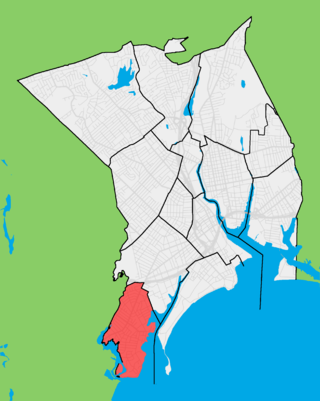
Black Rock is a neighborhood in the southwestern section of the city of Bridgeport, Connecticut. It borders Fairfield and the Ash Creek tidal estuary on the west, the West Side/West End of Bridgeport on the north and east, and Black Rock Harbor and Long Island Sound on the south. Black Rock comprises census tracts 701 and 702 and part of census tract 703. It includes two historic districts listed on the National Register of Historic Places. Residences comprise 86% of properties in Black Rock, 10% are commercial, and 4% are industrial or other property classes.

The history of Bridgeport, Connecticut was, in the late 17th and most of the 18th century, one of land acquisitions from the native inhabitants, farming and fishing. From the mid-18th century to the mid-19th century, Bridgeport's history was one of shipbuilding, whaling and rapid growth. Bridgeport's growth accelerated even further from the mid-19th century to the mid-20th century with the advent of the railroad, Industrialization, massive immigration, labor movements until, at its peak population in 1950, Bridgeport with some 159,000 people was Connecticut's second most populous city. In the late 20th century, Bridgeport's history was one of deindustrialization and declining population, though it overtook Hartford as the state's most populous city by 1980.

The Black Rock Gardens Historic District is a historic district in the Black Rock neighborhood of Bridgeport, Connecticut. It encompasses a small residential development built between 1916 and 1920 to provide housing for workers in war-related industries in the city. It is a well-preserved example of one of several such developments made in the city with funding by the United States Housing Corporation, a government agency. The district was listed on the National Register of Historic Places in 1990.

The Southport Historic District in the town of Fairfield, Connecticut is a 225-acre (91 ha) area historic district that was listed on the National Register of Historic Places in 1971. It preserves a portion of the modern neighborhood and former borough of Southport, Connecticut. Since the British burnt almost all of Southport's structures in 1779, there is only one home built prior to that date, the Meeker House at 824 Harbor Road, which survives.

The Thomas Wheeler House is a historic Colonial home located at 266 Brewster Street, in the village of Black Rock Harbor in Bridgeport, Connecticut.The core of the house may date to as early as 1680. Thomas Wheeler was Black Rock's first white settler. The house, Bridgeport's oldest, is located near the Fayerweather Boat Yard. The roof pitch is in excess of 60 degrees; the framing timbers are exposed on the interior. Abbot Lowell Cummings, Professor Emeritus, American Art, Yale University, observed the restoration work done in the late 1980s, when carpenters uncovered an old casement window frame in a wall during restoration work. The house was recently threatened by the encroachment of a large development in 2006. The Wheeler House is listed on the National Register of Historic Places within the Black Rock Historic District added on March 15, 1979.

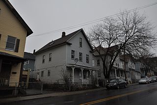
The Sterling Hill Historic District in Bridgeport, Connecticut is a historic district that was listed on the National Register of Historic Places in 1992. The district is a two-block area of 43 urban residential structures dating as far back as 1821. Most of the buildings are from later in the 19th century when the neighborhood was largely occupied by Irish working-class residents. Most of the early buildings are vernacular wood-frame structures with modest Federal, Greek Revival, or Gothic Revival details, while the later additions include multiunit tenement-style buildings. The area includes the oldest urbanized part of the city.

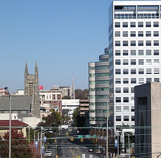
Bridgeport is the most populous city in the U.S. state of Connecticut and the fifth-most populous city in New England, with a population of 148,654 in 2020. Located in eastern Fairfield County at the mouth of the Pequonnock River on Long Island Sound, it is a port city 60 miles (97 km) from Manhattan and 40 miles (64 km) from The Bronx. It is bordered by the towns of Trumbull to the north, Fairfield to the west, and Stratford to the east. Bridgeport and other towns in Fairfield County make up the Greater Bridgeport Planning Region, as well as the Bridgeport-Stamford-Norwalk-Danbury metropolitan statistical area, the second largest metropolitan area in Connecticut. The Bridgeport-Stamford-Norwalk-Danbury metropolis forms part of the New York metropolitan area.

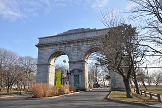
Seaside Park, located in Bridgeport, Connecticut, is a 2.5-mile (4.0 km) long crescent-shaped park bordering Bridgeport Harbor, Long Island Sound, and Black Rock Harbor. The park lies within Bridgeport's South End neighborhood.

The Mary and Eliza Freeman Houses are historic residences in Bridgeport, Connecticut. The simple, clapboard-covered dwellings were built in 1848 in what became known as Little Liberia, a neighborhood settled by free blacks starting in the first quarter of the nineteenth century. As the last surviving houses of this neighborhood on their original foundations, these were added to the National Register of Historic Places on February 22, 1999. The houses are the oldest remaining houses in Connecticut built by free blacks, before the state completed its gradual abolition of slavery in 1848. The homes and nearby Walter's Memorial A.M.E. Zion Church are also listed sites on the Connecticut Freedom Trail.

The Bridgeport Downtown South Historic District encompasses the historic elements of the southern part of downtown Bridgeport, Connecticut. It is 27 acres (11 ha) in size, roughly bordered on the east by Main and Middle Streets, on the north by Elm Street, the west by Broad Street, and the south by Cesar Batalla Way. This area includes the highest concentration of buildings developed in the commercial downtown between about 1840 and the 1930s, the period of the city's major growth as a manufacturing center, and includes a diversity of architectural styles representative of that time period. The district was listed on the National Register of Historic Places in 1987.

The Bridgeport Downtown North Historic District encompasses a portion of the commercial downtown of Bridgeport, Connecticut. It isroughly bounded on the north by Congress Street, the east by Water and Middle Streets, the south by Fairfield Avenue, and the west by Lyon Terrace, roughly the northeastern quadrant of the downtown area. It is one of two large clusters of historically significant commercial and civic buildings encapsulating the city's growth as an urban industrial and regional government center. It was listed on the National Register of Historic Places in 1987.

Bridgeport, Connecticut is a major city of Connecticut located on Long Island Sound at the mouth of the Pequonnock River.

Lambert & Bunnell was a long-lived American architectural firm from Bridgeport, Connecticut, in business from 1860 to 1901. It was established by Edward R. Lambert (1834-1904) and Rufus W. Bunnell (1835-1909).

The Cassidy House is a historic house at 691 Ellsworth Street in Bridgeport, Connecticut. Built in 1849, it is a well-preserved example of early Italianate residential architecture, and the only documented building in the city from that period which retains its original board and batten siding. It was listed on the National Register of Historic Places in 2011.

The Deacon's Point Historic District encompasses a historic 19th-century residential area of eastern Bridgeport, Connecticut. Roughly bounded by Seaview Avenue and Williston, Bunnell and Deacon Streets, the district was first laid out for development shortly after the American Civil War, and contains modest examples of residential architecture dating from 1866 to the early 20th century. The district was listed on the National Register of Historic Places in 1992.

The Division Street Historic District encompasses one of the best-preserved 19th-century residential areas of Bridgeport, Connecticut. Now separated from downtown Bridgeport by the Connecticut Route 25 highway, the area includes a cross-section of 19th-century architectural styles, as well as a diversity of sophistication, from working-class accommodations to high-style Victorian mansions. The district was listed on the National Register of Historic Places in 1982.

The Fairfield County Jail was a historic penal facility at 1106 North Avenue in Bridgeport, Connecticut. Built in 1870-71, it served as a jail and prison for over a century, and was the state's oldest such facility in active use at the time of its listing on the National Register of Historic Places in 1985. It has subsequently been demolished; the property is now home to the more modern facilities of the Bridgeport Correctional Center.


