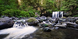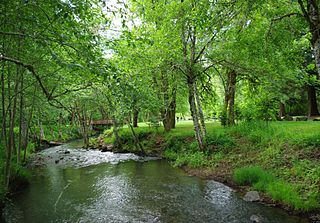
Multnomah Falls is a waterfall located in the Columbia River Gorge, east of Troutdale, between Corbett and Dodson, Oregon, United States. The waterfall is accessible from the Historic Columbia River Highway and Interstate 84. Spanning two tiers on basalt cliffs, it is the tallest waterfall in the state of Oregon at 620 ft (189 m) in height.

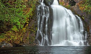
Youngs River Falls is a 54-foot (16 m) tall waterfall on the Youngs River in central Clatsop County, northwestern Oregon, United States. They are located about 10 miles (16 km) south of Astoria.

Toketee Falls is a waterfall in Douglas County, Oregon, United States, on the North Umpqua River at its confluence with the Clearwater River. It is located approximately 58 miles (93 km) east of Roseburg near Oregon Route 138.

Watson Falls is a 272-foot (83 m) waterfall on Watson Creek, a tributary of the Clearwater River, in Douglas County in the U.S. state of Oregon. It is located at an elevation of 3,353 feet (1,022 m).

Prospect State Scenic Viewpoint, is a state park south of the community of Prospect on Oregon Route 62 in Jackson County, in the U.S. state of Oregon. It was formerly known as Mill Creek Falls Scenic Area, a private hiking area that was developed by Willamette Industries along the Rogue River. Both Mill Creek Falls and Pearsony Falls are contained within the area, with Barr Creek Falls close by.

Silver Falls State Park is a state park in the U.S. state of Oregon, located near Silverton, about 20 miles (32 km) east-southeast of Salem. It is the largest state park in Oregon with an area of more than 9,000 acres (36 km2), and it includes more than 24 miles (39 km) of walking trails, 14 miles (23 km) of horse trails, and a 4-mile (6.4 km) bike path. Its 8.7-mile (14.0 km) Canyon Trail/Trail of Ten Falls runs along the banks of Silver Creek and by ten waterfalls, from which the park received its name. Four of the ten falls have an amphitheater-like surrounding that allows the trail to pass behind the flow of the falls. The Silver Falls State Park Concession Building Area and the Silver Creek Youth Camp-Silver Falls State Park are separately listed on the U.S. National Register of Historic Places.

Hole-in-the-Wall Falls, also known as Warren Falls, is a 96-foot man-made waterfall on Warren Creek in Starvation Creek State Park, Hood River County, Oregon, United States. Its main drop is 60 feet. It was created in 1938 when Warren Creek was diverted through a tunnel to prevent washouts of the Columbia River Highway. The creation of the falls shut off a natural cascade known as Warren Creek Falls named after the creek that formed it.

The Clearwater River is a river in Douglas County of the U.S. state of Oregon. It is a roughly 15-mile (24 km) long tributary of the North Umpqua River, located about 50 miles (80 km) east of Roseburg in the Cascade Range.

Coopey Falls is a waterfall on Coopey Creek in the Columbia River Gorge, on the Historic Columbia River Highway in Multnomah County, Oregon. The falls is a horsetail waterfall with a drop of 150 feet (46 m).
Whitehorse Falls is a 14-foot (4.3 m) waterfall on the Clearwater River, in Douglas County in the U.S. state of Oregon. It is located within the Whitehorse Falls Campground, about 4 miles east of Toketee Lake along Oregon Route 138.
Little Niagara Falls, is a waterfall located on the Salmon River at the south skirt of the Mount Hood National Forest, in Clackamas County, in the U.S. state of Oregon. It is located in a privileged area where the river creates several waterfalls: Final Falls, Vanishing Falls, Frustration Falls, and Copper Creek Falls are within a mile from Little Niagara Falls; while Hideaway Falls, Split Falls, and Stein Falls are approximately two miles away.

Paulina Creek Falls is a cascade and plunge waterfall from a streambed draining from Paulina Lake in Newberry National Volcanic Monument, south of Bend, Oregon. The waterfall is notable for its side-by-side drop of 80 feet (24 m) that surrounds a small island at the edge of the cliff.

Upper Butte Creek Falls, is a waterfall located in the south edge of the Table Rock Wilderness at the east end of the city of Salem, in Marion County, in the U.S. state of Oregon. It is located in a privileged area on the east foothills of Drake Crossing. Several prominent rivers and waterfalls are located in the Butte Creek Falls trail system.

Wizard Falls, was a waterfall located in Jefferson County, in the U.S. state of Oregon. It was located in a privileged area on the northwest foothills of Deschutes National Forest, just north of Black Butte and the city of Sisters, Oregon. To the west sits volcano Three Fingered Jack, between Mount Washington to the South and Mount Jefferson to the North.
Wilson Falls, is a waterfall located in Tillamook County, in the U.S. state of Oregon. It is located in a secluded area on the heart of the Tillamook State Forest, just south of Smith Homestead Forest and north of the community of Jordan Creek. The waterfall follows the Wilson River Trail and the Footbridge Trailhead, a short distance from Oregon Route 6.
Ayers Falls, is a waterfall located on the outside edge of Santiam State Forest near Mehama, in Marion County, in the U.S. state of Oregon. It is located in an area on the west foothills where Mount Hood National Forest meets with the Middle Santiam Wilderness.

Baker Creek Falls, is a waterfall located at the east end of the city of McMinnville, in Yamhill County, in the U.S. state of Oregon. It is located off Baker Creek Road on the north skirt of Slide Mountain, five miles upstream from Ed Grenfell Park and the Miller Woods Conservation Area. Other waterfalls surround Baker Creek, including Burton Creek Falls, Slide Mountain Falls and Gilbert Creek Falls; all of difficult access or located within private properties.
Beaver Creek Falls, is a small waterfall located at the confluence of Beaver and Sweet Creeks in Lane County, in the U.S. state of Oregon. The waterfall is known for joining of the two creeks becoming one intertwined waterfall.
Bonnie Falls, also called Scappoose Falls is a small waterfall located in Columbia County, in the U.S. state of Oregon. The waterfall is known for a fish ladder that bypasses the waterfall to assist fish navigate the waterfall.
Clover Falls, also known in the past as Upper Hemlock Falls, is a waterfall from the Hemlock Creek, in the heart of the Umpqua National Forest, just north of Hemlock Lake and its campground, in Douglas County, Oregon. Access to Clover Falls is from the Lake of the Woods campground. The waterfall is located in a privileged natural area where the river creates several waterfalls; Hemlock Falls, Yakso Falls, and Tributary Falls are within a mile distance.


