Charleston, Utah

Last updated

Charleston, Utah
Charleston Utah Town Hall.jpeg
Charleston Town Hall
UTMap-doton-Charleston.PNG
Location of Charleston, Utah
Coordinates: 40°28′1″N111°28′7″W / 40.46694°N 111.46861°W / 40.46694; -111.46861
Country United States
State Utah
County Wasatch
Settled1858
Founded byAaron Daniels
Named for Charles Shelton
Area
[1]
  Total3.07 sq mi (7.95 km2)
  Land2.86 sq mi (7.41 km2)
  Water0.21 sq mi (0.54 km2)
Elevation
5,440 ft (1,658 m)
Population
 (2010)
  Total415
  Estimate 
(2019) [2]
487
  Density170.10/sq mi (65.68/km2)
Time zone UTC-7 (Mountain (MST))
  Summer (DST) UTC-6 (MDT)
ZIP code
84032
Area code 435
FIPS code 49-12420 [3]
GNIS feature ID1426539 [4]
Website www.charlestonutah.org

Charleston is a town in Wasatch County, Utah, United States. The population was 436 at the 2020 census. [5]

Contents

The community was named after Charles Shelton, a first settler. [6]

Geography

According to the United States Census Bureau, the town has a total area of 1.9 square miles (4.9 km2), of which 1.7 square miles (4.4 km2) is land, and 0.2 square miles (0.52 km2), or 10.16%, is water.

History

In 1858, trapper Aaron Daniels moved to a place on the Provo River just north of where Charleston is today. [7]

The first farmers put in crops at Charleston in 1859, and the first houses were built by George Noakes and William Manning late that year near Noakes springs. Manning and George Noakes were the only residents until 1863 when a few others moved in. In 1866, there were about a dozen families, and after that, the population began to grow even faster. [7]

Noakes was the first Presiding elder in Charleston. Until 1877, the branch was part of the Heber Ward. The Charleston Ward was formed in July 1877, with Nymphus C. Murdock as bishop. The ward had 397 members in 1930, with 467 people living within the ward boundaries. [7]

Demographics

Historical population
CensusPop.Note
1880 246
1890 501103.7%
1900 490−2.2%
1910 5246.9%
1920 361−31.1%
1930 343−5.0%
1940 323−5.8%
1950 201−37.8%
1960 22310.9%
1970 196−12.1%
1980 32063.3%
1990 3365.0%
2000 37812.5%
2010 4159.8%
2019 (est.)487 [2] 17.3%
U.S. Decennial Census [8]

As of the census [3] of 2000, there were 378 people, 120 households, and 101 families residing in the town. The population density was 225.5 people per square mile (87.1/km2). There were 131 housing units at an average density of 78.2 per square mile (30.2/km2). The racial makeup of the town was 97.88% White, 0.26% African American, and 1.85% from two or more races. Hispanic or Latino of any race were 5.03% of the population.

There were 120 households, out of which 48.3% had children under the age of 18 living with them, 75.0% were married couples living together, 7.5% had a female householder with no husband present, and 15.8% were non-families. Of all households 12.5% were made up of individuals, and 4.2% had someone living alone who was 65 years of age or older. The average household size was 3.15 and the average family size was 3.49.

In the town, the population was spread out, with 33.9% under the age of 18, 7.7% from 18 to 24, 23.5% from 25 to 44, 24.1% from 45 to 64, and 10.8% who were 65 years of age or older. The median age was 37 years. For every 100 females, there were 98.9 males. For every 100 females age 18 and over, there were 96.9 males.

The median income for a household in the town was $42,813, and the median income for a family was $44,063. Males had a median income of $40,125 versus $24,167 for females. The per capita income for the town was $21,836. About 2.2% of families and 3.1% of the population were below the poverty line, including 4.2% of those under age 18 and 3.6% of those age 65 or over.

Related Research Articles

<span class="mw-page-title-main">Hollywood, South Carolina</span> Town in South Carolina, United States

Hollywood is a town in Charleston County, South Carolina, United States. The population was 4,714 at the 2010 census, up from 3,946 in 2000. Hollywood is part of the Charleston, South Carolina metropolitan area and the Charleston-North Charleston Urbanized Area.

<span class="mw-page-title-main">Garland, Utah</span> City in Utah, United States

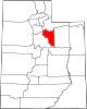
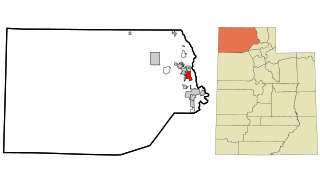
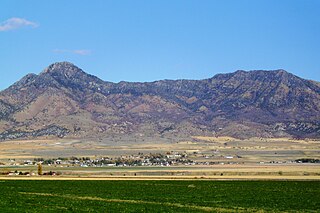
Garland is a city in northeastern Box Elder County, Utah, United States. The population was 2,589 at the 2020 census.

<span class="mw-page-title-main">Honeyville, Utah</span> City in Utah, United States

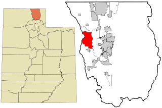
Honeyville is a city near the eastern edge of Box Elder County, Utah, United States. The population was 1,606 as of the 2020 census.

<span class="mw-page-title-main">Plymouth, Utah</span> Town in Utah, United States

Plymouth is a town in Box Elder County, Utah, United States. The population was 414 at the 2010 census.

<span class="mw-page-title-main">Amalga, Utah</span> Town in the state of Utah, United States

Amalga is a town in Cache County, Utah, United States. The population was 488 at the 2010 census. It is included in the Logan, Utah-Idaho (partial) Metropolitan Statistical Area.

<span class="mw-page-title-main">Cornish, Utah</span> Town in the state of Utah, United States

Cornish is a town in Cache County, Utah, United States. The population was 288 at the 2010 census. It is included in the Logan, Utah-Idaho (partial) Metropolitan Statistical Area.

<span class="mw-page-title-main">Peter, Utah</span> Census-designated place in Utah, United States

Petersboro is a census-designated place (CDP) on the west-central edge of Cache County, Utah, United States. The population was 324 at the 2010 census. It is included in the Logan, Utah-Idaho (partial) Metropolitan Statistical Area.

<span class="mw-page-title-main">Garden City, Utah</span> Town in the state of Utah, United States

Garden City is a town in northwestern Rich County, Utah, United States. The population was 562 at the 2010 census. Garden City sits on the shores of Bear Lake and is a popular summer resort destination town, thus nicknamed the "Caribbean of the Rockies”.

<span class="mw-page-title-main">Sterling, Utah</span> Town in Utah, United States

Sterling is a town in Sanpete County, Utah, United States. The population was 235 at the 2000 census.

<span class="mw-page-title-main">Joseph, Utah</span> Town in the state of Utah, United States

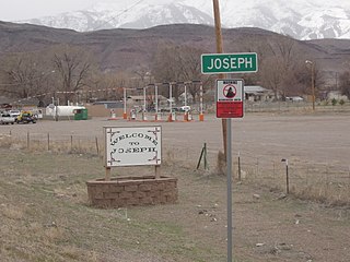
Joseph is a town in Sevier County, Utah, United States. The population was 269 at the 2000 census. The town was named for Joseph Angell Young, an apostle of the Church of Jesus Christ of Latter-day Saints. Joseph was settled in 1871.

<span class="mw-page-title-main">Redmond, Utah</span> Town in the state of Utah, United States

Redmond is a town in Sevier County, Utah, United States. The population was 730 at the 2010 census. Redmond was first settled in 1876, and named for red mounds to the west of the town.

<span class="mw-page-title-main">Sigurd, Utah</span> Town in the United States

Sigurd is a town in Sevier County, Utah, United States. The population was 429 at the 2010 census.

<span class="mw-page-title-main">Henefer, Utah</span> Town in Utah, United States

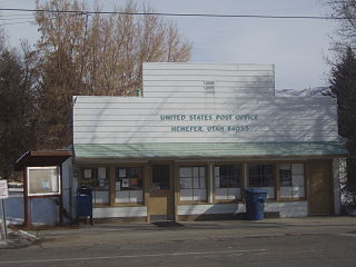
Henefer is a town in Summit County, Utah, United States. It is part of the Salt Lake City, Utah Metropolitan Statistical Area. The population was 766 at the 2010 census.

<span class="mw-page-title-main">Cedar Fort, Utah</span> Town in Utah, United States

Cedar Fort is a town in Utah County, Utah, United States. It is part of the Provo–Orem Metropolitan Statistical Area. The population was 368 at the 2010 census.

<span class="mw-page-title-main">Elk Ridge, Utah</span> City in Utah, United States

Elk Ridge is a city in Utah County, Utah, United States. Named for a herd of elk that wintered in the area, it is part of the Provo–Orem, Utah Metropolitan Statistical Area. The population was 4,687 at the time of the 2020 census. Elk Ridge became a fifth-class city by state law in November 2000.

<span class="mw-page-title-main">Genola, Utah</span> Town in Utah, United States

Genola is a town in Utah County, Utah, United States. It is part of the Provo–Orem Metropolitan Statistical Area. The population was 1,370 at the 2010 census.

<span class="mw-page-title-main">Palmyra, Utah</span> CDP in Utah, United States

Palmyra is a census-designated place (CDP) in Utah County, Utah, United States. It is part of the Provo–Orem Metropolitan Statistical Area. The population was 491 at the 2010 census. Palmyra is located directly west of Springville and northwest of Spanish Fork.

<span class="mw-page-title-main">Woodland Hills, Utah</span> City in Utah, United States

Woodland Hills is a city in Utah County, Utah, United States. It is part of the Provo–Orem Metropolitan Statistical Area. The population was 1,521 at the 2020 census. Woodland Hills became a city at the end of 2000.

<span class="mw-page-title-main">Toquerville, Utah</span> City in Utah, United States

Toquerville is a city in east–central Washington County, Utah, United States. The population was 1,370 at the 2010 census.

<span class="mw-page-title-main">Lyman, Utah</span> Town in the state of Utah, United States

Lyman is a town along State Route 24 in Wayne County, Utah, United States. The population was 258 at the 2010 census.

References

  1. "2019 U.S. Gazetteer Files". United States Census Bureau. Retrieved August 7, 2020.
  2. 1 2 "Population and Housing Unit Estimates". United States Census Bureau. May 24, 2020. Retrieved May 27, 2020.
  3. 1 2 "U.S. Census website". United States Census Bureau . Retrieved January 31, 2008.
  4. "US Board on Geographic Names". United States Geological Survey. October 25, 2007. Retrieved January 31, 2008.
  5. "Explore Census Data". data.census.gov. Retrieved May 1, 2024.
  6. The Utah Genealogical and Historical Magazine, Volumes 9-10. 1918. p. 83.
  7. 1 2 3 Jenson, Andrew. Encyclopedic History of the Church of Jesus Christ of Latter-day Saints. (Salt Lake City: Deseret News Publishing Company, 1941), p. 132
  8. "Census of Population and Housing". Census.gov. Retrieved June 4, 2015.