Chase, Pennsylvania | |
|---|---|
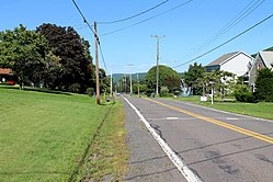 Street in Chase | |
 Chase Location in Pennsylvania  Chase Location in the United States | |
| Coordinates: 41°17′5″N75°57′46″W / 41.28472°N 75.96278°W | |
| Country | United States |
| State | Pennsylvania |
| County | Luzerne |
| Township | Jackson |
| Area | |
• Total | 2.29 sq mi (5.94 km2) |
| • Land | 2.29 sq mi (5.93 km2) |
| • Water | 0.00 sq mi (0.01 km2) |
| Population | |
• Total | 928 |
| • Density | 405.24/sq mi (156.48/km2) |
| Time zone | UTC-5 (Eastern (EST)) |
| • Summer (DST) | UTC-4 (EDT) |
| ZIP code | 18708 [3] |
| Area code | 570 |
| FIPS code | 42-12864 |
Chase is a census-designated place (CDP) in Jackson Township, Luzerne County, Pennsylvania, United States. The CDP population was 978 at the 2010 census. [4]
