Ebervale, Pennsylvania

Last updated

Ebervale, Pennsylvania
Unincorporated community
PA 940 wb in Ebervale, July 2023.jpg
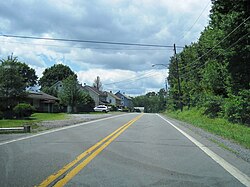
Looking west along PA 940
USA Pennsylvania location map.svg
Red pog.svg
Ebervale
Usa edcp location map.svg
Red pog.svg
Ebervale
Coordinates: 40°59′10″N75°56′29″W / 40.98611°N 75.94139°W / 40.98611; -75.94139
Country United States
State Pennsylvania
County Luzerne
Township Hazle
Elevation
1,542 ft (470 m)
Time zone UTC-5 (Eastern (EST))
  Summer (DST) UTC-4 (EDT)
ZIP code
18223
Area code(s) 570 and 272
GNIS feature ID1173962 [1]

Ebervale is an unincorporated community located in Hazle Township in Luzerne County, Pennsylvania. Ebervale is located along Pennsylvania Route 940, northeast of Hazleton and west of Jeddo. [2] The village takes its name from an Anglicization of the place name Ebbw Vale, a town in Wales.

Related Research Articles

<span class="mw-page-title-main">Pennsylvania Route 940</span> State highway in Pennsylvania, US

Pennsylvania Route 940 is a 43.2-mile-long (69.5 km) Pennsylvania highway located in the Pocono Mountains. It runs from PA 309 in Hazleton east to PA 191 in Paradise Valley. Large segments of PA 940 are located in densely forested areas. The route heads northeast through Luzerne County from Hazleton, passing through Freeland and coming to an interchange with Interstate 80 (I-80) in White Haven. From here, PA 940 turns east and runs a short distance north of I-80, coming to an interchange with both I-80 and I-476 in northern Carbon County. The route continues through Monroe County and passes through Pocono Pines before it has an interchange with I-380. PA 940 passes through Mount Pocono prior to continuing to its eastern terminus.

<span class="mw-page-title-main">Tobyhanna State Park</span>

Tobyhanna State Park is a Pennsylvania state park on 5,440 acres (2,201 ha) mostly in Coolbaugh Township, Monroe County, with a small portion of the park in Dreher and Lehigh townships in Wayne County, all in Pennsylvania in the United States. The park includes the 170-acre (69 ha) Tobyhanna Lake and a portion of Tobyhanna Creek. It is located 2.1 miles (3.4 km) north of the town of Tobyhanna, with the main park entrance on Pennsylvania Route 423, and a portion that borders on Pennsylvania Route 196. The park lies immediately adjacent to Gouldsboro State Park, Pennsylvania State Game Lands 312, and State Game Land 127.

<span class="mw-page-title-main">Locust Lake State Park</span>

Locust Lake State Park is a Pennsylvania state park on 1,089 acres (441 ha) in Ryan Township, Schuylkill County, Pennsylvania in the United States. Locust Lake State Park is located approximately 7 miles (11 km) north of Pottsville, 3 miles (5 km) south of Mahanoy City, 8 miles (13 km) west of Tamaqua and 6 miles (10 km) west of Tuscarora State Park. The lake is 52 acres (21 ha). The park offers hiking, camping, boating, fishing, swimming, biking, and a wide array of other seasonal activities.

<span class="mw-page-title-main">Nescopeck State Park</span>

Nescopeck State Park is a Pennsylvania state park on 3,550 acres (1,437 ha) in Butler and Dennison Townships, Luzerne County, Pennsylvania. The park is one of the newest state parks in Pennsylvania. In the early 1970s, the state acquired 164 properties which made up the park. The park's Environmental Education Center is one of its newest additions; it opened in April 2005. Nescopeck Creek runs through the valley between Mount Yeager and Nescopeck Mountain. The park is near Interstate 80 just off Pennsylvania Route 309.

<span class="mw-page-title-main">Gouldsboro State Park</span> State park in Monroe and Wayne counties, Pennsylvania

Gouldsboro State Park is a 2,880-acre (1,165 ha) Pennsylvania state park in Coolbaugh Township, Monroe County and Lehigh Township, Wayne County, Pennsylvania in the United States. The park includes the 250-acre (100 ha) Gouldsboro Lake. Gouldsboro State Park is located very close to Tobyhanna State Park and Pennsylvania State Game Lands 127 and 312. It is on Pennsylvania Route 507 near the small village of Gouldsboro.

<span class="mw-page-title-main">Huntington Creek (Pennsylvania)</span>

Huntington Creek is a tributary of Fishing Creek in Luzerne and Columbia counties, Pennsylvania, in the United States. It is approximately 29.5 miles (47.5 km) long.

<span class="mw-page-title-main">Luzerne, Michigan</span> Unincorporated community in Michigan, United States

Luzerne is an unincorporated community in Oscoda County in the U.S. state of Michigan. The community is located within Big Creek Township. As an unincorporated community, Luzerne has no legally defined boundaries or population statistics of its own but does have its own post office with the 48636 ZIP Code.

The 118th Pennsylvania House of Representatives District is located in northeastern Pennsylvania. The district has been represented by Democrat Jim Haddock since 2023.

<span class="mw-page-title-main">National Register of Historic Places listings in Luzerne County, Pennsylvania</span>

This is a list of the National Register of Historic Places listings in Luzerne County, Pennsylvania.

<span class="mw-page-title-main">Little Shickshinny Creek</span> Tributary in Pennsylvania, United States

Little Shickshinny Creek is a tributary of Shickshinny Creek in Columbia County and Luzerne County, in Pennsylvania, United States. It is 9.5 miles (15.3 km), nearly as long as Shickshinny Creek itself. The creek flows through Briar Creek Township, Columbia County; Salem Township, Luzerne County; and the borough of Shickshinny, in Luzerne County. It is designated as a high-quality coldwater fishery. Pennsylvania State Game Lands #55 and #260 are in the creek's watershed. The watershed has an area of 9.8 square miles, which includes swamps and forests. Waterfalls known as the Little Shickshinny Creek Falls are located on the creek.

Sugarloaf Creek is a tributary of Tomhicken Creek in Luzerne County and Schuylkill County, in Pennsylvania, in the United States. It is approximately 3.5 miles (5.6 km) long and flows through Hazle Township and Black Creek Township in Luzerne County and North Union Township in Schuylkill County.

Shingle Run is a tributary of Huntington Creek in Luzerne County, Pennsylvania, in the United States. It is approximately 1.8 miles (2.9 km) long and flows through Ross Township. The watershed of the stream has an area of 1.83 square miles (4.7 km2) and it has no tributaries. The stream is considered to be Class A Wild Trout Waters for its entire length. Additionally, it is listed in the Luzerne County Natural Areas Inventory. Various species of butterfly inhabit the stream's vicinity. Trees in the area include hemlocks and yellow birches. The stream is small, but nevertheless is perennial.

<span class="mw-page-title-main">Marsh Run</span> Stream in Pennsylvania, United States

Marsh Run is a tributary of Coles Creek in Luzerne County and Columbia County, in Pennsylvania, in the United States. It is approximately one mile (1.6 km) long and flows through Fairmount Township in Luzerne County and Sugarloaf Township in Columbia County. The stream's watershed has an area of 0.44 square miles (1.1 km2). Wild trout reproduce throughout the stream. It is named after marshes, which can be found in the vicinity of the stream. Alluvium and Wisconsinian Outwash area also present, as is bedrock consisting of sandstone and shale. The stream has one unnamed tributary.

<span class="mw-page-title-main">Roaring Brook (Hunlock Creek tributary)</span> River

Roaring Brook is a tributary of Hunlock Creek in Luzerne County, Pennsylvania, in the United States. It is approximately 5.0 miles (8.0 km) long and flows through Ross Township and Hunlock Township. The watershed of the stream has an area of 6.17 square miles (16.0 km2). It has one named tributary, which is known as Lewis Run. Additionally, a dammed pond known as Harris Pond is located at the stream's headwaters. The Roaring Brook Swamp, which is listed as a Locally Significant Area on the Luzerne County Natural Areas Inventory, is also located in the watershed.

Scotch Run (also known as Scotch Run Creek is a tributary of Black Creek in Luzerne County, Pennsylvania, in the United States. It is approximately 1.6 miles long and flows through Black Creek Township. The stream is fed by springs and is located at the base of Nescopeck Mountain. It has not been assessed by the Pennsylvania Fish and Boat Commission.

Alden is an unincorporated community in Newport Township in Luzerne County, Pennsylvania, United States. Alden is located at the intersection of Kirmar Avenue, Alden Mountain Road, and Robert Street, southwest of Nanticoke.

<span class="mw-page-title-main">Drifton, Pennsylvania</span> Unincorporated community in Pennsylvania, United States

Drifton is an unincorporated community located in Hazle Township in Luzerne County, Pennsylvania. Drifton is located along Pennsylvania Route 940, northwest of Jeddo and southwest of Freeland.

<span class="mw-page-title-main">Milnesville, Pennsylvania</span> Unincorporated community in Pennsylvania, United States

Milnesville is an unincorporated community located in Hazle Township in Luzerne County, Pennsylvania. Milnesville is located along Pennsylvania Route 309, a short distance south of the Airport Beltway intersection to the north of Hazleton.

Saint Johns is an unincorporated community located in Butler Township in Luzerne County, Pennsylvania. Saint Johns is located at the intersection of St. Johns Road and Mill Mountain Road to the north of Hazleton.

Rock Glen is an unincorporated community located in Black Creek Township in Luzerne County, Pennsylvania. Rock Glen is located along Tomhicken Road and the Black Creek, west of Hazleton and south of Nescopeck.

References

  1. "Ebervale". Geographic Names Information System . United States Geological Survey, United States Department of the Interior.
  2. Luzerne County, Pennsylvania Highway Map (PDF) (Map). PennDOT. 2016. Archived from the original (PDF) on January 15, 2018. Retrieved June 19, 2017.