Butler Township, Luzerne County, Pennsylvania

Last updated

Butler Township,
Luzerne County,
Pennsylvania
Butler Township LuzCo PA St. Johns UCC.jpg
St. John's United Church of Christ in Butler Township
Map of Luzerne County, Pennsylvania Highlighting Butler Township.PNG
Map of Luzerne County highlighting Butler Township
Map of Pennsylvania highlighting Luzerne County.svg
Map of Pennsylvania highlighting Luzerne County
Country United States
State Pennsylvania
County Luzerne
Area
[1]
  Total33.61 sq mi (87.06 km2)
  Land33.36 sq mi (86.40 km2)
  Water0.25 sq mi (0.65 km2)
Population
 (2020) [2]
  Total9,469 Increase2.svg
  Estimate 
(2021) [2]
9,651
  Density289.02/sq mi (111.59/km2)
Time zone UTC-5 (Eastern (EST))
  Summer (DST) UTC-4 (EDT)
FIPS code 42-079-10480
Website butlertownship.org

Butler Township is a township in Luzerne County, Pennsylvania, United States. The population was 9,469 at the 2020 census. [2]

Contents

History

Founding

An old map of Butler Township ButlerTwp.OldMap.jpg
An old map of Butler Township

The township is named after Col. Zebulon Butler; he is most famous for his action at the Battle of Wyoming, which resulted in his defeat by British-allied forces. Butler lost 340 men while attacking a superior force of Loyalists and Iroquois. In 1839, Butler Township was formed from a section of Sugarloaf Township. The southern portion of Butler Township was transferred over to Hazle Township in 1861. [3]

Drums Village

18th century

Drums is an unincorporated community in Butler Township. The village was named after the Drum family, whose members developed the village's first school, post office, hotels, churches, roads, and businesses. Family members held positions as pioneers, land developers, justices of the peace, postmasters, school presidents, educators, tailors, shoe makers, hotel proprietors, lawyers, and Pennsylvania state legislators. [4]

In 1738, Philip Drum, aged 36, immigrated to America from Germany with his eight-year-old son Jacob. In 1749, Jacob married Catharine Strauss, who gave birth to a son, George, on June 12, 1762, in Williams Township, Northampton County. According to the 1790 United States Federal Census, George Drum lived in "Allen Township" (now West Bethlehem) during the 1790s before moving his family to the Nescopeck Valley (now Sugarloaf Valley). [5] While in the valley, he established a hotel business and eventually established the towns of Drums and Conyngham. [6] [7] [8] [9] [10] [11]

19th century

In 1808, Philip Drum (son of George Sr.) bought land in Luzerne County from Benjamin Rush, [12] who was a close advisor to George Washington during the American Revolutionary War [13] and signed the United States Declaration of Independence. [7] In 1810, Philip established Drums' first carding mill on the Little Nescopeck River. In addition, Philip established the first wool-processing mill in 1835; it was located a short distance from the carding mill. [14] In 1814, George's second son, George Jr. (born Oct. 16, 1792), bought land next to his brother Philip. [12] Philip bought additional land in 1814, 1826, 1836, and 1847. George Sr., George Jr., Philip, and other Drum family members owned vast acreage of land in Drums, Conyngham, and surrounding counties. George Drum's two century old estate still stands in immaculate condition in Conyngham and is a fine example of colonial architecture. George Sr. and George Jr. both died in 1831. On February 27, 1858, Philip died at the age of 71 in Drums, Butler Township. [7]

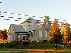
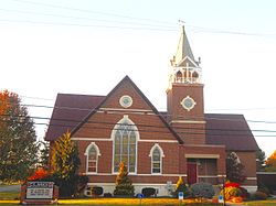
Further community and land development by family members made Drums and St. Johns the commercial centers of Butler Township. Drums is the principal village of the township. [14]

Recent history

The Luzerne County Fresh Air Camp was listed on the National Register of Historic Places in 2004. [15]

Geography

Interstate 80 westbound near Butler Westbound (3) (15578015405).jpg
Interstate 80 westbound near Butler
Luzerne County Fresh Air Camp dormitory LUZERNE COUNTY FRESH AIR CAMP; LUZERNE COUNTY, PA.jpg
Luzerne County Fresh Air Camp dormitory
Hazleton Area School District is located in the southern portion of Luzerne County. Map of Luzerne County Pennsylvania School Districts.png
Hazleton Area School District is located in the southern portion of Luzerne County.

According to the United States Census Bureau, the township has a total area of 33.6 square miles (87.1 km2), of which 33.4 square miles (86.4 km2) is land and 0.27 square miles (0.7 km2), or 0.75%, is water. [16] It is drained by Nescopeck Creek westward into the Susquehanna River. Lake of the Four Seasons is a body of water located in the eastern portion of the township.

Butler Township is a mostly rural community consisting of farmland and forests. It is located mainly in the Sugarloaf Valley between Nescopeck Mountain to the north and Buck Mountain to the south. Its villages include Beech Mountain Lakes, Drums, Edgewood, Kis-Lyn, Nescopeck Pass (also in Dorrance Township), St. Johns, and Sand Spring.

Climate

Butler Township has a warm-summer humid continental climate (Dfb) and the hardiness zone is 6a. Average monthly temperatures in St. Johns range from 25.4 °F in January to 70.8 °F in July.

Transportation

Education

Hazleton Area School District operates public schools in the township. They include: [17]

Hazleton Area High School in Hazle Township is the zoned high school for all Butler Township residents.

Neighboring municipalities

Weather

Butler Township during winter Walled (8418261483).jpg
Butler Township during winter

2005 Butler Township weather summary

2006 weather summary

2007 weather summary

Demographics

Historical population
CensusPop.Note
2000 7,166
2010 9,22128.7%
2020 9,4692.7%
2021 (est.)9,651 [2] 1.9%
[18]
St. John's Lutheran Church in Butler Township Butler Township LuzCo PA St. Johns Lutheran.jpg
St. John's Lutheran Church in Butler Township

As of the census [19] of 2000, there were 7,166 people, 2,523 households, and 1,899 families residing in the township. The population density was 215.2 inhabitants per square mile (83.1/km2). There were 2,747 housing units at an average density of 82.5 per square mile (31.9/km2). The racial makeup of the township was 92.69% White, 5.67% African American, 0.15% Native American, 0.50% Asian, 0.01% Pacific Islander, 0.39% from other races, and 0.59% from two or more races. Hispanic or Latino of any race were 1.79% of the population.

There were 2,523 households, out of which 32.1% had children under the age of 18 living with them, 64.4% were married couples living together, 7.2% had a female householder with no husband present, and 24.7% were non-families. 20.6% of all households were made up of individuals, and 8.9% had someone living alone who was 65 years of age or older. The average household size was 2.54 and the average family size was 2.93.

In the township the population was spread out, with 23.5% under the age of 18, 9.1% from 18 to 24, 27.3% from 25 to 44, 25.5% from 45 to 64, and 14.6% who were 65 years of age or older. The median age was 39 years. For every 100 females, there were 100.1 males. For every 100 females age 18 and over, there were 97.5 males.

The median income for a household in the township was $46,783, and the median income for a family was $53,958. Males had a median income of $38,926 versus $23,299 for females. The per capita income for the township was $21,020. About 3.2% of families and 10.3% of the population were below the poverty line, including 2.7% of those under age 18 and 6.1% of those age 65 or over.

Notable people

See also

Related Research Articles

<span class="mw-page-title-main">Luzerne County, Pennsylvania</span> County in Pennsylvania, United States

Luzerne County is a county in the Commonwealth of Pennsylvania. According to the United States Census Bureau, the county has a total area of 906 square miles (2,350 km2), of which 890 square miles (2,300 km2) is land and 16 square miles (41 km2) is water. It is Northeastern Pennsylvania's second-largest county by total area. As of the 2020 census, the population was 325,594, making it the most populous county in the northeastern part of the state. The county seat and largest city is Wilkes-Barre. Other populous communities include Hazleton, Kingston, Nanticoke, and Pittston. Luzerne County is included in the Scranton–Wilkes-Barre–Hazleton Metropolitan Statistical Area, which has a total population of 555,426 as of 2017.

<span class="mw-page-title-main">Banks Township, Carbon County, Pennsylvania</span> Township in Pennsylvania, United States

Banks Township is a township in Carbon County, Pennsylvania. It is part of Northeastern Pennsylvania.

<span class="mw-page-title-main">Conyngham, Pennsylvania</span> Borough in Pennsylvania, United States

Conyngham is a borough in Luzerne County, Pennsylvania, United States. The population was 1,820 at the 2020 census.

<span class="mw-page-title-main">Conyngham Township, Luzerne County, Pennsylvania</span> Township in Pennsylvania

Conyngham Township is a township in Luzerne County, Pennsylvania, United States. The population was 1,309 at the 2020 census.

<span class="mw-page-title-main">Hazle Township, Luzerne County, Pennsylvania</span> Township in Pennsylvania, United States

Hazle Township is a township in Luzerne County, Pennsylvania, United States. The population was 10,150 at the time of the 2020 census. The township surrounds the city of Hazleton and the borough of West Hazleton.

<span class="mw-page-title-main">Hazleton, Pennsylvania</span> City in Pennsylvania, United States

Hazleton is a city in Luzerne County, Pennsylvania, United States. The population was 29,963 at the 2020 census. Hazleton is the second largest city in Luzerne County. It was incorporated as a borough on January 5, 1857, and as a city on December 4, 1891.

<span class="mw-page-title-main">Hollenback Township, Luzerne County, Pennsylvania</span> Township in Pennsylvania, United States

Hollenback Township is a township which is located in Luzerne County, Pennsylvania, United States. The population was 1,125 at the time of the 2020 census.

<span class="mw-page-title-main">Nescopeck, Pennsylvania</span> Borough in Pennsylvania, United States

Nescopeck is a borough in Luzerne County, Pennsylvania, United States. The population was 1,480 as of the 2020 census.

<span class="mw-page-title-main">Nescopeck Township, Pennsylvania</span> Township in Pennsylvania, United States

Nescopeck Township is a township in Luzerne County, Pennsylvania, United States. As of the 2020 census, the township population was 1,080.

<span class="mw-page-title-main">Sugarloaf Township, Luzerne County, Pennsylvania</span> Township in Pennsylvania, United States

Sugarloaf Township is a townshipthat is located in Luzerne County, Pennsylvania, United States. The population was 3,879 at the time of the 2020 census.

<span class="mw-page-title-main">Kline Township, Schuylkill County, Pennsylvania</span> Township in Pennsylvania, United States

Kline Township is a township in Schuylkill County, Pennsylvania. The population was 1,473 at the 2020 census.

<span class="mw-page-title-main">McAdoo, Pennsylvania</span> Borough in Schuylkill County, Pennsylvania, U.S.

McAdoo is a borough and coal town in Schuylkill County, Pennsylvania, United States, 5 miles (8.0 km) south of Hazleton and seven miles north of Tamaqua. McAdoo contains the picturesque Silver Brook Meadow. In the past, anthracite coal mining and a shirt factory, the McAdoo Manufacturing Company, provided gainful employment to the populace. The population was 2,477 at the 2020 census.

<span class="mw-page-title-main">Pennsylvania Route 93</span> State highway in Pennsylvania, US

Pennsylvania Route 93 is a 41-mile-long (66 km) state route located in Carbon, Luzerne, and Columbia counties in northeastern Pennsylvania. The southern terminus is at U.S. Route 209 in Nesquehoning, about halfway from PA just north of the 1800s community of Lausanne Landing, the southern toll station of the Lausanne & Nescopeck Turnpike (1804)—along whose path the highway was built. The northern terminus of the route is at PA 487 in Orangeville, the part of the road west of the Susquehanna and Berwick once being part of the Susquehanna & Tioga Turnpike (1806).

<span class="mw-page-title-main">Black Creek (Nescopeck Creek tributary)</span>

Black Creek is a long source tributary of Nescopeck Creek so part of the Susquehanna River drainage basin. It is also the second & longer stream of the same name recognized by the USGS GNIS system in Luzerne County, Pennsylvania, in the United States—compared to the Black Creek beyond the ridgeline of the drainage divide, so in the Lehigh River valley and Carbon County. The headwaters of both Black Creeks in Luzerne county are only a few miles apart, and both valleys were traversed by the Lausanne-Nescopeck Turnpike in the first half of the 19th-century.

<span class="mw-page-title-main">Hazleton Area School District</span> School district in Pennsylvania

The Hazleton Area School District is a large, rural public school district in Pennsylvania, stretching across portions of Luzerne, Schuylkill, and Carbon Counties. Its headquarters are in Hazle Township. Students in grade nine through 12 attend Hazleton Area High School.

<span class="mw-page-title-main">Drums, Pennsylvania</span>

Drums is an unincorporated community in Butler Township, Luzerne County, Pennsylvania. Located about 1,500 feet (460 m) altitude in the Sugarloaf Valley, it is situated east of Interstate 81 and north of Nescopeck Creek, a tributary of the Susquehanna River. It was founded by the Drum family in the late 18th century and was originally known as Drum's. Its ZIP Code is 18222, served by the 788 exchange in Area Code 570.

<span class="mw-page-title-main">Little Nescopeck Creek</span> Tributary of Nescopeck Creek in Luzerne County, Pennsylvania, United States

Little Nescopeck Creek is a tributary of Nescopeck Creek in Luzerne County, Pennsylvania, in the United States. It is approximately 8.5 miles (13.7 km) long and flows through Butler Township, Sugarloaf Township, and Conyngham. The watershed of the creek has an area of 14.0 square miles (36 km2). The creek is acidic and receives mine water from the Jeddo Tunnel. The main rock formation in the watershed is the Mauch Chunk Formation. However, the Pottsville Formation also appears in some areas. Soil series in the drainage basin include the Arnot Series, the Basher Series, and various other soil types.

Sugarloaf Creek is a tributary of Tomhicken Creek in Luzerne County and Schuylkill County, in Pennsylvania, in the United States. It is approximately 3.5 miles (5.6 km) long and flows through Hazle Township and Black Creek Township in Luzerne County and North Union Township in Schuylkill County. The watershed of the stream has an area of 3.34 square miles (8.7 km2). The stream is considered to be a Coldwater Fishery. The main rock formation in the stream's watershed are the Mauch Chunk Formation and the main soil is the Hazleton soil. The creek has been impaired by acid mine drainage from the Oneida Number One Tunnel.

Stony Creek is a tributary of Black Creek in Luzerne County, Pennsylvania, in the United States. It is approximately 3.7 miles (6.0 km) long and flows through Hazle Township and West Hazleton. Its named tributaries include Cranberry Creek and Wolffs Run. Stony Creek is considered to be impaired by acid mine drainage and also has measurable concentrations of iron, aluminum, and manganese. The Llwellyn Formation and the Mauch Chunk Formation can be found near the creek. Land uses in its watershed include forested land and barren land. A reservoir has been constructed in the watershed and at least one bridge has been built over the creek. The creek is considered to be a coldwater fishery and a migratory fishery.

Cranberry Creek is a tributary of Stony Creek in Luzerne County, Pennsylvania, in the United States. It is approximately 4.4 miles (7.1 km) long and flows through Hazle Township. The creek is affected by acid mine drainage. It also contains metals such as iron, manganese, and aluminum. It is in the drainage basin of the Jeddo Tunnel. Major roads in the creek's watershed include Pennsylvania Route 924, Pennsylvania Route 309, and Interstate 81. At least one bridge has been built over it. The creek has undergone restoration and there are plans to construct an area known as the Cranberry Creek Gateway Park in its vicinity.

References

  1. "2016 U.S. Gazetteer Files". United States Census Bureau. Retrieved August 14, 2017.
  2. 1 2 3 4 Bureau, US Census. "City and Town Population Totals: 2020—2021". Census.gov. US Census Bureau. Retrieved August 1, 2022.
  3. "Butler Township".
  4. Helman 1927, pp. 2–3, 12–14, 28.
  5. Bradsby, Henry (1893). History of Luzerne County, Pennsylvania. Chicago: S.B. Nelson & Co., Publishers. ISBN   9781169821187.
  6. Moravian Archives, Bethlehem, Pa. Drawer I -right, #1
  7. 1 2 3 Helman, Laura M. (1927). The History and Genealogy of the Drum Family. Berkemeyer, Keck & Company. ISBN   9781014257659.
  8. Hazleton Standard-Speaker newspaper publication, Hazleton, Pa., October 10, 1966, p. 23
  9. Hazleton Standard-Speaker publication, Hazleton, Pa. August 29, 1973, p. 40
  10. Bradsby 1893, p. 539.
  11. Helman 1927, p. 3.
  12. 1 2 Helman 1927, p. 28.
  13. Corner, George W. (1948). The Autobiography of Benjamin Rush: His Travels Through Life Together with His Commonplace Books for 1789–1813. Princeton University Press, Princeton, N.J. p. 126. ISBN   9780837130378.
  14. 1 2 Bradsby 1893, p. 540.
  15. "National Register Information System". National Register of Historic Places . National Park Service. July 9, 2010.
  16. "Geographic Identifiers: 2010 Demographic Profile Data (G001): Butler township, Luzerne County, Pennsylvania". United States Census Bureau . Retrieved April 13, 2012.
  17. "Locate Us." Hazleton Area School District. Retrieved on July 18, 2016.
  18. "Census 2020".
  19. "U.S. Census website". United States Census Bureau . Retrieved January 31, 2008.
  20. "Bio: Nate Eachus". Kansas City Chiefs. Archived from the original on October 31, 2012. Retrieved April 27, 2013.
  21. "Jack Palance to Auction Pa. Home Items". Washington Post. Associated Press. October 9, 2006. Retrieved January 9, 2018.

40°59′30″N75°59′29″W / 40.99167°N 75.99139°W / 40.99167; -75.99139