Saint Johns, Pennsylvania

Last updated
Saint Johns, Pennsylvania
Unincorporated community
Nickname(s): 
St. Johns, Pennsylvania
USA Pennsylvania location map.svg
Red pog.svg
Saint Johns
Usa edcp location map.svg
Red pog.svg
Saint Johns
Coordinates: 41°01′41″N76°00′22″W / 41.02806°N 76.00611°W / 41.02806; -76.00611 Coordinates: 41°01′41″N76°00′22″W / 41.02806°N 76.00611°W / 41.02806; -76.00611
Country United States
State Pennsylvania
County Luzerne
Township Butler
Elevation
971 ft (296 m)
Time zone UTC-5 (Eastern (EST))
  Summer (DST) UTC-4 (EDT)
ZIP code
18247
Area code(s) 570 and 272
GNIS feature ID1186054 [1]

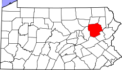
Saint Johns is an unincorporated community located in Butler Township in Luzerne County, Pennsylvania. Saint Johns is located at the intersection of St. Johns Road and Mill Mountain Road to the north of Hazleton. [2]

Related Research Articles

Luzerne County, Pennsylvania County in Pennsylvania

Luzerne County is a county in the Commonwealth of Pennsylvania. According to the U.S. Census Bureau, the county has a total area of 906 square miles (2,350 km2), of which 890 square miles (2,300 km2) is land and 16 square miles (41 km2) is water. It is Northeastern Pennsylvania's second-largest county by total area. As of the 2010 census, the population was 320,918, making it the most populous county in the northeastern part of the state. The county seat and largest city is Wilkes-Barre. Other populous communities include Hazleton, Kingston, Nanticoke, and Pittston. Luzerne County is included in the Scranton–Wilkes-Barre–Hazleton Metropolitan Statistical Area, which has a total population of 555,426.

Columbia County, Pennsylvania County in Pennsylvania

Columbia County is a county located in the north-central part of the U.S. state of Pennsylvania. As of the 2010 census, the population was 67,295. Its county seat is Bloomsburg. The county was created on March 22, 1813, from part of Northumberland County. It was named Columbia, alluding to the United States and Christopher Columbus.

Pennsylvania Route 115 (PA 115) is a 35.7-mile-long (57.5 km) north–south state highway in eastern Pennsylvania. It stretches from U.S. Route 209 (US 209) in Brodheadsville, Monroe County northwest to Interstate 81 (I-81) and PA 309 near Wilkes-Barre in Luzerne County. PA 115 passes through rural areas along its route, intersecting PA 903 in Tunkhannock Township, I-80 and PA 940 in Tobyhanna Township, and I-476 in Bear Creek Township. The road serves as a connector between the Pocono Mountains and the Wyoming Valley.

Nescopeck State Park

Nescopeck State Park is a Pennsylvania state park on 3,550 acres (1,437 ha) in Butler and Dennison Townships, Luzerne County, Pennsylvania. The park is one of the newest state parks in Pennsylvania. In the early 1970s, the state acquired 164 properties which made up the park. The park's Environmental Education Center is one of its newest additions; it opened in April 2005. Nescopeck Creek runs through the valley between Mount Yeager and Nescopeck Mountain. The park is near Interstate 80 just off Pennsylvania Route 309.

Pennsylvania Route 424 is a 3.75-mile-long (6.04 km) state highway located in north-central Pennsylvania. The western terminus is at Interstate 81 (I-81) exit 141 in Hazle Township. The eastern terminus is at PA 93 on the southeastern edge of Hazleton. The highway is called the Greater Hazleton Chamber Of Commerce Beltway or Arthur Gardner Highway and is a two-lane undivided road that forms a southern bypass of the city of Hazleton in Luzerne County, with an intermediate intersection with PA 309. The section of the road between PA 309 and PA 93 was constructed by 1980 and became State Route 3032. The road was extended west to I-81 in 1999, and PA 424 was designated between I-81 and PA 93 in 2000. PA 424 was constructed to provide access to the Hazleton Commerce Center and to reduce truck traffic on adjacent roads. There are plans to extend the route west to PA 924 near Humboldt Industrial Park.

Pennsylvania Route 315 is an 8.2-mile-long (13.2 km) state highway located in Luzerne County, Pennsylvania. The southern terminus is at an interchange with the PA 309 freeway in Wilkes-Barre. The northern terminus is at the entrance of the Wilkes-Barre/Scranton International Airport in Pittston Township just past an interchange with Interstate 81 (I-81). PA 315 heads northeast from PA 309 as a multilane road through suburban development in the Wyoming Valley parallel to I-81. The route comes to an interchange with I-81 and I-476 before passing through Dupont along a one-way pair. Past here, PA 315 follows a divided highway to I-81 and the airport.

Pennsylvania Route 339 is a 32.8-mile-long (52.8 km), north–south state highway located in Schuylkill, Columbia, and Luzerne counties in Pennsylvania. The southern terminus is at PA 54 in Mahanoy City. The northern terminus is at PA 93 in Nescopeck. The route is a two-lane road that passes through mountainous areas in the eastern part of the state. PA 339 runs north through the Coal Region to Brandonville, where it heads northwest to follow the Catawissa Creek to Mainville. From Mainville, the route passes through farmland to Mifflinville, where it follows the Susquehanna River to Nescopeck. PA 339 forms a concurrency with PA 924 in Brandonville and has an interchange with Interstate 80 (I-80) in Mifflinville.

Pennsylvania Route 348 (PA 348) is a 7.21-mile-long (11.60 km) state highway located in Lackawanna and Wayne counties in Pennsylvania. The western terminus is at PA 435 near Elmhurst. The eastern terminus is at PA 590 near Hollisterville. PA 348 is a two-lane undivided road that runs through rural areas east of Scranton. From its beginning, the route runs a short distance to the north of Interstate 84 (I-84) before reaching an intersection with PA 247 in Mount Cobb. After this, PA 348 heads farther north from I-84 and leaves Lackawanna County for Wayne County, where it ends at PA 590.

Pennsylvania Route 415 is a 10.035-mile-long (16.150 km) state highway located in Luzerne and Wyoming counties in Pennsylvania. The southern terminus is at PA 309 in Dallas while the northern terminus is at PA 29 near Harveys Lake in the community of Ruggles. A rare feature of this road is that the right-of-way splits in Harveys Lake, where the State Route 0415 alignment heads along the western side of Harveys Lake, while SR 1415 heads along the eastern side. The two routes merge several miles north.

Pennsylvania Route 437 is an 11.2-mile-long (18.0 km) state highway located in Luzerne County in Pennsylvania. The southern terminus is at PA 940 in White Haven. The northern terminus is at PA 309 in the Fairview Township community of Mountain Top. PA 437 runs southeast-northwest through forested mountain areas as a two-lane undivided road. The roadway was paved by 1930 and designated PA 437 in the 1960s.

Pennsylvania Route 502 is a 13.8-mile-long (22.2 km) state highway located in Lackawanna and Luzerne Counties in Pennsylvania. The western terminus is at U.S. Route 11 in Moosic. The eastern terminus is at PA 435 in Covington Township. The route is a two-lane undivided road that runs through rural areas to the south of Scranton. From US 11, PA 502 comes to a northbound ramp to Interstate 81 (I-81) before winding through forested areas. Farther east, the route intersects the western terminus of PA 690 and crosses PA 307 before continuing to its eastern terminus at PA 435 in Daleville. PA 502 was designated in 1928 between US 11 in Moosic and US 611 in Daleville along an unpaved road. The route was paved in the 1930s.

Pennsylvania Route 590 is a 45.0-mile-long (72.4 km) state highway located in Lackawanna, Wayne, and Pike Counties in Pennsylvania. The western terminus is at PA 435 in Elmhurst Township. The eastern terminus is at PA 434 in the community of Greeley in Lackawaxen Township. PA 590 is mostly a two-lane road that runs through rural areas in Northeastern Pennsylvania. The route serves the communities of Hamlin, Hawley, and Lackawaxen and passes to the north of Lake Wallenpaupack. PA 590 has intersections with PA 690 and PA 348 in Hollisterville, PA 191/PA 196 in Hamlin, and U.S. Route 6 in Hawley.

Pennsylvania Route 924 is a 22-mile-long (35 km) state highway in the U.S. state of Pennsylvania. The highway runs from PA 61 in Frackville, Schuylkill County northeast to PA 309 in Hazleton, Luzerne County. PA 924 runs through rural areas in the Coal Region, serving Gilberton, Shenandoah, Brandonville, and West Hazleton. The route is mostly a two-lane road with the section between Frackville and Shenandoah a four-lane divided highway with an interchange serving Gilberton and another four-lane divided highway section to the west of Hazleton. PA 924 intersects PA 54 in Shenandoah, PA 339 in Brandonville, Interstate 81 (I-81) west of Hazleton, and PA 93 in West Hazleton.

Drums, Pennsylvania

Drums is an unincorporated community in Butler Township, Luzerne County, Pennsylvania. Located about 1,500 feet (460 m) altitude in the Sugarloaf Valley, it sits east of Interstate 81 and north of Nescopeck Creek, a tributary of the Susquehanna River. It was founded by the Drum family in the late 18th century originally and was originally known as Drum's. Its ZIP Code is 18222, served by the 788 exchange in Area Code 570.

Hunlock Creek River in eastern Pennsylvania

Hunlock Creek is a tributary of the Susquehanna River in Luzerne County, Pennsylvania, in the United States. It is approximately 7.8 miles (12.6 km) long and flows through Lehman Township and Hunlock Township. The watershed of the creek has an area of 32.5 square miles (84 km2) and is situated in northwestern Luzerne County. It has one named tributary, which is known as Roaring Brook, and a number of unnamed and unofficially named tributaries, such as "West Branch Hunlock Creek".

Alden, Pennsylvania Unincorporated community in Pennsylvania, United States

Alden is an unincorporated community in Newport Township in Luzerne County, Pennsylvania, United States. Alden is located at the intersection of Kirmar Avenue, Alden Mountain Road, and Robert Street southwest of Nanticoke.

Drifton, Pennsylvania Unincorporated community in Pennsylvania, United States

Drifton is an unincorporated community located in Hazle Township in Luzerne County, Pennsylvania. Drifton is located along Pennsylvania Route 940 northwest of Jeddo and southwest of Freeland.

Ebervale, Pennsylvania Unincorporated community in Pennsylvania, United States

Ebervale is an unincorporated community located in Hazle Township in Luzerne County, Pennsylvania. Ebervale is located along Pennsylvania Route 940 northeast of Hazleton and west of Jeddo. The village takes its name from an Anglicization of the place name Ebbw Vale, a town in Wales.

Milnesville, Pennsylvania Unincorporated community in Pennsylvania, United States

Milnesville is an unincorporated community located in Hazle Township in Luzerne County, Pennsylvania. Milnesville is located along Pennsylvania Route 309 a short distance south of the Airport Beltway intersection to the north of Hazleton.

Rock Glen, Pennsylvania Unincorporated community in Pennsylvania, United States

Rock Glen is an unincorporated community located in Black Creek Township in Luzerne County, Pennsylvania. Rock Glen is located along Tomhicken Road and the Black Creek west of Hazleton and south of Nescopeck.

References

  1. "Saint Johns". Geographic Names Information System . United States Geological Survey.
  2. Luzerne County, Pennsylvania Highway Map (PDF) (Map). PennDOT. 2016. Retrieved June 19, 2017.