Warrior Run, Pennsylvania | |
---|---|
Borough | |
Coordinates: 41°11′15″N75°57′09″W / 41.18750°N 75.95250°W Coordinates: 41°11′15″N75°57′09″W / 41.18750°N 75.95250°W | |
Country | United States |
State | Pennsylvania |
County | Luzerne |
Incorporated | 1895 |
Government | |
• Type | Borough Council |
• Mayor | Tom Shypulefski |
Area | |
• Total | 0.66 sq mi (1.71 km2) |
• Land | 0.66 sq mi (1.71 km2) |
• Water | 0.00 sq mi (0.00 km2) |
Elevation | 665 ft (203 m) |
Population | |
• Total | 528 |
• Estimate (2021) [2] | 529 |
• Density | 880.30/sq mi (339.70/km2) |
Time zone | UTC-5 (Eastern (EST)) |
• Summer (DST) | UTC-4 (EDT) |
Zip code | 18706 |
Area code | 570 |
FIPS code | 42-81080 |
Website | www |
Warrior Run is a borough in Luzerne County, Pennsylvania, United States. The population was 528 at the time of the 2020 census. [2]
The first settlers of Warrior Run were Connecticut natives Elisha and Anna Blackman and their young children, Henry and Ebenezer. In 1791, they cleared trees and built a log cabin.
Coal mining was the chief industry in the region. In 1864, the Warrior Run Mining Company was organized; it reopened the old Holland and Hillman mine. The company built a breaker at the foot of the mountain; it opened in 1867.
At about the same time, both the Lehigh Valley Railroad and the Nanticoke Branch of the Central Railroad of New Jersey completed their lines through the area, thus making it possible to conveniently mine, transport, and market the area's coal. The occupations of the majority of residents were directly associated to mining in some way.
Ultimately, in the 20th century, the coal industry in the region died out.
Warrior Run Mining Village arose on the land owned by the Warrior Run Mining Company. On January 25, 1895, the Borough of Warrior Run was incorporated. Charles Williams was elected the first burgess on February 19. [3]
A lot on Hanover Street was selected for the borough's first town hall.
The borough celebrated its 100th anniversary in 1995.
Warrior Run is located at 41°11′15″N75°57′9″W / 41.18750°N 75.95250°W (41.187463, -75.952584) — just southeast of Nanticoke. [4]
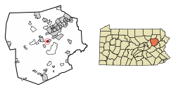
According to the United States Census Bureau, the borough has a total area of 0.73 square miles (1.9 km2), all of it land.
It is located on a historical battleground and on mostly fertile soil. The northern and western sections of the community consist mostly of homes and businesses; the southern and eastern areas of the borough are predominantly woodland.
Historical population | |||
---|---|---|---|
Census | Pop. | %± | |
1900 | 965 | — | |
1910 | 1,251 | 29.6% | |
1920 | 1,387 | 10.9% | |
1930 | 1,516 | 9.3% | |
1940 | 1,339 | −11.7% | |
1950 | 1,056 | −21.1% | |
1960 | 833 | −21.1% | |
1970 | 816 | −2.0% | |
1980 | 784 | −3.9% | |
1990 | 656 | −16.3% | |
2000 | 624 | −4.9% | |
2010 | 584 | −6.4% | |
2020 | 528 | −9.6% | |
2021 (est.) | 529 | [2] | 0.2% |
Sources: [5] [6] [7] |
As of the census [6] of 2000, there were 624 people, 257 households, and 178 families living in the borough.
The population density was 806.2 people per square mile (312.9/km2). There were 285 housing units at an average density of 368.2 per square mile (142.9/km2).
The racial makeup of the borough was 98.88% White, 0.32% African American, 0.16% Asian, and 0.64% from two or more races. Hispanic or Latino of any race were 0.80% of the population.
There were 257 households, out of which 26.5% had children under the age of eighteen living with them; 51.0% were married couples living together, 16.0% had a female householder with no husband present, and 30.7% were non-families. 25.7% of all households were made up of individuals, and 13.6% had someone living alone who was sixty-five years of age or older.
The average household size was 2.43 and the average family size was 2.94.
In the borough the population was spread out, with 22.6% under the age of eighteen, 6.1% from eighteen to twenty-four, 28.5% from twenty-five to forty-four, 24.7% from forty-five to sixty-four, and 18.1% who were sixty-five years of age or older. The median age was forty years.
For every one hundred females there were 86.3 males. For every one hundred females who were aged eighteen and older, there were 82.3 males.
The median income for a household in the borough was $29,583, and the median income for a family was $36,250. Males had a median income of $28,958 compared with that of $21,304 for females.
The per capita income for the borough was $15,693.
Roughly 10.0% of families and 9.1% of the population were living below the poverty line, including 12.2% of those who were under the age of eighteen and 9.8% of those who were aged sixty-five or over.
Parryville is a borough in Carbon County, Pennsylvania. It is part of Northeastern Pennsylvania, and is located 3 miles (5 km) southeast of Lehighton and 1 mile (1.6 km) north of Bowmanstown, off Route 248 and 4 miles (6 km) northwest of Palmerton.
Weissport East is a census-designated place (CDP) in Franklin Township in Carbon County, Pennsylvania. It is part of Northeastern Pennsylvania.
Newell is a borough in Fayette County, Pennsylvania, United States. The population was 512 at the time of the 2020 census.
Worthville is a borough in Jefferson County, Pennsylvania, United States. The population was sixty-seven at the time of the 2010 census, a decline from the figure of eighty-five, which had been tabulated in 2000.
Hanover Township is a township in Luzerne County, Pennsylvania. As of the 2020 census, the population was 11,424, making it the most populous township in the county.
Laflin is a borough in the Greater Pittston area of Luzerne County, Pennsylvania, United States. The population was 1,443 at the time of the 2020 census.
Luzerne is a borough located 5 miles (8 km) north of Wilkes Barre in Luzerne County, Pennsylvania, United States.
Pringle is a borough in Luzerne County, Pennsylvania, United States. As of the 2020 census, the borough population was eight hundred and ninety-one.
Sugar Notch is a borough in Luzerne County, Pennsylvania, United States. The population was nine hundred and ninety-six at the time of the 2020 census.
Shinglehouse is a borough in Potter County, Pennsylvania, United States. The population was 1,108 at the time of the 2020 census.
Landingville is a borough in Schuylkill County, Pennsylvania, United States. The population was 137 at the time of the 2020 census.
Mechanicsville is a borough in Schuylkill County, Pennsylvania, United States. Part of the Pottsville Area School District, it lies between Pottsville and Port Carbon. Pottsville Street is the community's main street.
New Ringgold is a borough in Schuylkill County, Pennsylvania, United States. The population was 253 at the time of the 2020 census.
Tremont is a borough in Schuylkill County, Pennsylvania, United States. Situated in the eastern section of Tremont Township, it was incorporated as a borough in 1866, around the same time that a water system was erected in the community.
Knoxville is a borough in northwestern Tioga County, Pennsylvania, United States. The population was 682 at the time of the 2020 census.
Liberty is a small borough in Tioga County, Pennsylvania, United States. The population was 232 at the time of the 2020 census.
Prompton is a borough in Wayne County, Pennsylvania, United States. The population was 250 at the 2010 census.
North Belle Vernon is a borough in Westmoreland County, Pennsylvania, United States. The population was 1,971 at the time of the 2010 census.
North Irwin is a borough in Westmoreland County, Pennsylvania, United States. The population was 846 at the 2010 census.
Railroad is a borough in York County, Pennsylvania, United States. The population was two hundred fifty-nine at the time of the 2020 census.