Tomhicken, Pennsylvania

Last updated
Tomhicken, Pennsylvania
USA Pennsylvania location map.svg
Red pog.svg
Tomhicken
Usa edcp location map.svg
Red pog.svg
Tomhicken
Coordinates: 40°58′07″N76°05′37″W / 40.96861°N 76.09361°W / 40.96861; -76.09361 Coordinates: 40°58′07″N76°05′37″W / 40.96861°N 76.09361°W / 40.96861; -76.09361
Country United States
State Pennsylvania
County Luzerne
Township Sugarloaf
Elevation
1,350 ft (410 m)
Time zone UTC-5 (Eastern (EST))
  Summer (DST) UTC-4 (EDT)
Area code(s) 570

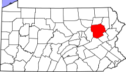
Tomhicken (also Tomhickon) is an unincorporated community in Sugarloaf Township, Luzerne County, Pennsylvania, United States. [1] Tomhicken is notable for being a junction point between the Lehigh Valley Railroad's Tomhicken Branch and the Pennsylvania Railroad's Catawissa Branch. Tomhicken is part of the Greater Hazleton region.

Related Research Articles

Garrett, Pennsylvania Borough in Pennsylvania, United States

Garrett is a borough in Somerset County, Pennsylvania, United States. It is part of the Johnstown, Pennsylvania, Metropolitan Statistical Area. The population was 456 at the 2010 census.

Rockwood, Pennsylvania Borough in Pennsylvania, United States

Rockwood is a borough in Somerset County, Pennsylvania, United States. The population was 890 at the 2010 census. It is part of the Johnstown, Pennsylvania, Metropolitan Statistical Area, and located due north of Pennsylvania's highest peak, Mount Davis, which significantly constricts land travel routing south of the municipality.

Baltimore and Ohio Railroad

The Baltimore and Ohio Railroad was the first common carrier railroad and the oldest railroad in the United States, with its first section opening in 1830. Merchants from the city of Baltimore, which had benefitted to some extent from the construction of the National Road early in the century, wanted to continue to compete for trade with trans-Appalachian settlers with the newly constructed Erie Canal, another canal being proposed by Pennsylvania, the Chesapeake and Ohio Canal, and the James River Canal, which directed traffic toward Richmond and Norfolk, Virginia. At first the B&O was located entirely in the state of Maryland, its original line extending from the port of Baltimore west to Sandy Hook. There it connected with Harper's Ferry across the Potomac into Virginia, and also with the navegable Shenandoah River.

Susquehanna River

The Susquehanna River is a major river located in the northeastern and mid-Atlantic United States. At 444 miles (715 km) long, it is the longest river on the East Coast of the United States. It drains into the Chesapeake Bay. With its watershed, it is the 16th-largest river in the United States, and the longest river in the early 21st-century continental United States without commercial boat traffic.

Reading Company

The Reading Company was a railroad in southeast Pennsylvania and neighboring states whose final iteration ran from 1924 until 1976, when it was absorbed by Conrail. The Reading’s oldest corporate predecessor, however, was the Schuylkill and Susquehanna Navigation Company incorporated, a canal company, making the Reading the oldest railroading corporation in the United States.

Central Railroad of New Jersey

The Central Railroad of New Jersey, also known as the Jersey Central or Jersey Central Lines, was a Class I railroad with origins in the 1830s. It filed for bankruptcy three times; in 1939, 1947 and on March 22, 1967, the CNJ filed for bankruptcy for the final time. It foreshadowed the rest of New Jersey's railroads, but not by much. It then pulled out of Pennsylvania completely in 1972. While most of the passenger services, structures and equipment were picked up by the State of New Jersey, later NJ Transit, it was absorbed into Conrail in April 1976 along with several other prominent bankrupt railroads of the northeastern United States. Only two of the railroad's steam locomotives were preserved: CNJ No. 592 & CNJ No. 113; the latter is the only one that is still operational.

Richmond, Fredericksburg and Potomac Railroad

The Richmond, Fredericksburg, and Potomac Railroad was a railroad connecting Richmond, Virginia, to Washington, D.C. The track is now the RF&P Subdivision of the CSX Transportation system; the original corporation is no longer a railroad company.

Monongahela Railway

The Monongahela Railway was a coal-hauling short line railroad in Pennsylvania and West Virginia in the United States. It was jointly controlled originally by the Pennsylvania Railroad, New York Central subsidiary Pittsburgh and Lake Erie Railroad, and the Baltimore and Ohio Railroad, with NYC and PRR later succeeded by Penn Central Transportation. The company operated its own line until it was merged into Conrail on May 1, 1993.

The North Pennsylvania Railroad was a railroad company which served Philadelphia, Montgomery County, Bucks County and Northampton County, Pennsylvania. It was formed in 1852 and began operation in 1855. The Philadelphia and Reading Railway, predecessor to the Reading Company, leased the North Pennsylvania in 1879. Its tracks were transferred to Conrail and the Southeastern Pennsylvania Transportation Authority (SEPTA) in 1976.

Catawissa Creek

Catawissa Creek is a 41.8-mile-long (67.3 km) tributary of the Susquehanna River in east-central Pennsylvania in the United States. Its watershed has an area of 153 square miles (400 km2).

Clearfield Creek is a 73.4-mile-long (118.1 km) tributary of the West Branch Susquehanna River in Cambria and Clearfield counties, Pennsylvania, in the United States.

Black Creek (Nescopeck Creek tributary)

Black Creek is a long source tributary of Nescopeck Creek so part of the Susquehanna River drainage basin. It is also the second & longer stream of the same name recognized by the USGS GNIS system in Luzerne County, Pennsylvania, in the United States—compared to the Black Creek beyond the ridgeline of the drainage divide, so in the Lehigh River valley and Carbon County. The headwaters of both Black Creeks in Luzerne county are only a few miles apart, and both valleys were traversed by the Lausanne-Nescopeck Turnpike in the first half of the 19th-century.

Sunbury Line

The Sunbury Line is a rail line that is owned and operated by Norfolk Southern Railway which in turn is owned by the Norfolk Southern Corporation. The line travels from Sunbury, Pennsylvania, to Binghamton, New York, connecting with Norfolk Southern's Southern Tier Line at Binghamton and Norfolk Southern's Buffalo Line at Sunbury.

Schuylkill Branch

The Schuylkill Branch was a rail line owned and operated by the former Pennsylvania Railroad in the U.S. state of Pennsylvania. The line ran from the Philadelphia to Harrisburg Main Line at 52nd Street in Philadelphia north via Norristown, Reading, and Pottsville to Delano Junction. From Delano Junction, the PRR had trackage rights over the Lehigh Valley Railroad's Hazleton Branch and Tomhicken Branch to Tomhicken, where the PRR's Catawissa Branch began. In conjunction with the Catawissa Branch, Nescopeck Branch, and Wilkes-Barre Branch, the Schuylkill Branch gave the PRR a direct line from Philadelphia to Wilkes-Barre.

The Danville, Hazleton and Wilkes-Barre Railroad, also called the D.H. & W.B. Railroad, was a railroad in northeastern Pennsylvania. It ran from Sunbury to Tomhicken, a total of 43.44 miles plus 10.1 miles of branch lines, making the whole railroad 53.54 miles long. The railroad was completed in 1870. As of 2010, the Danville, Hazleton and Willkes-Barre Railroad tracks belong to the Pennsylvania Railroad. The railroad's gauge was 4 ft 9 in.

Tomhicken Creek Tributary of Catawissa Creek in Pennsylvania, US

Tomhicken Creek is a stream in Luzerne County and Schuylkill County, in Pennsylvania, in the United States. It is approximately 11 miles (18 km) long and is the largest tributary of Catawissa Creek. Named tributaries of the creek include Little Crooked Run, Little Tomhicken Creek, Raccoon Creek, and Sugarloaf Creek. The watershed of the main stem has an area of 20.6 square miles. A number of mine tunnels discharge into the creek and its tributaries.

Raccoon Creek (Tomhicken Creek tributary)

Raccoon Creek is a tributary of Tomhicken Creek in Luzerne County and Schuylkill County, in Pennsylvania, in the United States. It is approximately 3.3 miles (5.3 km) long and flows through Black Creek Township in Luzerne County and North Union Township in Schuylkill County. The watershed of the stream has an area of 2.67 square miles (6.9 km2). The stream is considered to be a High-Quality Coldwater Fishery and Class A Wild Trout Waters. The main rock formations in the stream's watershed are the Mauch Chunk Formation and the Pottsville Formation and the main soil is the Leck Kill soil.

Sugarloaf Creek is a tributary of Tomhicken Creek in Luzerne County and Schuylkill County, in Pennsylvania, in the United States. It is approximately 3.5 miles (5.6 km) long and flows through Hazle Township and Black Creek Township in Luzerne County and North Union Township in Schuylkill County. The watershed of the stream has an area of 3.34 square miles (8.7 km2). The stream is considered to be a Coldwater Fishery. The main rock formation in the stream's watershed are the Mauch Chunk Formation and the main soil is the Hazleton soil. The creek has been impaired by acid mine drainage from the Oneida Number One Tunnel.

Little Crooked Run

Little Crooked Run is a tributary of Tomhicken Creek in Schuylkill County, Pennsylvania, in the United States. It is approximately 1.7 miles (2.7 km) long and flows through North Union Township. The watershed of the stream has an area of 1.22 square miles (3.2 km2). The stream is considered to be a High-Quality Coldwater Fishery and Class A Wild Trout Waters. The main rock formations in the stream's watershed are the Mauch Chunk Formation and the Pottsville Formation and the main soil is the Hazleton soil.

The Oneida Number Three Tunnel is a mine tunnel in Schuylkill County, Pennsylvania, in the United States. It is one of five major mine tunnels in the watershed of Catawissa Creek. The tunnel discharges into Tomhicken Creek downstream of the mouth of Little Tomhicken Creek. The tunnel was constructed in the 1930s and a passive treatment system was installed at the site of the tunnel in 2009. The tunnel is more than a mile long.

References

  1. "Tomhicken, Pennsylvania". Geographic Names Information System . United States Geological Survey.