Glen Lyon, Pennsylvania

Last updated

Glen Lyon, Pennsylvania
Glen Lyon, Pennsylvania (8481309763).jpg
Houses in Glen Lyon
USA Pennsylvania location map.svg
Red pog.svg
Glen Lyon
Location in Pennsylvania
Usa edcp location map.svg
Red pog.svg
Glen Lyon
Location in the United States
Coordinates: 41°10′32″N76°4′28″W / 41.17556°N 76.07444°W / 41.17556; -76.07444
Country United States
State Pennsylvania
County Luzerne
Township Newport
Area
[1]
  Total3.77 sq mi (9.78 km2)
  Land3.59 sq mi (9.31 km2)
  Water0.18 sq mi (0.47 km2)
Population
 (2020) [2]
  Total1,877
  Density522.26/sq mi (201.67/km2)
Time zone UTC-5 (Eastern (EST))
  Summer (DST) UTC-4 (EDT)
ZIP code
18617
Area code 570
FIPS code 42-29680

Glen Lyon is a census-designated place (CDP) in Newport Township, Pennsylvania, United States. The population was 1,873 at the 2010 census. [3]

Contents

History

The town of Glen Lyon was founded after anthracite coal mining began in Newport Township (ca. 1869). The colliery was operated by the Susquehanna Coal Company, a Pennsylvania Railroad property. The west side of the community was once called Morgantown; the east side was referred to as Williamstown. Later, the Glen Lyon Rail Station was established and the town was named after the terminus. Part of the east side, which was separated from the rest of the community by the railroad, became known as Canada. Roads and a streetcar line linked the town to Nanticoke and Wilkes-Barre. The streetcar line was replaced eventually by buses and automobiles as the main means of transport.

A hill divided the community into two parts. Sixth Shaft was established on the hill. Coal hoisted from that mine was moved across a bridge to the breaker (coal processing plant), which was built in 1887. Gravity moved the coal through a series of stages. The coal would then come out the north end of the breaker, where it was loaded onto railroad cars and trucks. The Seventh Shaft colliery operated west of Glen Lyon.

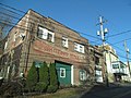
The town was originally developed by Welsh miners (who were Protestants); they were usually members of the Methodist church. There was a small Methodist church on Market Street. Later, immigrants from Central Europe (e.g., Poland) [4] and Southern Europe became predominant. Two Polish Catholic parishes, Saint Adalbert's and Saint Michael's, were founded in the late nineteenth century. Their churches were built on the west side of the breaker. Other European miners and their families belonged to Ukrainian or "Byzantine Rite" parishes on the east side of town. A company-operated store existed for quite some time in Glen Lyon; it closed in the 1920s. Commercial structures were erected on Nanticoke Street, later Main Street, providing food and supplies to the community. Several neighborhood taverns existed throughout the town. Glen Lyon's miners were involved in unionization activities, culminating in their representation by the United Mine Workers.

Mining declined after the Second World War. The M. A. Hanna Company closed Seventh Shaft but retained Sixth Shaft and its breaker well into the 1960s. The breaker closed in 1971; it later burned overnight in October 1974. The death of deep mining in Northeastern Pennsylvania after the 1959 Knox Mine Disaster also diminished the town. However, some strip mining did continue in the following years. Small dress factories provided employment, mostly for women, in the period when mining was in decline; but they too closed. Retirees formed a large portion of the population. Many businesses closed as deep mining declined, and increasing numbers of houses stood vacant. The Roman Catholic churches were gradually consolidated, and St. Michael's was demolished (ca. 2004). St. Dennis, the "Irish" church, became a possession of the Knights of Columbus.

Glen Lyon was fictionalized as "Coaltown" for the 1948 film The Miracle of the Bells , and some exterior scenes were shot there.

Geography

Glen Lyon is located at 41°10′32″N76°4′28″W / 41.17556°N 76.07444°W / 41.17556; -76.07444 (41.175582, -76.074556). [5]

According to the United States Census Bureau, the CDP has a total area of 3.4 square miles (8.8 km2), of which 3.3 square miles (8.5 km2) is land and 0.1 square miles (0.26 km2), or 2.05%, is water.

Demographics

Historical population
CensusPop.Note
2020 1,877
U.S. Decennial Census [6]

As of the census [7] of 2000, there were 1,881 people, 828 households, and 494 families residing in the CDP. The population density was 563.5 inhabitants per square mile (217.6/km2). There were 1,089 housing units at an average density of 326.3 per square mile (126.0/km2). The racial makeup of the CDP was 97.98% White, 1.49% African American, 0.21% Asian, and 0.32% from two or more races. Hispanic or Latino of any race were 0.37% of the population.

There were 828 households, out of which 26.8% had children under the age of 18 living with them, 38.9% were married couples living together, 15.2% had a female householder with no husband present, and 40.3% were non-families. 34.7% of all households were made up of individuals, and 20.4% had someone living alone who was 65 years of age or older. The average household size was 2.27 and the average family size was 2.89.

In the CDP, the population was spread out, with 23.0% under the age of 18, 9.1% from 18 to 24, 28.6% from 25 to 44, 20.5% from 45 to 64, and 18.8% who were 65 years of age or older. The median age was 37 years. For every 100 females, there were 92.5 males. For every 100 females age 18 and over, there were 84.8 males.

The median income for a household in the CDP was $24,271, and the median income for a family was $36,250. Males had a median income of $28,576 versus $20,323 for females. The per capita income for the CDP was $13,753. About 16.9% of families and 22.2% of the population were below the poverty line, including 35.0% of those under age 18 and 16.2% of those age 65 or over.

Notable people

Sources

Related Research Articles

<span class="mw-page-title-main">Roanoke, Illinois</span> Village in Illinois, United States

Roanoke is a village in Roanoke Township, Woodford County, Illinois, United States. The population was 2,065 at the 2010 census, up from 1,994 at the 2000 census. It is part of the Peoria, Illinois Metropolitan Statistical Area.

<span class="mw-page-title-main">Coalville, Iowa</span> CDP in Iowa, United States

Coalville is a census-designated place (CDP) in Webster County, Iowa, United States. The population was 610 at the 2010 census. The community is located on U.S. Route 20 near Fort Dodge's large gypsum mines.

<span class="mw-page-title-main">Nanticoke, New York</span> Town in New York, United States

Nanticoke is a town in Broome County, New York, United States. The population was 1,672 at the 2010 census. The town was named after the Nanticoke people, who were a Native American tribe native to Chesapeake Bay.

<span class="mw-page-title-main">Lyon Mountain, New York</span> Census-designated place & hamlet in New York, United States

Lyon Mountain is a hamlet and census-designated place located in the town of Dannemora in Clinton County, New York, United States. The population was 423 at the 2010 census.

<span class="mw-page-title-main">Commodore, Pennsylvania</span> Census-designated place in Pennsylvania, United States

Commodore is a census-designated place (CDP) in Green Township, Indiana County, Pennsylvania, United States. The population was 331 at the 2010 census.

<span class="mw-page-title-main">Glen Campbell, Pennsylvania</span> Borough in Pennsylvania, United States

Glen Campbell is a borough in Indiana County, Pennsylvania, United States. The borough is located about 80 miles east of Pittsburgh. Glen Campbell has only two borders, including the townships of Banks to the north, east and west, and Montgomery to the south.

Heilwood is a census-designated place (CDP) in Indiana County, Pennsylvania, United States. The population was 711 at the time of the 2010 census.

Rossiter is a Census-designated place (CDP) in Indiana County, Pennsylvania, United States. The population was 646 at the 2010 census.

<span class="mw-page-title-main">Hanover Township, Luzerne County, Pennsylvania</span> Township in Pennsylvania, United States

Hanover Township is a township in Luzerne County, Pennsylvania. As of the 2020 census, the population was 11,424, making it the most populous township in the county.

<span class="mw-page-title-main">Newport Township, Pennsylvania</span> First Class Township in Pennsylvania, United States

Newport Township is a township in Luzerne County, Pennsylvania, United States. As of 2020, the population was 4,444. Newport is located on the outskirts of Nanticoke City.

<span class="mw-page-title-main">Plymouth Township, Luzerne County, Pennsylvania</span> Township in Pennsylvania, United States

Plymouth Township is located in Luzerne County, Pennsylvania, United States. The population was 1,712 at the 2020 census.

<span class="mw-page-title-main">Warrior Run, Pennsylvania</span> Borough in Pennsylvania, United States

Warrior Run is a borough in Luzerne County, Pennsylvania, United States. The population was 528 at the time of the 2020 census.

<span class="mw-page-title-main">Heckscherville, Pennsylvania</span> CDP in Pennsylvania, United States

Heckscherville is a census-designated place (CDP) in Schuylkill County, Pennsylvania, United States. The population was 220 at the 2010 census.

<span class="mw-page-title-main">Forest City, Pennsylvania</span> Borough in Pennsylvania, United States

Forest City is a borough in Susquehanna County, Pennsylvania, United States, situated at the corner of Susquehanna, Lackawanna and Wayne counties and is designated by a marker which is located in the Forest City Industrial Park.

<span class="mw-page-title-main">Crabtree, Pennsylvania</span> CDP in Pennsylvania, United States

Crabtree is a census-designated place (CDP) and former coal town in Salem Township, Westmoreland County, Pennsylvania, United States. The population was 277 at the 2010 census. It has its own post office, with postal code 15624.

<span class="mw-page-title-main">Herminie, Pennsylvania</span>

Herminie is a census-designated place (CDP) in Sewickley Township, Westmoreland County, Pennsylvania, United States. The population was 856 at the 2000 census.

<span class="mw-page-title-main">Slickville, Pennsylvania</span> CDP in Pennsylvania, United States

Slickville is a census-designated place (CDP) in Westmoreland County, Pennsylvania, United States. The population was 372 at the 2000 census.

<span class="mw-page-title-main">Alum Creek, West Virginia</span> Census-designated place in West Virginia, United States

Alum Creek is a census-designated place (CDP) in Kanawha and Lincoln counties along the Coal River in the U.S. state of West Virginia. It includes the unincorporated communities of Alum Creek, Forks of Coal, and Priestley. The CDP had a population of 1,749 at the 2010 census, down from 1,839 at the 2000 census.

<span class="mw-page-title-main">Mineral Ridge, Ohio</span> Census-designated place in Ohio, United States

Mineral Ridge is an unincorporated community and census-designated place in southern Trumbull and northern Mahoning counties in the U.S. state of Ohio. The population was 3,951 at the 2020 census. It is a suburb of the Youngstown–Warren metropolitan area. Mineral Ridge was named for valuable coal deposits near the original town site.

<span class="mw-page-title-main">Gamerco, New Mexico</span> Unincorporated community in New Mexico, United States

Gamerco, also called in Navajo: Łigaiyaaʼáhí, is an unincorporated community in McKinley County, New Mexico, United States. As of the 2010 Census, the community population was 1,956. Gamerco was used as a base for coal mining until the 1960s.

References

  1. "ArcGIS REST Services Directory". United States Census Bureau. Retrieved October 12, 2022.
  2. "Census Population API". United States Census Bureau. Retrieved October 12, 2022.
  3. "Profile of General Population and Housing Characteristics: 2010 Demographic Profile Data (DP-1): Glen Lyon CDP, Pennsylvania". United States Census Bureau . Retrieved April 20, 2012.
  4. "Polish Ancestry Search - Polish Genealogy by City - ePodunk.com". Archived from the original on June 2, 2011. Retrieved January 3, 2014.
  5. "US Gazetteer files: 2010, 2000, and 1990". United States Census Bureau. February 12, 2011. Retrieved April 23, 2011.
  6. "Census of Population and Housing". Census.gov. Retrieved June 4, 2016.
  7. "U.S. Census website". United States Census Bureau . Retrieved January 31, 2008.