Milnesville, Pennsylvania | |
|---|---|
Unincorporated community | |
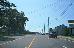 Along PA 309 southbound | |
 Milnesville  Milnesville | |
| Coordinates: 40°59′25″N75°58′58″W / 40.99028°N 75.98278°W | |
| Country | United States |
| State | Pennsylvania |
| County | Luzerne |
| Township | Hazle |
| Elevation | 1,608 ft (490 m) |
| Time zone | UTC-5 (Eastern (EST)) |
| • Summer (DST) | UTC-4 (EDT) |
| ZIP code | 18239 |
| Area codes | 570 and 272 |
| GNIS feature ID | 1181295 [1] |
Milnesville is an unincorporated community located in Hazle Township in Luzerne County, Pennsylvania. Milnesville is located along Pennsylvania Route 309, a short distance south of the Airport Beltway intersection to the north of Hazleton. [2]
