West Wyoming, Pennsylvania

Last updated
West Wyoming, Pennsylvania
Borough
8th Street wb in West Wyoming, PA (2), Sept. 2023.jpg
8th Street in West Wyoming
Luzerne County Pennsylvania Incorporated and Unincorporated areas West Wyoming Highlighted.svg
Location of West Wyoming in Luzerne County, Pennsylvania.
USA Pennsylvania location map.svg
Red pog.svg
West Wyoming
Usa edcp location map.svg
Red pog.svg
West Wyoming
Coordinates: 41°18′50″N75°51′06″W / 41.31389°N 75.85167°W / 41.31389; -75.85167
Country United States
State Pennsylvania
County Luzerne
Region Greater Pittston
Incorporated1898
Government
  TypeBorough Council
  MayorJoseph T. Herbert
Area
[1]
  Total3.59 sq mi (9.31 km2)
  Land3.59 sq mi (9.31 km2)
  Water0.00 sq mi (0.00 km2)
Population
 (2020) [2]
  Total2,631 Decrease2.svg
  Estimate 
(2021) [2]
2,636
  Density744.78/sq mi (287.54/km2)
Time zone UTC-5 (Eastern (EST))
  Summer (DST) UTC-4 (EDT)
Area code 570
FIPS code 42-84272
Website www.westwyoming.org

West Wyoming is a borough that is located in Luzerne County, Pennsylvania, United States. The borough is part of the Greater Pittston metro area.

Contents

The population was 2,631 at the time of the 2020 census. [2]

History

Establishment

Abrahams Creek in 1878 Abrahams Creek in 1878.JPG
Abrahams Creek in 1878

In 1768, the Susquehanna Company of Connecticut devised a plan to divide the Wyoming Valley into five townships. Each township was to be divided among forty settlers. West Wyoming was originally part of Kingston Township. The community's first forty settlers arrived in February 1769.

Benjamin Carpenter and his brother Gilbert developed several mills along the banks of Abrahams Creek around 1800. The earliest businesses included a grist mill and a saw mill.
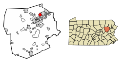
Borough

Borough municipal building West Wyoming, PA municipal building, Sept. 2023.jpg
Borough municipal building

The community eventually broke away from Kingston Township in 1885. The town was originally known as Carpentersville, Shoemaker's Mills, and New Troy. It was officially incorporated as the Borough of West Wyoming in 1898. [3]

Geography

West Wyoming is part of Greater Pittston; it is located at 41°18′50″N75°51′6″W / 41.31389°N 75.85167°W / 41.31389; -75.85167 (41.313780, -75.851640). [4] According to the United States Census Bureau, the borough has a total area of 3.6 square miles (9.4 km2), all land.

The northern and northeastern sections of the borough are mostly made up of thick forests and mountains. Frances Slocum State Park is located nearby. West Eighth Street and Abrahams Creek run through a mountain pass — which links Greater Pittston to the Back Mountain. West Eighth Street intersects with Shoemaker Avenue near the eastern portion of the borough. Most homes and businesses are located in the southern and eastern sections of West Wyoming.

The following communities neighbor West Wyoming: Exeter Township (north), Exeter Borough (northeast, east), Wyoming Borough (southeast), Swoyersville Borough (southwest), and Kingston Township (west, northwest).

Demographics

Historical population
CensusPop.Note
1900 1,344
1910 1,62120.6%
1920 1,93819.6%
1930 2,76942.9%
1940 2,9928.1%
1950 2,863−4.3%
1960 3,16610.6%
1970 3,65915.6%
1980 3,288−10.1%
1990 3,117−5.2%
2000 2,833−9.1%
2010 2,725−3.8%
2020 2,631−3.4%
2021 (est.)2,636 [2] 0.2%
Sources: [5] [6] [7]

As of the census [6] of 2000, there were 2,833 people, 1,183 households, and 822 families residing in the borough. The population density was 780.2 inhabitants per square mile (301.2/km2). There were 1,240 housing units at an average density of 341.5 per square mile (131.9/km2). The racial makeup of the borough was 99.33% White, 0.18% African American, 0.07% Asian, 0.04% Pacific Islander, 0.04% from other races, and 0.35% from two or more races. Hispanic or Latino of any race were 0.25% of the population.

There were 1,183 households, out of which 26.0% had children under the age of 18 living with them, 57.6% were married couples living together, 8.2% had a female householder with no husband present, and 30.5% were non-families. 26.7% of all households were made up of individuals, and 15.0% had someone living alone who was 65 years of age or older. The average household size was 2.39 and the average family size was 2.91.

In the borough the population was spread out, with 20.9% under the age of 18, 5.6% from 18 to 24, 27.3% from 25 to 44, 24.2% from 45 to 64, and 21.9% who were 65 years of age or older. The median age was 42 years. For every 100 females there were 92.7 males. For every 100 females age 18 and over, there were 87.9 males.

The median income for a household in the borough was $37,275, and the median income for a family was $44,214. Males had a median income of $38,398 versus $25,664 for females. The per capita income for the borough was $17,603. About 0.2% of families and 3.8% of the population were below the poverty line, including 1.7% of those under age 18 and 11.6% of those age 65 or over.

Related Research Articles

<span class="mw-page-title-main">Tuscarora Township, Bradford County, Pennsylvania</span> Township in Pennsylvania, United States

Tuscarora Township is a township in Bradford County, Pennsylvania. It is part of Northeastern Pennsylvania. The population was 1,131 at the 2010 census.

<span class="mw-page-title-main">West Hempfield Township, Pennsylvania</span> Township in Pennsylvania, United States

West Hempfield Township is a township in west central Lancaster County, Pennsylvania, United States. The population was 17,061 at the 2020 census.

<span class="mw-page-title-main">Avoca, Pennsylvania</span> Borough in Pennsylvania, United States

Avoca is a borough within the Greater Pittston area of Luzerne County, Pennsylvania, United States. It is located 7.5 miles (12.1 km) northeast of Wilkes Barre and 3.4 miles (5.5 km) southwest of Scranton. The population was 2,501 at the time of the 2020 census. The Wilkes-Barre/Scranton International Airport (AVP) is located near Avoca.

<span class="mw-page-title-main">Back Mountain</span> Region in Pennsylvania, United States

The Back Mountain is a region and former census-designated place (CDP) in Luzerne County, Pennsylvania, United States. It is near the cities of Scranton and Wilkes-Barre. The population was 33,551 as of 2016. The region has a total area of 117.59 square miles (304.6 km2). The area was not delineated as a CDP for the 2010 census. The name "Back Mountain" refers to the area's location behind the mountain ridge forming the northwest side of the Wyoming Valley. The area includes the townships of Dallas, Franklin, Jackson, Kingston, Lake, and Lehman. The region also includes the boroughs of Dallas and Harveys Lake. Each township and borough is independently governed.

<span class="mw-page-title-main">Dallas, Pennsylvania</span> Borough in Pennsylvania, United States

Dallas is a borough in Luzerne County, Pennsylvania, United States. The population was 2,692 at the 2020 census. The local government describes the borough as the "Pride" of the Back Mountain. The area includes the townships of Dallas, Franklin, Jackson, Kingston, Lake, and Lehman. The region also includes the boroughs of Dallas and Harveys Lake. Dallas is in the vicinity of Misericordia University and Dallas State Correctional Institution.

<span class="mw-page-title-main">Dupont, Pennsylvania</span> Borough in Pennsylvania, United States

Dupont is a borough in the Greater Pittston area of Luzerne County, Pennsylvania, United States. The population was 2,536 as of the 2020 census.

<span class="mw-page-title-main">Duryea, Pennsylvania</span> Borough in Pennsylvania, United States

Duryea is a borough in the Greater Pittston area of Luzerne County, Pennsylvania, United States, 9 miles (14 km) south of Scranton. The Susquehanna River marks Duryea's western boundary and the Lackawanna River flows through Duryea. It was incorporated as a borough in 1901, and had a notable switching rail yard, the Duryea yard, connecting the central Wyoming Valley to destinations in lower New York and down-state Pennsylvania. Coal mining and silk manufacturing were the chief industries in Duryea's early years. The population was 5,032 at the 2020 census.

<span class="mw-page-title-main">Exeter, Pennsylvania</span> Borough in Pennsylvania, United States

Exeter is a borough in the Greater Pittston-Wilkes-Barre area of Luzerne County, Pennsylvania, United States, about 10 miles (16 km) west of Scranton and a few miles north of Wilkes-Barre. It is located on the western bank of the Susquehanna River and has a total area of 5.0 square miles (12.9 km2). As of 2020, Exeter had a population of 5,513.

<span class="mw-page-title-main">Exeter Township, Luzerne County, Pennsylvania</span> Township in Pennsylvania, United States

Exeter Township is a township within the Greater Pittston area of Luzerne County, Pennsylvania, United States. The population was 2,047 at the 2020 census. Upper Exeter and Harding are two villages in the township.

<span class="mw-page-title-main">Hanover Township, Luzerne County, Pennsylvania</span> Township in Pennsylvania, United States

Hanover Township is a township in Luzerne County, Pennsylvania. As of the 2020 census, the population was 11,424, making it the most populous township in the county.

<span class="mw-page-title-main">Jenkins Township, Luzerne County, Pennsylvania</span> Township in Pennsylvania, United States

Jenkins Township is a township in the Greater Pittston area of Luzerne County, Pennsylvania, United States. The population was 4,282 at the 2020 census.

<span class="mw-page-title-main">Kingston Township, Luzerne County, Pennsylvania</span> Township in Pennsylvania, United States

Kingston Township is a township in Luzerne County, Pennsylvania, United States. The population was 7,096 at the 2020 census. The villages of Trucksville and Shavertown are located within the township. It is home to Frances Slocum State Park. The township is described as "the gateway to the Back Mountain". The area includes the townships of Dallas, Franklin, Jackson, Kingston, Lake, and Lehman. The region also includes the boroughs of Dallas and Harveys Lake.

<span class="mw-page-title-main">Larksville, Pennsylvania</span> Borough in Pennsylvania, United States

Larksville is a borough in Luzerne County, Pennsylvania, United States. It is 2 miles (3 km) west of Wilkes Barre on the Susquehanna River. The population was 4,216 as of the 2020 census.

<span class="mw-page-title-main">Pittston Township, Pennsylvania</span> Township in Pennsylvania, United States

Pittston Township is a township in Luzerne County, Pennsylvania. The population was 3,179 as of the 2020 census. The township is located within the Greater Pittston region. As of 2010, the total population of Greater Pittston was 48,020. The Wilkes-Barre/Scranton International Airport is located in Pittston Township.

<span class="mw-page-title-main">Plains Township, Pennsylvania</span> Township in Pennsylvania, United States

Plains Township is a township in Luzerne County, Pennsylvania, United States. The population was 9,816 at the 2020 census. The municipality is the birthplace of Chicago White Sox hall of famer Ed Walsh and John J. Yeosock, a United States Army general who commanded the 3rd U.S. Army during Operation Desert Shield and Operation Desert Storm. Mohegan Pennsylvania is a casino in Plains Township.

<span class="mw-page-title-main">West Pittston, Pennsylvania</span> Borough in Pennsylvania, United States

West Pittston is a borough in the Greater Pittston area of Luzerne County, Pennsylvania, United States. It is located on the Susquehanna River. In 2020, the population was 4,644.

<span class="mw-page-title-main">Wyoming, Pennsylvania</span> Borough in Luzerne County, Pennsylvania, US

Wyoming is a borough in the Greater Pittston area of Luzerne County, Pennsylvania, United States. It is located 5 miles (8 km) north of Wilkes-Barre, along the Susquehanna River. The population was 3,097 as of the 2020 census.

<span class="mw-page-title-main">Yatesville, Pennsylvania</span> Borough in Pennsylvania, United States

Yatesville is a borough in the Greater Pittston area of Luzerne County, Pennsylvania. The population was 638 as of the 2020 census.

<span class="mw-page-title-main">Thompson, Pennsylvania</span> Borough in Pennsylvania, United States

Thompson is a borough in Susquehanna County, Pennsylvania, United States. The population was 255 at the 2020 census.

<span class="mw-page-title-main">Tunkhannock, Pennsylvania</span> Borough in Pennsylvania, United States

Tunkhannock is a borough in Wyoming County, Pennsylvania, 31 miles (50 km) northwest of Wilkes-Barre. In the past, lumbering was carried on extensively. Today, many residents are employed by the Procter & Gamble plant in nearby Washington Township. As of the 2020 census, the borough population was 1,766. It is the county seat of Wyoming County. Tunkhannock is in the Scranton–Wilkes-Barre–Hazleton, PA Metropolitan Statistical Area.

References

  1. "2019 U.S. Gazetteer Files". United States Census Bureau. Retrieved July 28, 2020.
  2. 1 2 3 4 Bureau, US Census. "City and Town Population Totals: 2020—2021". Census.gov. US Census Bureau. Retrieved August 5, 2022.
  3. "West Wyoming Borough".
  4. "US Gazetteer files: 2010, 2000, and 1990". United States Census Bureau. 2011-02-12. Retrieved 2011-04-23.
  5. "Census of Population and Housing". U.S. Census Bureau. Retrieved 11 December 2013.
  6. 1 2 "U.S. Census website". United States Census Bureau . Retrieved 2008-01-31.
  7. "Incorporated Places and Minor Civil Divisions Datasets: Subcounty Resident Population Estimates: April 1, 2010 to July 1, 2012". Population Estimates. U.S. Census Bureau. Archived from the original on 11 June 2013. Retrieved 11 December 2013.