Huntington Township, Luzerne County, Pennsylvania

Last updated
Huntington Township,
Luzerne County,
Pennsylvania
Northeastern Huntington Township, Luzerne County, Pennsylvania from Cemetery Hill Road 2.JPG
Northeastern Huntington Township
Map of Luzerne County, Pennsylvania Highlighting Huntington Township.PNG
Map of Luzerne County highlighting Huntington Township
Map of Pennsylvania highlighting Luzerne County.svg
Map of Pennsylvania highlighting Luzerne County
Country United States
State Pennsylvania
County Luzerne
Area
[1]
  Total28.72 sq mi (74.39 km2)
  Land28.48 sq mi (73.75 km2)
  Water0.24 sq mi (0.63 km2)
Population
 (2020) [2]
  Total2,052 Decrease2.svg
  Estimate 
(2021) [2]
2,056
  Density77.68/sq mi (29.99/km2)
Time zone UTC-5 (Eastern (EST))
  Summer (DST) UTC-4 (EDT)
FIPS code 42-079-36432

Huntington Township is an American township which is in Luzerne County, Pennsylvania. The population was 2,052 at the time of the 2020 census. [2]

Contents

History

Bittenbender Covered Bridge BITTENBENDER COVERED BRIDGE.jpg
Bittenbender Covered Bridge

Huntington Township is located in western Luzerne County. This area is also known as the Wyoming Valley. In 1762, the Susquehanna Company attempted to settle the land. Company executives, who employed rough six hundred people from Windham County, Connecticut during this time, sent a number of their personnel to the modern-day counties of Luzerne, Lackawanna, Wyoming, Bradford, and Susquehanna to resettle there. Conflict with Native Americans in the region ensued, causing delays in those plans, which were also delayed further by the Revolutionary War (from 1775 to 1783).

The first settler, John Franklin, came from Connecticut as one of the Susquehanna landowners. He was soon followed by the families of Levi Seward, Nathaniel Goss, Abraham Hess, and Reuben Culver (all of whom were influential settlers in Huntington Township).

Finally, following the Revolutionary War, under the acts of the General Assembly of Pennsylvania passed in 1799, Huntington Township was created along with seventeen other certified townships in the counties of Luzerne, Lackawanna, Wyoming, Bradford, and Susquehanna.

Previous to the acts of the Assembly, Huntington Township was known as Bloomingdale Township and considered part of Connecticut. However, in 1799, once the township was inducted into Luzerne County, Bloomingdale Township was renamed Huntington Township after Samuel Huntington (one of the original signers of the Declaration of Independence). [3]

Notable architectural features

The Bittenbender Covered Bridge was listed on the National Register of Historic Places in 1980. [4]

Geography

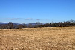
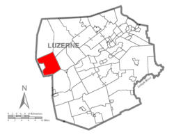
According to the United States Census Bureau, the township has a total area of 28.7 square miles (74.4 km2), of which 28.5 square miles (73.8 km2) is land and 0.23 square miles (0.6 km2), or 0.85%, is water. Most of the township is made up of small farming communities (e.g., Cambra, Harveyville, Huntington Mills, and Waterton). It is bordered to the south by Huntington Mountain. Huntington Creek flows through the center of the municipality. The only major route in the township is PA 239.

Demographics

Historical population
CensusPop.Note
2000 2,104
2010 2,2446.7%
2020 2,052−8.6%
2021 (est.)2,056 [2] 0.2%
U.S. Decennial Census [5]

As of the census [6] of 2000, there were 2,104 people, 780 households, and 601 families living in the township.

The population density was 74.0 people per square mile (28.6/km2). There were 893 housing units at an average density of 31.4/sq mi (12.1/km2).

The racial makeup of the township was 98.29% White, 0.29% African American, 0.10% Native American, 0.19% Asian, 0.14% from other races, and 1.00% from two or more races. Hispanic or Latino of any race were 0.62% of the population.

There were 780 households, out of which 32.4% had children under the age of eighteen living with them; 65.4% were married couples living together, 7.9% had a female householder with no husband present, and 22.9% were non-families. 18.5% of all households were made up of individuals, and 8.3% had someone living alone who was sixty-five years of age or older.

The average household size was 2.61 and the average family size was 2.96.

In the township, the population was spread out, with 23.3% under the age of eighteen, 6.7% from eighteen to twenty-four, 28.9% from twenty-five to forty-four, 25.3% from forty-five to sixty-four, and 15.8% who were sixty-five years of age or older. The median age was thirty-nine years.

For every one hundred females, there were 98.3 males. For every one hundred females who were aged eighteen or older, there were 93.8 males.

The median income for a household in the township was $38,173, and the median income for a family was $41,940. Males had a median income of $32,097 compared with that of $20,750 for females.

The per capita income for the township was $17,461.

Roughly 7.5% of families and 9.1% of the population were living below the poverty line, including 9.1% of those who were under the age of eighteen and 7.8% of those who were aged sixty-five or older.

Bridge in Huntington Township, Luzerne County, Pennsylvania.JPG
Bridge over Huntington Creek (in Huntington Township)
Northeastern Huntington Township, Luzerne County, Pennsylvania from Cemetery Hill Road 6.JPG
Northeastern Huntington Township
Northeastern Huntington Township, Luzerne County, Pennsylvania from Cemetery Hill Road 1.JPG
Northeastern Huntington Township
Rusty farm equipment in Huntington Township, Luzerne County, Pennsylvania.JPG
Rusty farm equipment in Huntington Township

Related Research Articles

<span class="mw-page-title-main">Huntington Township, Adams County, Pennsylvania</span> Township in Pennsylvania, United States

Huntington Township is a rural township which is located in Adams County, Pennsylvania, United States. The population was 2,369 at the time of the 2010 census.

<span class="mw-page-title-main">Mifflin Township, Columbia County, Pennsylvania</span> Township in Pennsylvania, United States

Mifflin Township is a township in Columbia County, Pennsylvania. It is part of Northeastern Pennsylvania. The population was 2,277 at the 2020 census.

<span class="mw-page-title-main">Montour Township, Columbia County, Pennsylvania</span> Township in Pennsylvania, United States

Montour Township is a township in Columbia County, Pennsylvania. It is part of Northeastern Pennsylvania.

<span class="mw-page-title-main">Sugarloaf Township, Columbia County, Pennsylvania</span> Township in Pennsylvania, United States

Sugarloaf Township is a township in Columbia County, Pennsylvania. It is part of Northeastern Pennsylvania.

<span class="mw-page-title-main">Hiller, Pennsylvania</span> Census-designated place in Pennsylvania, United States

Hiller is an unincorporated community and census-designated place in Fayette County, Pennsylvania, United States. As of the 2010 census, it had a population of 1,155, down from 1,234 at the 2000 census.

<span class="mw-page-title-main">Ransom Township, Lackawanna County, Pennsylvania</span> Place in Pennsylvania, United States

Ransom Township is a township in Lackawanna County, Pennsylvania, United States. The population was 1,401 at the 2020 census. The township includes the village of Milwaukee.

<span class="mw-page-title-main">Duryea, Pennsylvania</span> Borough in Pennsylvania, United States

Duryea is a borough in the Greater Pittston area of Luzerne County, Pennsylvania, United States, 9 miles (14 km) south of Scranton. The Susquehanna River marks Duryea's western boundary and the Lackawanna River flows through Duryea. It was incorporated as a borough in 1901, and had a notable switching rail yard, the Duryea yard, connecting the central Wyoming Valley to destinations in lower New York and down-state Pennsylvania. Coal mining and silk manufacturing were the chief industries in Duryea's early years. The population was 5,032 at the 2020 census.

<span class="mw-page-title-main">Exeter Township, Luzerne County, Pennsylvania</span> Township in Pennsylvania, United States

Exeter Township is a township within the Greater Pittston area of Luzerne County, Pennsylvania, United States. The population was 2,047 at the 2020 census. Upper Exeter and Harding are two villages in the township.

<span class="mw-page-title-main">Fairmount Township, Luzerne County, Pennsylvania</span> Township in Pennsylvania, United States

Fairmount Township is a township in Luzerne County, Pennsylvania, United States. The population was 1,207 at the 2020 census. Fairmount Township is home to Ricketts Glen State Park. The park receives tens of thousands of visitors each year.

<span class="mw-page-title-main">Hanover Township, Luzerne County, Pennsylvania</span> Township in Pennsylvania, United States

Hanover Township is a township in Luzerne County, Pennsylvania. As of the 2020 census, the population was 11,424, making it the most populous township in the county.

<span class="mw-page-title-main">Hollenback Township, Luzerne County, Pennsylvania</span> Township in Pennsylvania, United States

Hollenback Township is a township which is located in Luzerne County, Pennsylvania, United States. The population was 1,125 at the time of the 2020 census.

<span class="mw-page-title-main">Jenkins Township, Luzerne County, Pennsylvania</span> Township in Pennsylvania, United States

Jenkins Township is a township in the Greater Pittston area of Luzerne County, Pennsylvania, United States. The population was 4,282 at the 2020 census.

<span class="mw-page-title-main">Pittston Township, Luzerne County, Pennsylvania</span> Township in Pennsylvania, United States

Pittston Township is a township in Luzerne County, Pennsylvania. The population was 3,179 as of the 2020 census. The township is located within the Greater Pittston region. As of 2010, the total population of Greater Pittston was 48,020. The Wilkes-Barre/Scranton International Airport is located in Pittston Township.

<span class="mw-page-title-main">Plains Township, Luzerne County, Pennsylvania</span> Township in Pennsylvania, United States

Plains Township is a township in Luzerne County, Pennsylvania, United States. The population was 9,816 at the 2020 census. The municipality is the birthplace of Chicago White Sox hall of famer Ed Walsh and John J. Yeosock, a United States Army general who commanded the 3rd U.S. Army during Operation Desert Shield and Operation Desert Storm. Mohegan Pennsylvania is a casino in Plains Township.

<span class="mw-page-title-main">Ross Township, Luzerne County, Pennsylvania</span> Township in Pennsylvania, United States

Ross Township is a township in Luzerne County, Pennsylvania, United States. The population was 2,719 at the 2020 census.

<span class="mw-page-title-main">Salem Township, Luzerne County, Pennsylvania</span> Township in Pennsylvania, United States

Salem Township is a township in Luzerne County, Pennsylvania, United States. The population was 4,019 at the 2020 census. The Susquehanna Steam Electric Station, a nuclear power plant, is located in Salem.

<span class="mw-page-title-main">Sugar Notch, Pennsylvania</span> Borough in Pennsylvania, United States

Sugar Notch is a borough in Luzerne County, Pennsylvania, United States. The population was nine hundred and ninety-six at the time of the 2020 census.

<span class="mw-page-title-main">Union Township, Luzerne County, Pennsylvania</span> Township in Pennsylvania, United States

Union Township is a township in Luzerne County, Pennsylvania, United States. The population was 2,033 at the 2020 census.

<span class="mw-page-title-main">Wyoming, Pennsylvania</span> Borough in Luzerne County, Pennsylvania, US

Wyoming is a borough in the Greater Pittston area of Luzerne County, Pennsylvania, United States. It is located 5 miles (8 km) north of Wilkes-Barre, along the Susquehanna River. The population was 3,097 as of the 2020 census.

<span class="mw-page-title-main">Clifford Township, Susquehanna County, Pennsylvania</span> Township in Pennsylvania, United States

Clifford Township is a township in Susquehanna County, Pennsylvania, United States. The population was 2,107 at the time of the 2020 census.

References

  1. "2016 U.S. Gazetteer Files". United States Census Bureau. Retrieved Aug 14, 2017.
  2. 1 2 3 4 Bureau, US Census. "City and Town Population Totals: 2020—2021". Census.gov. US Census Bureau. Retrieved August 4, 2022.
  3. Bradsby, Henry C. (1893). History of Luzerne County, Pennsylvania with Biographical Selections. Chicago: S.B Nelson and Co. Publishers. pp. 584–588.
  4. "National Register Information System". National Register of Historic Places . National Park Service. July 9, 2010.
  5. "Census of Population and Housing". Census.gov. Retrieved June 4, 2016.
  6. "U.S. Census website". United States Census Bureau . Retrieved 2008-01-31.

Coordinates: 41°12′00″N76°15′59″W / 41.20000°N 76.26639°W / 41.20000; -76.26639