
Kollampronunciation (help·info), known by its former name Quilonpronunciation (help·info) and Koolam, Coulão, and Desinganadu, is an ancient seaport and city on the Malabar Coast of India bordering the Laccadive Sea, which is a part of the Arabian Sea. It is 66 km (41 mi) north of the state capital Thiruvananthapuram. The city is on the banks of Ashtamudi Lake and the Kallada river.
Kollam district is one of 14 districts of the state of Kerala, India. The district has a cross-section of Kerala's natural attributes; it is endowed with a long coastline, a major Laccadive Sea seaport and an inland lake. The district has many water bodies. Kallada River is one among them, and the east side land of river is East Kallada and the west side land is West Kallada.
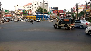
Kottarakkara, also transliterated as Kottarakara, is a town and municipality in the Kollam district of the Kerala, India. The town is close to Kollam Port, which has a rich history linked to the early medieval period as well as the reputation as an important commercial, industrial and trading center. Kottarakkara lies 27 kilometres (17 mi) to the east of Kollam city centre.

Thalavoor is a village located in the district of Kollam in the Kerala state of India. It is 77 km to the north of the State Capital, Thiruvananthapuram, and 28 km to the east of District Capital, Kollam. Thalavoor village is bordered by Pattazhy village to the north, Pidavoor village to the north-east, Vilakkudy village to the south-east, Melila village to the south and Mylom village to the west. Thalavoor is a part of Pathanapuram Block Panchayat
Pakalkuri is a charming village situated in the eastern part of Varkala Taluk in Thiruvananthapuram District in Kerala, India. It is situated 20km east of Varkala Town on the banks of the river Ithikkara and well known for its serene beauty and landscape. The river Ithikkara, which originates from the Western Ghats, separates Thiruvananthapuram and Kollam Districts at Pakalkuri in its meandering to the Arabian sea.
Karunagappally is a municipality in the Kollam district of Kerala, India. It is 24 km north of Kollam and 60 km (37 mi) south of Alappuzha. Karunagappally taluk consists of Alappad, Ochira, Adinad, Karunagappally, Thazhava, Pavumba, Thodiyoor, Kallalibhagom, Thevalakkara, Chavara, Neendakara, Clappana, Kulasekharapuram, Thekkumbhagam, Ayanivelikulangara, Panmana, Ponmana and Vadakumthala. The taluk is bound on the north by Kayamkulam, on the east by Kunnathur taluk, on the south by Kollam and on the west by the Arabian Sea. It is one of the fastest developing towns in Kerala and is part of Kollam metropolitan area.

Kudavattoor is a small village of the Kottarakara Taluk in the Kollam district of the Indian state of Kerala. In the local Malayalam language, kuda means "umbrella" and vattor "round". A predominantly rural village, Kudavattoor comes under the administration of the Veliyam Grama Panchayat made up of Marroor, Chirakarakonnam and Kudavattoor chandhamukku. The village is situated on the Kottarakara—Odanavattam—Kollam route, which provides access to Kollam via Kundara or Nedumankavu as well as to Kottarakara. Kollam, the district headquarters is situated about 25 km from Kudavattoor.

Thevannoor is a village near Ayoor in Kollam district, Kerala, India.

Pavithreswaram is a village in Kottarakkara taluk of Kollam district in the state of Kerala, India.
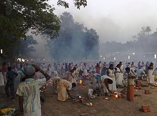
Vettikkavala is a village located in the Kollam district in the state of Kerala, India. One point of interest within the village is a Shiva-Vishnu temple which hosts a special deity called Vathukkal Njali Kunju. An annual celebration of Pongala is held at the temple. The village is also well known for temple arts and a palace constructed by Sree Moolam Thirunal.

Eravipuram is a Neighbourhood of the city of Kollam in Kerala, India. It is one among the 6 zones of the Kollam City Corporation. Other zones of the city of Kollam are Central Zone-I, Central Zone-II, Sakthikulangara, Kilikollur and Vadakkevila.
Edakkidom is a village in the Kollam district, in the Indian state of Kerala, located about 21 km (13 mi) north of Kollam city. The main attraction is Thettikkunnil Sree Mahadevi Devaswam and pulichani cave.
Poovattoor is a village located in Kottarakara taluk in the northern part of the Kollam District, Kerala state, India. It is best known as the site of an ancient Bhagavathy temple, Poovattoor Devi Temple, sister of Pattazhy Devi Temple and Mannadi Devi temple. .
Hinduism, Islam and Christianity are the prominent religions in Kollam district.
Avaneeswaram is a small village located on Kunnicode-Pathanapuram road in Kollam district, Kerala. It is about 7 kilometers south of Pathanapuram town and 36 kilometers from Kollam. It is a part of Vilakkudy panchayat. Avaneeswaram has a FCI storage facility. Economy of this village primarily is agricultural. Most common farm produce includes coconut, tapioca, areca, and cashews. Some rice cultivation is also seen.
Valakom is a town in the Kollam district of Kerala, India. It lies within Kottarakkara taluk.one of the famous eco tourism malamel para is here.

Ezhukone railway station is a railway station in Kollam district of Kerala state, India. Ezhukone railway station is coming under Madurai railway division of Southern Railway zone. It is one among the 26 railway stations in Kollam district.
Kollam district, earlier called Quilon district, is one of the 14 districts of Kerala state, India. The district is representative of all the natural attributes of Kerala states, and is endowed with a long coastal region, a major sea port on the Arabian Sea, plains and the mountains, lakes, lagoons and Kerala Backwaters, forests and the farm land, and rivers and streams. The area had mercantile relationship with Phoenicians and the Romans.


