Clyde, New Jersey | |
---|---|
Coordinates: 40°29′14″N74°30′47″W / 40.487341°N 74.513189°W [1] [2] | |
Country | United States |
State | New Jersey |
County | Somerset |
Township | Franklin |
Area | |
• Total | 0.38 sq mi (0.99 km2) |
• Land | 0.38 sq mi (0.99 km2) |
• Water | 0.00 sq mi (0.00 km2) 0.00% |
Elevation | 115 ft (35 m) |
Population | |
• Total | 243 |
• Density | 634.46/sq mi (244.80/km2) |
Time zone | UTC−05:00 (Eastern (EST)) |
• Summer (DST) | UTC−04:00 (Eastern (EDT)) |
Area code(s) | 609 and 732/848 |
FIPS code | 3413990 [1] [6] |
GNIS feature ID | 02583980 [1] |
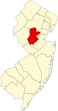
Clyde is an unincorporated community and census-designated place (CDP) located in Franklin Township, in Somerset County, in the U.S. state of New Jersey. [7] [8] [9] It was a station stop on the Penna RR's Millstone Branch. As of the 2010 United States Census, the CDP's population was 213. [10]
According to the United States Census Bureau, Clyde had a total area of 0.383 square miles (0.993 km2), all of which was land. [1] [2]
Census | Pop. | Note | %± |
---|---|---|---|
2010 | 213 | — | |
2020 | 243 | 14.1% | |
Population sources: 2010 [10] [5] |
The 2010 United States census counted 213 people, 73 households, and 64 families in the CDP. The population density was 555.8 per square mile (214.6/km2). There were 73 housing units at an average density of 190.5 per square mile (73.6/km2). The racial makeup was 65.73% (140) White, 28.17% (60) Black or African American, 0.00% (0) Native American, 6.10% (13) Asian, 0.00% (0) Pacific Islander, 0.00% (0) from other races, and 0.00% (0) from two or more races. Hispanic or Latino of any race were 4.23% (9) of the population. [10]
Of the 73 households, 37.0% had children under the age of 18; 74.0% were married couples living together; 9.6% had a female householder with no husband present and 12.3% were non-families. Of all households, 11.0% were made up of individuals and 2.7% had someone living alone who was 65 years of age or older. The average household size was 2.92 and the average family size was 3.14. [10]
24.9% of the population were under the age of 18, 3.8% from 18 to 24, 16.0% from 25 to 44, 43.2% from 45 to 64, and 12.2% who were 65 years of age or older. The median age was 46.6 years. For every 100 females, the population had 100.9 males. For every 100 females ages 18 and older there were 95.1 males. [10]
Greentree is an unincorporated community and census-designated place (CDP) located within Cherry Hill Township, in Camden County, in the U.S. state of New Jersey. As of the 2010 United States Census, the CDP's population was 11,367.
East Freehold is an unincorporated community and census-designated place (CDP) located within Freehold Township, in Monmouth County, in the U.S. state of New Jersey. As of the 2010 United States Census, the CDP's population was 4,894.
Allenwood is an unincorporated community and census-designated place (CDP) located within Wall Township, in Monmouth County, in the U.S. state of New Jersey. As of the 2010 United States Census, the CDP's population was 925.
Holiday Heights is an unincorporated community and census-designated place (CDP) located within Berkeley Township, in Ocean County, in the U.S. state of New Jersey. As of the 2010 United States Census, the CDP's population was 2,099.
Leisure Knoll is an unincorporated community and census-designated place (CDP) located within Manchester Township, in Ocean County, in the U.S. state of New Jersey. As of the 2010 United States Census, the CDP's population was 2,490.
Vernon Valley is an unincorporated community and census-designated place (CDP) located in Vernon Township, in Sussex County, in the U.S. state of New Jersey. As of the 2010 United States Census, the CDP's population was 1,626.
Harlingen is an unincorporated community and census-designated place (CDP) located within Montgomery Township, in Somerset County, in the U.S. state of New Jersey. As of the 2010 United States Census, the CDP's population was 297.
Middlebush is an unincorporated community and census-designated place (CDP) located in Franklin Township, in Somerset County, in the U.S. state of New Jersey. As of the 2010 United States Census, the CDP's population was 2,326. It is perhaps most distinguished as being the host section for Franklin Township's municipal complex.
Blawenburg is an unincorporated community and census-designated place (CDP) located within Montgomery Township, in Somerset County, in the U.S. state of New Jersey. As of the 2010 United States Census, the CDP's population was 280. It is located at the juncture of two large roads, CR 518 and CR 601.
Robbinsville is a census-designated place (CDP) located within Robbinsville Township in Mercer County, in the U.S. state of New Jersey. The area is served as United States Postal Service ZIP Code 08691. As of the 2010 United States Census, the population for the CDP was 3,041.
Oxford is an unincorporated community and census-designated place (CDP) located within Oxford Township in Warren County, New Jersey, United States, that was created as part of the 2010 United States Census. As of the 2010 Census, the CDP's population was 1,090.
East Rocky Hill is an unincorporated community and census-designated place (CDP) located in Franklin Township, in Somerset County, in the U.S. state of New Jersey. As of the 2010 United States Census, the CDP's population was 469.
Franklin Center is an unincorporated community and census-designated place (CDP) located in Franklin Township, in Somerset County, in the U.S. state of New Jersey. As of the 2010 United States Census, the CDP's population was 4,460.
Brainards is an unincorporated community and census-designated place (CDP) located within Harmony Township, in Warren County, in the U.S. state of New Jersey, that was created as part of the 2010 United States Census. As of the 2010 United States Census, the CDP's population was 202. It was formerly known as Martin's Creek.
Bridgeville is an unincorporated community and census-designated place (CDP) located within White Township, in Warren County, in the U.S. state of New Jersey, that was created as part of the 2010 United States Census. As of the 2010 Census, the CDP's population was 106.
Broadway is an unincorporated community and census-designated place (CDP) located within Franklin Township, in Warren County, in the U.S. state of New Jersey, that was created as part of the 2010 United States Census. As of the 2010 Census, the CDP's population was 244.
Finderne is an unincorporated community and census-designated place (CDP) located within Bridgewater Township, in Somerset County, in the U.S. state of New Jersey. As of the 2010 United States Census, the CDP's population was 5,600.
Green Knoll is an unincorporated community and census-designated place (CDP) located within Bridgewater Township, in Somerset County, in the U.S. state of New Jersey. As of the 2010 United States Census, the CDP's population was 6,200.
Ten Mile Run is an unincorporated community and census-designated place (CDP) located in Franklin Township, in Somerset County, in the U.S. state of New Jersey. As of the 2010 United States Census, the CDP's population was 1,959.
Voorhees is an unincorporated community and census-designated place (CDP) located in Franklin Township, in Somerset County, in the U.S. state of New Jersey. As of the 2010 United States Census, the CDP's population was 1,959.