Dankaur

Last updated

Dankaur
Town
Dankaur.jpg
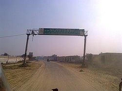
West entrance of Dankaur (Dronacharya Nagari)
India Uttar Pradesh location map.svg
Red pog.svg
Dankaur
Location in Uttar Pradesh, India
India location map 3.png
Red pog.svg
Dankaur
Dankaur (India)
Coordinates: 28°21′N77°33′E / 28.35°N 77.55°E / 28.35; 77.55
CountryFlag of India.svg  India
State Uttar Pradesh
District Gautam Buddha Nagar
Elevation
194 m (636 ft)
Population
 (2001)
  Total11,982
Language
  Official Hindi [1]
  Additional official Urdu [1]
Time zone UTC+5:30 (IST)
PIN
203201
Vehicle registration UP-16

Dankaur is a town and a nagar panchayat in Gautam Buddha Nagar district in the Indian state of Uttar Pradesh. It is situated on Yamuna Expressway, south of Greater Noida.

Contents

History

Before 1997, Dankaur and Jewar were parts of the Bulandshahr district.

In Mahabharata, Dankaur was the Dronacharya's ashram, where Kauravas and Pandavas took their training.

And in present there is also a famous temple which represent Guru Dronacharya and Eklavya. Also it is only the temple in the world for Dronacharya.

Geography

Dankaur is located on 28°21′N77°33′E / 28.35°N 77.55°E / 28.35; 77.55 . [2] It has an average elevation of 194 metres (636 feet). It is situated approximately 55 kilometres east of Delhi along the bank of river Yamuna.

Dankaur is also home to Dhanauri Wetlands, place for Sarus Crane.

Demographics

As of 2011 India census, [3] Dankaur had a population of 13,520. Males constitute 54% of the population and females 46%. Dankaur has an average literacy rate of 57%, lower than the national average of 59.5%: male literacy is 67% and, female literacy is 47%.

Connectivity

Road

Dankaur is well connected by road to Greater Noida, Jewar, Sikandrabad and Tappal. It is situated opposite to F1 race circuit on Yamuna Expressway. The Eastern Peripheral Expressway (EPE) also crosses nearby.

Rail

Dankaur railway station is situated between Ghaziabad Junction and Aligarh Junction on Delhi-Kanpur section of Indian railways. The physical location of Dankaur station is at Shyam Nagar Mandi on Dankaur-Sikandrabad road.

Politics

Dankaur is part of the Jewar Assembly constituency, represented by a MLA.

Education

See also

Related Research Articles

<span class="mw-page-title-main">Noida</span> Metropolis in Uttar Pradesh, India

Noida, short for New Okhla Industrial Development Authority, is a city located in Gautam Buddha Nagar district of the Indian state of Uttar Pradesh. Noida is a satellite city of Delhi and is a part of the National Capital Region. As per provisional reports of Census of India, the population of Noida in 2011 was 642,381. The city is managed by New Okhla Industrial Development Authority (NOIDA). The district's administrative headquarters are in the nearby city of Greater Noida.

<span class="mw-page-title-main">Khurja</span> City in Uttar Pradesh, India

Khurja is a city in Bulandshahr district in the Indian state of Uttar Pradesh. It is situated around 20 km from Bulandshahr, 85 km from Delhi. Khurja supplies a large portion of the ceramics used in the country, hence it is sometimes called The Ceramics City. The city is also famous for its special sweet, known as "khurchan".

<span class="mw-page-title-main">Gautam Buddha Nagar district</span> District of Uttar Pradesh in India

Gautam Buddha Nagardistrict is a district of Uttar Pradesh, named after Gautama Buddha. It is a part of Delhi NCR and is divided into 3 sub-divisions (Tehsils) i.e. Noida, Dadri and Jewar. Greater Noida is the administrative headquarters of Gautam Buddha Nagar district. Noida, Greater Noida, Dadri, Jewar, YEIDA city and Dankaur fall under this district.

<span class="mw-page-title-main">Greater Noida</span> City in Uttar Pradesh, India

Greater Noida is a planned city located in the Gautam Buddha Nagar district of the Indian state of Uttar Pradesh. The city was created as an extension of the area under the UP Industrial Area Development Act, of 1976. Situated 30 km (19 mi) southeast of the capital city of New Delhi, it takes around 30 minutes to travel between the cities via the Noida-Greater Noida Expressway. The city is administered by the Greater Noida Industrial Development Authority (GNIDA). It is the part of Meerut Division in Uttar Pradesh.

<span class="mw-page-title-main">Dadri</span> Town in Uttar Pradesh, India

Dadri is a town and a municipal board in Gautam Buddha Nagar District in the state of Uttar Pradesh, India. Noida, Dadri and Jewar are the 3 sub-divisions of GB Nagar district, each headed by a SDM.

Gulaothi is a town, near Bulandshahr city in the Bulandshahr district that falls under the Meerut division of the Indian state of Uttar Pradesh.

Jewar is a town and a nagar panchayat in Gautam Buddha Nagar district in the Indian state of Uttar Pradesh. Noida, Dadri and Jewar are the 3 sub-divisions of GB Nagar district, each headed by a SDM.

Rabupura is a town and a nagar panchayat in Jewar Tehsil, Gautam Buddha Nagar district in the Indian state of Uttar Pradesh. It is situated on Yamuna Expressway. A new Film City is planned at Rabupura by the Yamuna Expressway Industrial Development Authority (YEIDA).

Sikandrabad is a city and a municipal board, just outside of Bulandshahr city in Bulandshahr district in the Indian state of Uttar Pradesh. It is part of the Delhi NCR region. Sikandrabad tehsil is now a part of Bulandshahr district which is situated throughout 60+ villages.

<span class="mw-page-title-main">Akbarpur, Ambedkar Nagar</span> City in Uttar Pradesh, India

Akbarpur is a city, municipal corporation, tehsil, and the administrative headquarters of Ambedkar Nagar district in the state of Uttar Pradesh, India. It is a part of Ayodhya division.

Dalla is a village on the outskirts of the Trans-Yamuna region of Delhi, India. this is Gurjars village of DEDHA'S this village is best known for its traditional Gurjar life It is situated near Uttar Pradesh (UP) New Okhla Industrial Development Authority(NOIDA) border alongside Vasundhra Enclave and Kondli. It is one of the 24 DEDHA villages that are situated in the Trans Yamuna region. Hindon canal runs along one side of the village. It is well connected to Noida, Ghaziabad and rest of the Delhi. It falls under Kondli legislative assembly constituency(Reserved) and East Delhi parliamentary constituency.

Jahangirpur is a town/ hamlet in Jewar Tehsil, Gautam Buddha Nagar district of Uttar Pradesh, India. It comes under Jahangirpur Panchayat. It is located 32 km towards South from District headquarters Greater Noida. Jahangirpur is surrounded by Tappal towards South, Palwal towards west and Dankaur towards North. Jewar, Sikandrabad and Khurja are some nearby cities to Jahangirpur.

Loni is a town, near Ghaziabad city in Ghaziabad district in the state of Uttar Pradesh, India and Loni town is governed by Loni Municipal Council which comes under Ghaziabad Metropolitan Region.

Uttar Pradesh is the most populous state in India with a population of nearly 200 million people. The economy of Uttar Pradesh is the fifth largest of all the states in India. At current prices, the gross state domestic product (GSDP) of Uttar Pradesh is estimated to be Rs. 20.48 trillion in 2022–23. Merchandise exports from Uttar Pradesh reached US$21.03 billion in FY22.

<span class="mw-page-title-main">Noida International Airport</span> Upcoming international airport to serve Noida and Greater Noida in Uttar Pradesh, India

Noida International Airport, also known as Jewar Airport, is an upcoming international airport being constructed near Jewar in Gautam Buddha Nagar District, Uttar Pradesh in India, which will serve the National Capital Region (NCR). The airport is situated in the new planned YEIDA city.

<span class="mw-page-title-main">Yamuna Expressway</span> Indian expressway connecting Greater Noida and Agra

Yamuna Expressway is a 6-lane wide and 165.5 km (102.8 mi) long access-controlled expressway in the Indian state of Uttar Pradesh. It is presently India's 6th longest expressway and connects Greater Noida with Agra. It was built to de-congest the older Delhi–Agra national highway (NH-2) or Mathura Road.

Mirzapur and Nilonip Shahpur are twin villages and residential area in the Gautam Budh Nagar district of Uttar Pradesh, India. It is a part of Yamuna Expressway Industrial Development Authority (YEIDA), located 7 km (4.3 mi) from Dankaur

Vaina is a village and gram panchayat in Khair tehsil of Aligarh district in Uttar Pradesh, India. It borders Gautam Budh Nagar district in the north and west. It is 8 km away from Tappal and 5 km from Jewar.

Ranhera is a village and a Gram Panchayat in Jewar block of Gautam Buddha Nagar District in the Indian state of Uttar Pradesh.

Sarai Jagannath is a village located roughly 1 km south of Bilsuri. It is Gram Panchayat in Sikandrabad Block, Sikandrabad Tehsil in Bulandshahr District of the Indian state of Uttar Pradesh.

References

  1. 1 2 "52nd Report of the Commissioner for Linguistic Minorities in India" (PDF). nclm.nic.in. Ministry of Minority Affairs. Archived from the original (PDF) on 25 May 2017. Retrieved 4 January 2019.
  2. Falling Rain Genomics, Inc – Dankaur. Fallingrain.com. Retrieved on 16 May 2012.
  3. "Census of India 2001: Data from the 2001 Census, including cities, villages and towns (Provisional)". Census Commission of India. Archived from the original on 16 June 2004. Retrieved 1 November 2008.