Dayton, Maryland | |
---|---|
Coordinates: 39°17′38″N77°4′8″W / 39.29389°N 77.06889°W | |
Country | ![]() |
State | ![]() |
County | ![]() |
Elevation | 168 m (551 ft) |
Population | |
• Total | 2,114 |
Time zone | UTC-5 (EST) |
• Summer (DST) | UTC-4 (EDT) |
Area code | 240 and 301 |
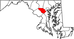
Dayton is an unincorporated community located in Howard County, Maryland, United States.
Dayton is located southwest of Baltimore and north of Washington, D.C., between Clarksville and Glenelg.
A postal office operated in the community from 21 July 1864 to present with brief stops in service during the American Civil War. [1] By 1878, the town expanded to three general stores and a wheelwright shop. One of the former is Maloney's General Store, built shortly after the Civil War, which served as a stagecoach stop and was later owned by Royal Harp III, Thomas Isaacs, Mr White, and the Grant family. [2]
The Dayton single-room school house was located along Green Bridge Road. After a fire in the single-room schoolhouse for colored children, a new brown tile two-room school was built at the crossroads of Ten Oaks, Green Bridge and Howard roads, and the colored children moved to the old white school. The two-room school is now on property owned by RLO Contractors. [3]
Dayton is in the 21036 zip code area and belongs to the 410 area code. The post office is still operating today.[ dubious – discuss ]
Dayton is also the home to the annual Dayton Daze Parade that began in honor of Lenny Hobbs. The Hobbs Family gas station was prominent in the crossroads community. [4]
The 21036 zip code is the wealthiest in the Baltimore metropolitan area as of 2013, with an average family net worth of $1.85 million, and is listed as a "super" zip code. [5] The median home value was $975,000 in 2016, with an average home size of 3,410 square feet. [6]
In 2014, a zoning case to move a large industrial mulching operation operated by a Sandy Spring Bank executive and RLO[ clarification needed ] president from Trinity Church in Elkridge to agricultural preservation land in Dayton prompted a large citizen reaction. [7]
39°15′06″N76°59′27″W / 39.25167°N 76.99083°W