Dorseyville, Maryland | |
|---|---|
| Coordinates: 39°15′40″N77°02′13″W / 39.26111°N 77.03694°W | |
| Country | |
| State | |
| County | |
| Time zone | UTC-5 (Eastern (EST)) |
| • Summer (DST) | UTC-4 (EDT) |
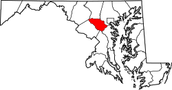
Dorseyville is an unincorporated community in Howard County, Maryland, United States. It is considered part of the modern Glenwood area. The village was situated along a fork in the rolling road that would service Annapolis or Tridelphia, Maryland. A stone dam, named Dorsey's Mill Dam, was situated on the Cattail Creek here before being washed out. [1]

