East Shore | |
---|---|
Coordinates: 40°14′33″N121°4′38″W / 40.24250°N 121.07722°W Coordinates: 40°14′33″N121°4′38″W / 40.24250°N 121.07722°W | |
Country | United States |
State | California |
County | Plumas |
Area | |
• Total | 1.183 sq mi (3.064 km2) |
• Land | 1.183 sq mi (3.064 km2) |
• Water | 0 sq mi (0 km2) 0% |
Elevation | 4,518 ft (1,377 m) |
Population (2010) | |
• Total | 156 |
• Density | 130/sq mi (51/km2) |
Time zone | UTC-8 (Pacific (PST)) |
• Summer (DST) | UTC-7 (PDT) |
ZIP code | 96137 |
Area code(s) | 530 |
FIPS code | 06-21138 |
GNIS feature ID | 1853387 |
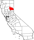
East Shore is a census-designated place (CDP) in Plumas County, California, United States. The population was 156 at the 2010 census, down from 177 at the 2000 census.
East Shore is located along the south-east shoreline of Lake Almanor, at 40°14′33″N121°4′38″W / 40.24250°N 121.07722°W (40.242583, -121.077361). [2]
According to the United States Census Bureau, the CDP has a total area of 1.2 square miles (3.1 km2), all of it land.
Historical population | |||
---|---|---|---|
Census | Pop. | %± | |
U.S. Decennial Census [3] |
At the 2010 census East Shore had a population of 156. The population density was 131.9 inhabitants per square mile (50.9/km2). The racial makeup of East Shore was 143 (91.7%) White, 0 (0.0%) African American, 7 (4.5%) Native American, 1 (0.6%) Asian, 0 (0.0%) Pacific Islander, 5 (3.2%) from other races, and 0 (0.0%) from two or more races. Hispanic or Latino of any race were 7 people (4.5%). [4]
The whole population lived in households, no one lived in non-institutionalized group quarters and no one was institutionalized.
There were 78 households, 7 (9.0%) had children under the age of 18 living in them, 56 (71.8%) were opposite-sex married couples living together, 0 (0%) had a female householder with no husband present, 0 (0%) had a male householder with no wife present. There were 2 (2.6%) unmarried opposite-sex partnerships, and 0 (0%) same-sex married couples or partnerships. 19 households (24.4%) were one person and 9 (11.5%) had someone living alone who was 65 or older. The average household size was 2.00. There were 56 families (71.8% of households); the average family size was 2.34.
The age distribution was 8 people (5.1%) under the age of 18, 6 people (3.8%) aged 18 to 24, 13 people (8.3%) aged 25 to 44, 76 people (48.7%) aged 45 to 64, and 53 people (34.0%) who were 65 or older. The median age was 60.8 years. For every 100 females, there were 88.0 males. For every 100 females age 18 and over, there were 94.7 males.
There were 265 housing units at an average density of 224.0 per square mile, of the occupied units 65 (83.3%) were owner-occupied and 13 (16.7%) were rented. The homeowner vacancy rate was 7.1%; the rental vacancy rate was 30.0%. 129 people (82.7% of the population) lived in owner-occupied housing units and 27 people (17.3%) lived in rental housing units.
At the 2000 census there were 177 people, 87 households, and 62 families in the CDP. The population density was 171.9 inhabitants per square mile (66.4/km2). There were 332 housing units at an average density of 322.4 per square mile (124.5/km2). The racial makeup of the CDP was 92.09% White, 4.52% Native American, 0.56% Asian, 1.69% from other races, and 1.13% from two or more races. 6.21% of the population were Hispanic or Latino of any race. [5] Of the 87 households 11.5% had children under the age of 18 living with them, 69.0% were married couples living together, 1.1% had a female householder with no husband present, and 27.6% were non-families. 20.7% of households were one person and 8.0% were one person aged 65 or older. The average household size was 2.03 and the average family size was 2.29.
The age distribution was 10.2% under the age of 18, 3.4% from 18 to 24, 15.3% from 25 to 44, 45.2% from 45 to 64, and 26.0% 65 or older. The median age was 54 years. For every 100 females, there were 92.4 males. For every 100 females age 18 and over, there were 93.9 males.
The median household income was $38,125 and the median family income was $38,906. Males had a median income of $25,781 versus $8,750 for females. The per capita income for the CDP was $18,985. About 10.8% of families and 16.7% of the population were below the poverty line, including none of those under the age of eighteen or sixty five or over.
In the state legislature, East Shore is in the 1st Senate District , represented by Republican Brian Dahle, [6] and the 1st Assembly District , represented by Republican Megan Dahle. [7]
Federally, East Shore is in California's 1st congressional district , represented by Republican Doug LaMalfa. [8]
Oroville East or Kelly Ridge is a census-designated place (CDP) in Butte County, California, United States. The population was 8,280 at the 2010 census, down from 8,680 at the 2000 census. Most citizens are dependent on the commerce of Oroville, and the vast majority of high school students in Kelly Ridge attend Las Plumas High School. The community of Kelly Ridge sits at Lake Oroville and offers direct access to boating, camping, fishing and a variety of water sports. Some of Oroville's most beautiful and modern properties can be found here and this neighborhood is also a popular place to retire and enjoy the outdoors.
Onyx is a census-designated place (CDP) in Kern County, California, United States. Onyx is located 3.5 miles (6 km) east-northeast of Weldon in the South Fork Valley at an elevation of 2,795 feet (852 m). The population was 475 at the 2010 census, down from 476 at the 2000 census.
North Auburn is a census-designated place (CDP) in Placer County, California, United States. It is part of the Sacramento–Arden-Arcade–Roseville Metropolitan Statistical Area. The population was 13,022 at the 2010 census, up from 11,847 at the 2000 census.
Bucks Lake is a census-designated place (CDP) in Plumas County, California, United States. Bucks Lake is located on the south shore of the lake of the same name, 13 miles (20.9 km) west-southwest of Quincy. The population was 10 at the 2010 census, down from 17 at the 2000 census.
Hamilton Branch is a census-designated place (CDP) in Plumas County, California, United States. The population was 587 at the 2000 census.
Lake Almanor Country Club is a census-designated place (CDP) in Plumas County, California, United States. The population was 419 at the 2010 census, down from 847 at the 2000 census. The ZIP code for the CDP is 96137.
Lake Almanor Peninsula is a census-designated place (CDP) in Plumas County, California, United States. The population was 356 at the 2010 census, up from 336 at the 2000 census.
Lake Almanor West is a census-designated place (CDP) in Plumas County, California, United States. The population was 270 at the 2010 census, down from 329 at the 2000 census.
Prattville is a census-designated place (CDP) in Plumas County, California, United States. The population was 33 at the 2010 census, up from 28 at the 2000 census.
Tobin is a census-designated place (CDP) in Plumas County, California, United States. The population was 12 at the 2010 census, up from 11 at the 2000 census.
Crestline is a census-designated place in the San Bernardino Mountains of San Bernardino County, California, USA. The population was 10,770 at the 2010 census, up from 10,218 at the 2000 census.
Garden Acres is a census-designated place (CDP) in San Joaquin County, California, United States. The population was 10,648 at the 2010 census, up from 9,747 at the 2000 census. It is the most populous CDP in San Joaquin County.
Kennedy is a census-designated place (CDP) in San Joaquin County, California, United States. The population was 3,356, at the 2020 census, up from 3,254 at the 2000 census.
Taft Mosswood is a census-designated place (CDP) in San Joaquin County, California, United States. The population was 1,530 at the 2010 census, up from 1,388 at the 2000 census. It comprises an unincorporated "island" within the City of Stockton.
East Foothills is a census-designated place (CDP) in Santa Clara County, California, United States and a neighborhood of San Jose. The population was 8,269 at the 2010 census and it is located about 4 miles east of downtown San Jose.
Fruitdale is a district of San Jose, California, located in West San Jose, though some portions are still unincorporated as a census-designated place. The population of the CDP was 935 at the 2010 census.
Lakewood Shores is a census-designated place (CDP) in Will County, Illinois, United States. The population was 1,347 at the 2010 census.
Beechwood is an unincorporated community in Ottawa County in the U.S. state of Michigan. It is a census-designated place (CDP) for statistical purposes, but is not an incorporated municipality. The population was 3,121 at the 2020 census.
Yorketown is an unincorporated community and census-designated place (CDP) within Manalapan Township, in Monmouth County, New Jersey, United States. At the 2010 census, the CDP's population was 6,535.
Canyon Creek is a census-designated place (CDP) in Snohomish County, Washington, United States. The population was 3,200 at the 2010 census. Prior to the 2010 census, the CDP was known as Jordan Road-Canyon Creek.