
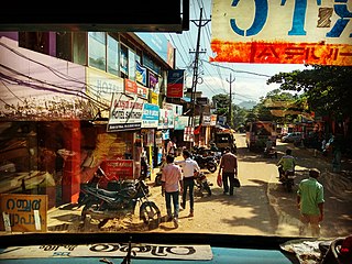
Iritty is a Municipality and a Taluk of Kannur district in Kerala State, India. The town is the main market place for the farmer communities in the surrounding regions. Iritty is known as The Coorg Valley in God's Own Country. Iritty is at a distance of 20 km (12 mi) from Kannur International Airport and one among five taluks in Kannur district. Iritty is one of the major towns lies between Coorg and Kannur international airport -Mattanur.

Mavelikkara is a taluk and municipality in the Onattukara region of Alappuzha district in the Indian state of Kerala. Located in the southern part of the district on the banks of the Achankovil River.

Perumbavoor is a place located at the bank of Periyar in Ernakulam District in the Indian state of Kerala. It is a part of the Kochi metropolitan area. It lies in the northeastern tip of the Greater Cochin area and is also the headquarters of Kunnathunad Taluk. Perumbavoor is famed in the state for wood industries and small-scale industries. Ernakulam lies 30 km southwest of Perumbavoor. The town lies between Angamaly and Muvattupuzha on the Main Central Road (MC), which connects Thiruvananthapuram to Angamaly through the old Travancore part of Kerala.

Pampady is a fast growing town in Kottayam district of Kerala, Southern India. It lies midway between the backwaters of Western Kerala and the mountains of the Western Ghats.
Vithura, also known as the Hill City Of Trivandrum, is located 36 km from Thiruvananthapuram capital of the Kerala state in India. Vithura is the culmination of the crossroads to many tourist, cultural, and religious centres. Surrounded by the Western Ghats (Sahyadris), Vithura is a prime tourist spot. The village is rich with a very scenic beauty and a good climate year-round. The Indian Institute of Science Education and Research, Thiruvananthapuram campus, one of the leading public science universities in the country, is situated here.

Mallappally is a taluk in Kerala state in India. It is one of the five taluks that make up the Pathanamthitta district. Historically a part of the kingdom of Travancore and Cochin. Called "Land of the BA graduates" due to English education imparted by the CMS College Kottayam in the 19th century, Mallappally is the original home of many Non-resident Indians, and has one of the lowest population growth and highest literacy rates in India. It comes under the Thiruvalla Revenue Division & Thiruvalla Constituency. It is Located 18 km from Thiruvalla railway station and NH 183 in Thiruvalla. Buses leave every five minutes From Thiruvalla to Mallappally and vice versa.

Piravom is a municipality in Ernakulam district and a suburb of Kochi in the Indian state of Kerala. It is located with in 31 km southeast of Kochi city center, at the boundary of the Ernakulam and Kottayam districts. Piravom is famous for its Hindu temples and Christian churches. Piravom has a river-front, verdant hills, and paddy fields.

Thalayolaparambu is a town situated in Kottayam district in Kerala, India. Spanning over an area of 19.3 square kilometres with a population of 22,571 people, this mini-town is home to some of the well-known personalities such as the former Chief minister of Travancore-Cochin A. J. John, Anaparambil, the late Malayalam novelist/writer Vaikom Muhammed Basheer, the former Chief Justice of India K. G. Balakrishnan, former President K. R. Narayanan and the Convenor of Left Democratic Front (LDF) in Kerala Vaikom Viswan, Jaykar T S, M.A.Mohammad, Vaikom Shamsudeen K V Pradeep Kumar, Principal Asramam H S S Vaikom. Thalayolaparambu also hosts the major market established during the administration of Velu Thampi Dalawa, and is one of those few Keralite markets that still retains its old-world charm till date.
Eloor is a suburb of Kochi and a municipality in Paravur Taluk, Ernakulam District in the Indian state of Kerala, India. It is an industrial area situated around 13 kilometres north of the city centre. It is an island of 14.21 km2 formed between two distributaries of river Periyar and is the largest industrial belt in Kerala. The neighbouring places of Eloor are Kalamassery industrial hub, Aluva, Cheranalloor and Paravur.
Mannar is a census town in Chengannur Taluk in Alappuzha District of Kerala state, India, on State Highway 6. It is also known as the Bell Metal Town.
Kunnukara is a census town and panchayat in Paravur Taluk of Ernakulam district, Kerala, India. The village is situated on the airport road connecting North Paravur (NH66) and Nedumbassery (NH544). North Paravur is the nearest town, 7 km from this village. Aluva (10 km) and Angamaly (12 km) are also near to Kunnukara. Its administrative headquarters is in Kunnukara Town itself. The Mini Civil Station has four hospitals, all the Govt. offices, a Khadi Unit Supermarkets etc.
Kulanada is a village in Pandalam, that is located in the district of Pathanamthitta bordering with Alappuzha district in Kerala state within India. Kulanada assumed its name from the combination of words "Kulam" and "Nada". Kulam meaning pond and Nada meaning the temple where the king of Pandalam worshiped.
Kelakam is a small town and Grama Panchayat located in the south eastern part of Kannur district in Kerala state, India.

Nedumkandam is the headquarters of Udumbanchola taluk which is situated in Idukki district of the Indian state of Kerala. Nedumkandam is among the fastest growing towns in the Idukki district. Nedumkandam is well known for its spices production and is a major contributor to the production of spices like cardamom and pepper. This town situated an average elevation of 900 meter above sea level and maximum elevation respectively 1190 meter 1100 meter and 975 meter and is a destination for economical stay and shopping for tourists in the popular Kumily-Munnar tourist route.

Bharanikkavu is a Panchayat in Alappuzha district in the Indian state of Kerala.

Karthikappally is a village in Alappuzha district in the Indian state of Kerala.Haripad is the headquarter of Karthikappally Taluk. Taluk office is located at revenue tower Haripad.
Kavumbhagom or Kavumbhagam is a place in Thiruvalla, Pathanamthitta, Kerala, India. Kavumbhagom is an important junction and part of the Thiruvalla Municipality. It is also a census village.
Perumpetty is a village under Mallappally Taluk in Pathanamthitta district, in the state of Kerala, India.
Vanchiyoor is a locality in downtown Thiruvananthapuram city, the capital of the India state of Kerala. Vanchiyoor occupies an important place in the history of Travancore. It was the district headquarters and most important offices were situated here. There are a lot of heritage monuments in the area. Major administrative, commercial, government and judicial establishments are still located in Vanchiyoor. It is part of Vanchiyoor Village, which holds the prominent administrative headquarters and landmarks of Kerala. Proximity with major educational institutions, offices and shopping centres coupled with easy road connectivity with all parts of the city make it a favoured residential locale in Thiruvananthapuram. Vanchiyoor is 2 kilometres (1.2 mi) from Statue Junction, about 3 kilometres (1.9 mi) from Palayam and 2 kilometres (1.2 mi) from the central railway and bus stations. Trivandrum International Airport lies 6 kilometres (3.7 mi) to the southwest of Vanchiyoor.
Vennikulam is a small town situated in the bank of Manimala River Near Thiruvalla in Pathanamthitta district of Kerala, South India. Town is located midway between Pullad and Mallapally towns. It Is Part Of Thiruvalla Constituency.

