Falconer, New York

Last updated
Falconer, New York
East Main Street, Falconer, New York - 20210427.jpg
East Main Street as seen in April 2021
USA New York location map.svg
Red pog.svg
Falconer
Location within the state of New York
Coordinates: 42°7′8″N79°12′1″W / 42.11889°N 79.20028°W / 42.11889; -79.20028
Country United States
State New York
County Chautauqua
Town Ellicott
Area
[1]
  Total1.08 sq mi (2.79 km2)
  Land1.08 sq mi (2.79 km2)
  Water0.00 sq mi (0.00 km2)
Elevation
1,263 ft (385 m)
Population
 (2020)
  Total2,269
  Density2,102.87/sq mi (811.97/km2)
Time zone UTC-5 (Eastern (EST))
  Summer (DST) UTC-4 (EDT)
ZIP code
14733
Area code 716
FIPS code 36-25164
GNIS feature ID0949863
Website falconerny.org

Falconer is a village in Chautauqua County, New York, United States. The population was 2,284 at the 2020 census. [2] Falconer is within the town of Ellicott and is on the eastern edge of the city of Jamestown.

Contents

History

The area now known as Falconer was inhabited by the Erie People until the mid-1600s. Five years of war with the Seneca Nation led to the Erie Nation's decimation; their people migrated and were absorbed into the Seneca community, who then inhabited this land. During the Revolutionary War, the thriving Seneca Nation sided with the losing British. In 1779, George Washington organized the Sullivan Expedition, a military campaign intended to weaken Loyalist and Haudenosaunee (Iroquois) communities. The Seneca signed the Treaty at Big Tree in 1797, surrendering most of their lands to the United States government.

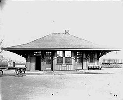
By White settlers, Falconer was originally called Worksburg, after Edward Work, who purchased the land from the Holland Land Company in August 1807. The first Falconer to own the land was Robert Falconer, who bought it from Edward Work in 1836. His son, Patrick, later consolidated his land holdings in the future village. In 1874 the community received its present name, after either William T. Falconer (1850–1915) or his father Patrick, who was on the board of directors of the Allegheny & Pittsburg Railroad and donated a large tract of land through town to the railroad concern. This resulted in the railroad line being routed through the middle of the community. [3] Route 380 in the village retains the name "Work Street" after the town's founder (it also now serves as a double entendre as the village's various industrial sites are on the same road and thus many people "work" there).

The village of Falconer was incorporated in 1891.

John Cheever selected the village as the location for the fictional Falconer State Prison in his novel Falconer .

Geography

Falconer is located in the eastern part of the town of Ellicott at 42°7′8″N79°12′1″W / 42.11889°N 79.20028°W / 42.11889; -79.20028 (42.118908, -79.200207). [4] It is bordered to the west by the city of Jamestown, while its eastern tip touches the border of the town of Poland.

The Chadakoin River, the outlet of Chautauqua Lake, flows from Jamestown and passes through the village, meeting Cassadaga Creek to the northeast at Levant. The river system is part of the Mississippi River basin via Conewango Creek and the Allegheny River.

According to the United States Census Bureau, the village has a total area of 2.8 square kilometres (1.1 sq mi), all land. [5]

New York State Route 394 (east-to-west) and Chautauqua County Route 380 (north-to-south) are the primary routes through Falconer. Access to and from Interstate 86 is available via exit 13, just east of the village. County Route 65 enters the village from the southeast. Falconer is unusual among villages in the area in that its speed limit is 25 miles per hour, the lowest of any village or town in Chautauqua County; Route 394 has a 35 mile-per-hour posted speed limit.

Former Erie Railroad station as seen in 1909 Falconer Station.jpg
Former Erie Railroad station as seen in 1909

Demographics

Historical population
CensusPop.Note
1890 574
1900 1,13697.9%
1910 2,14188.5%
1920 2,74228.1%
1930 3,57930.5%
1940 3,222−10.0%
1950 3,2922.2%
1960 3,3431.5%
1970 2,983−10.8%
1980 2,778−6.9%
1990 2,653−4.5%
2000 2,540−4.3%
2010 2,420−4.7%
2020 2,284−5.6%
2021 (est.)2,263 [2] −0.9%
U.S. Decennial Census [6]

As of the census [7] of 2000, there were 2,540 people, 1,109 households, and 699 families residing in the village. The population density was 2,346 inhabitants per square mile (906/km2). There were 1,216 housing units at an average density of 2,346.7 per square mile (906.1/km2). The racial makeup of the village was 97.8% White, 0.6% African American, 0.5% Native American, 0.3% Asian, 0.1% from other races, and 0.7% from two or more races. Hispanic or Latino of any race were 1.1% of the population.

There were 1,109 households, out of which 29.4% had children under the age of 18 living with them, 46.5% were married couples living together, 11.7% had a female householder with no husband present, and 37.0% were non-families. 31.5% of all households were made up of individuals, and 15.5% had someone living alone who was 65 years of age or older. The average household size was 2.29 and the average family size was 2.88.

In the village, the population was spread out, with 24.0% under the age of 18, 7.4% from 18 to 24, 27.0% from 25 to 44, 21.6% from 45 to 64, and 20.0% who were 65 years of age or older. The median age was 39.9 years. For every 100 females, there were 92.7 males. For every 100 females age 18 and over, there were 86.1 males.

The median income for a household in the village was $32,222, and the median income for a family was $41,711. Males had a median income of $34,961 versus $21,250 for females. The per capita income for the village was $15,205. About 6.2% of families and 10.1% of the population were below the poverty line, including 13.1% of those under age 18 and 12.9% of those age 65 or over.


Related Research Articles

<span class="mw-page-title-main">Chautauqua County, New York</span> County in New York

Chautauqua County is the westernmost county in the U.S. state of New York. As of the 2020 census, the population was 127,657. Its county seat is Mayville, and its largest city is Jamestown. Its name is believed to be the lone surviving remnant of the Erie language, a tongue lost in the 17th century Beaver Wars; its meaning is unknown and a subject of speculation. The county was created in 1808 and organized in 1811.

<span class="mw-page-title-main">Busti, New York</span> Town in New York, United States

Busti is a town in Chautauqua County, New York, United States. The population was 7,521 at the 2020 census. The town is named after Paul Busti, an official of the Holland Land Company, but its pronunciation uses a long i sound at the end, a frequent alteration in the names of several upstate New York towns. It has frequently been noted on lists of unusual place names.

<span class="mw-page-title-main">Carroll, New York</span> Town in New York, United States

Carroll is a town in Chautauqua County, New York, United States. The population was 3,524 at the 2010 census. The town is named after Charles Carroll, a signer of the Declaration of Independence.

Cassadaga is a village in Chautauqua County, New York, United States. The village is located within the northeast corner of the town of Stockton, east of the hamlet of Stockton, south of and immediately adjacent to Lily Dale in the town of Pomfret, and north of the village of Sinclairville. As of the 2020 census, the population of Cassadaga was 569.

Celoron is a village in Chautauqua County, New York, United States. It is part of the town of Ellicott and sits on the west boundary of the city of Jamestown. The population of Celoron was 1,082 at the 2020 census.

<span class="mw-page-title-main">Chautauqua, New York</span> Town in New York, United States

Chautauqua is a town and lake resort community in Chautauqua County, New York, United States. The population was 4,017 at the 2020 census. The town is named after Chautauqua Lake. It is the home of the Chautauqua Institution and the birthplace of the Chautauqua Movement.

<span class="mw-page-title-main">Ellery, New York</span> Town in New York, United States

Ellery is a town in Chautauqua County, New York, United States, located northwest of Jamestown and with an extended lakefront on the east side of Chautauqua Lake. In the 2020 census, Ellery had a population of 4,105.

<span class="mw-page-title-main">Ellicott, New York</span> Town in New York, United States

Ellicott is a town in Chautauqua County, New York, United States. The population was 8,771 at the 2020 census. The town is named after Joseph Ellicott, an agent of the Holland Land Company.

Frewsburg is a hamlet and census-designated place in the town of Carroll in Chautauqua County, New York, United States. The population was 1,906 at the 2010 census. The ZIP code is 14738 and the telephone exchange is 569.

<span class="mw-page-title-main">Gerry, New York</span> Town in New York, United States

Gerry is a town in Chautauqua County, New York, United States. The population was 1,789 at the 2020 census. The town is named after Elbridge Gerry, the fifth Vice President of the United States. The town is centrally located in the county and is north of Jamestown.

<span class="mw-page-title-main">Harmony, New York</span> Town in New York, United States

Harmony is a town in Chautauqua County, New York, United States. The population was 2,108 at the 2020 census. The town is on the south border of the county and southwest of Jamestown.

Jamestown West is a census-designated place (CDP) located near Jamestown in Chautauqua County, New York, United States. Also known as West Ellicott because of its location in the Town of Ellicott, the area population was 2,408 as of the 2010 census.

<span class="mw-page-title-main">Kiantone, New York</span> Town in New York, United States

Kiantone is a town in Chautauqua County, New York, United States. As of the 2020 census, the town had a population of 1,388. The town is immediately south of Jamestown and is at the south border of the county.

<span class="mw-page-title-main">Mayville, New York</span> Village in New York, United States

Mayville is a village in Chautauqua County, New York, United States. The population was 1,477 at the 2020 census, 13.7% less than in the 2010 census. Mayville is in the town of Chautauqua and is the county seat of Chautauqua County. The village and town offices share a building on Main Street, directly across from the Chautauqua County courthouse.

<span class="mw-page-title-main">Poland, Chautauqua County, New York</span> Town in New York, United States

Poland is an incorporated town in Chautauqua County, New York. The population was 2,201 at the time of the 2020 census. The town is on the county's eastern border.

<span class="mw-page-title-main">Sinclairville, New York</span> Village in New York, United States

Sinclairville is a village in Chautauqua County, New York, United States. The population was 578 at the 2020 census. The village is named after Major Samuel Sinclear, its founder. Sinclairville is north of Jamestown and is on the border of the towns of Charlotte and Gerry.

<span class="mw-page-title-main">Cattaraugus Reservation, Erie County, New York</span> Indian reservation in New York, United States

Cattaraugus Reservation is an Indian reservation located partly in Erie County, New York, United States. The population was 1,833 at the 2010 census.

Randolph is a town in Cattaraugus County, New York, United States. The population was 2,470 at the 2020 census. The town was named after Randolph, Vermont.

<span class="mw-page-title-main">Cherry Creek, New York</span> Town in New York, United States

Cherry Creek is a town in Chautauqua County, New York, United States. The population was 1,036 at the 2020 census. The name is derived from that of a small stream that flows through the town amid many cherry trees.

Lakewood is a village in Chautauqua County, New York, United States. The population was 2,993 at the 2020 census. The village is in the northern part of the town of Busti.

References

  1. "ArcGIS REST Services Directory". United States Census Bureau. Retrieved September 20, 2022.
  2. 1 2 Bureau, US Census. "City and Town Population Totals: 2020-2021". Census.gov. US Census Bureau. Retrieved 4 July 2022.
  3. "History of Fancher Chair". Archived from the original on 2006-12-07. Retrieved 2006-11-20.
  4. "US Gazetteer files: 2010, 2000, and 1990". United States Census Bureau. 2011-02-12. Retrieved 2011-04-23.
  5. "Geographic Identifiers: 2010 Demographic Profile Data (G001): Falconer village, New York". U.S. Census Bureau, American Factfinder. Archived from the original on February 12, 2020. Retrieved November 10, 2014.
  6. "Census of Population and Housing". Census.gov. Retrieved June 4, 2016.
  7. "U.S. Census website". United States Census Bureau . Retrieved 2008-01-31.