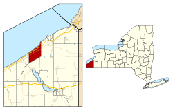
Portland, New York

Last updated

Portland, New York
Chautauqua County NY Portland town highlighted.svg
Location within Chautauqua County and New York
USA New York location map.svg
Red pog.svg
Portland
Location within the state of New York
Coordinates: 42°22′58″N79°27′43″W / 42.38278°N 79.46194°W / 42.38278; -79.46194
Country United States
State New York
County Chautauqua
Government
  Type Town Council
   Town Supervisor Daniel F. Schrantz (D)
   Town Council
Members' List
Area
[1]
  Total34.18 sq mi (88.53 km2)
  Land34.12 sq mi (88.36 km2)
  Water0.06 sq mi (0.17 km2)
Elevation
784 ft (239 m)
Population
 (2020) [2]
  Total4,366
  Estimate 
(2021) [2]
4,344
  Density136.74/sq mi (52.79/km2)
Time zone UTC-5 (Eastern (EST))
  Summer (DST) UTC-4 (EDT)
ZIP code
14769
Area code 716
FIPS code 36-013-59421
GNIS feature ID0979388
Website townofportland.org

Portland is a town in Chautauqua County, New York, United States. The population was 4,366 according to the 2020 census. [2] The town is on the shore of Lake Erie southwest of Dunkirk.

Contents

History

The area was first settled in 1804. The town of Portland was founded in 1813 from the town of Chautauqua. Subsequently, the town was reduced in size to form two new towns: Ripley (1816) and Westfield (1829).

Portland is the site of an 1872 fatal train wreck.

A genealogical history of Portland was published in 1873 by Dr. H. C. Taylor, titled Historical Sketches of the Town of Portland, New York. An all names index was created for this book by Agnes Lee Mitchell in 1989 and published by the Chautauqua County Genealogical Society.

Geography

According to the United States Census Bureau, the town has a total area of 34.18 square miles (88.53 km2), of which 34.12 square miles (88.36 km2) is land and 0.07 square miles (0.17 km2), or 0.19%, is water. [3]

The New York State Thruway (Interstate 90) and US 20 cross the northern part of the town. NY 5 parallels the shore of Lake Erie.

Communities and locations in Portland

Demographics

Historical population
CensusPop.Note
1820 1,162
1830 1,77152.4%
1840 2,13620.6%
1850 1,905−10.8%
1860 1,9844.1%
1870 1,887−4.9%
1880 2,0146.7%
1890 2,42320.3%
1900 2,69011.0%
1910 3,05813.7%
1920 3,1402.7%
1930 3,001−4.4%
1940 2,965−1.2%
1950 3,33912.6%
1960 3,6058.0%
1970 3,8025.5%
1980 4,43316.6%
1990 4,8329.0%
2000 5,50213.9%
2010 4,827−12.3%
2020 4,366−9.6%
2021 (est.)4,344 [2] −0.5%
U.S. Decennial Census [4]

The Lakeview Shock Incarceration Correctional Facility is within Portland, and their residents are therefore counted in the following demographics.

As of the census [5] of 2000, there were 5,502 people, 1,655 households, and 1,161 families residing in the town. The population density was 160.6 inhabitants per square mile (62.0/km2). There were 2,096 housing units at an average density of 61.2 per square mile (23.6/km2). The racial makeup of the town was 82.93% White, 12.05% African American, 0.49% Native American, 0.02% Asian, 0.02% Pacific Islander, 3.51% from other races, and 0.98% from two or more races. Hispanic or Latino of any race were 8.62% of the population.

There were 1,655 households, out of which 33.1% had children under the age of 18 living with them, 55.8% were married couples living together, 9.4% had a female householder with no husband present, and 29.8% were non-families. 25.4% of all households were made up of individuals, and 12.0% had someone living alone who was 65 years of age or older. The average household size was 2.57 and the average family size was 3.08.

In the town, the population was spread out, with 21.2% under the age of 18, 16.2% from 18 to 24, 32.3% from 25 to 44, 19.7% from 45 to 64, and 10.7% who were 65 years of age or older. The median age was 33 years. For every 100 females, there were 140.5 males. For every 100 females age 18 and over, there were 148.4 males.

The median income for a household in the town was $30,909, and the median income for a family was $37,006. Males had a median income of $27,464 versus $21,636 for females. The per capita income for the town was $12,881. About 8.9% of families and 11.2% of the population were below the poverty line, including 15.9% of those under age 18 and 6.7% of those age 65 or over.

Notable people

Related Research Articles

Brocton is a village in Chautauqua County, New York, United States. The name was derived by combining the names "Brockway" and "Minton", two prominent local families. The population was 1,335 at the 2020 census. Brocton is within the town of Portland.

<span class="mw-page-title-main">Busti, New York</span> Town in New York, United States

Busti is a town in Chautauqua County, New York, United States. The population was 7,521 at the 2020 census. The town is named after Paul Busti, an official of the Holland Land Company, but its pronunciation uses a long i sound at the end, a frequent alteration in the names of several upstate New York towns. It has frequently been noted on lists of unusual place names.

<span class="mw-page-title-main">Chautauqua, New York</span> Town in New York, United States

Chautauqua is a town and lake resort community in Chautauqua County, New York. The population was 4,009 at the 2020 census. The town is named after Chautauqua Lake. It is the home of the Chautauqua Institution and the birthplace of the Chautauqua movement.

<span class="mw-page-title-main">Ellery, New York</span> Town in New York, United States

Ellery is a town in Chautauqua County, New York, United States, located northwest of Jamestown and with an extended lakefront on the east side of Chautauqua Lake. In the 2020 census, Ellery had a population of 4,105.

<span class="mw-page-title-main">Ellicott, New York</span> Town in New York, United States

Ellicott is a town in Chautauqua County, New York, United States. The population was 8,771 at the 2020 census. The town is named after Joseph Ellicott, an agent of the Holland Land Company.

<span class="mw-page-title-main">French Creek, New York</span> Town in New York, United States

French Creek is a town in Chautauqua County, New York, United States. The population was 997 at the 2020 census. The town is named after the stream flowing through it, which ultimately flows to the Allegheny River in Pennsylvania. The town of French Creek is located in the far southwestern corner of the state.

<span class="mw-page-title-main">Hanover, New York</span> Town in New York, United States

Hanover is a town in Chautauqua County, New York, United States. The population was 6,893 at the 2020 census. The town lies in the northeast corner of Chautauqua County.

<span class="mw-page-title-main">Mina, New York</span> Town in New York, United States

Mina is a town in Chautauqua County, New York, United States. The population was 1,004 at the 2020 census. It is at the western county border and state line. The town is best known as a summer resort area, centered on the hamlet of Findley Lake.

<span class="mw-page-title-main">North Harmony, New York</span> Town in New York, United States

North Harmony is a town in Chautauqua County, New York, United States. The population was 2,182 at the 2020 census. The town is on the west side of Chautauqua Lake. The shore of the lake is the location of many summer resort communities.

<span class="mw-page-title-main">Pomfret, New York</span> Town in New York, United States

Pomfret is a town in Chautauqua County, New York, United States. The population was 13,236 at the 2020 census. The town lies in the north-central part of the county, south of Dunkirk, and includes the village of Fredonia.

<span class="mw-page-title-main">Sheridan, New York</span> Town in New York, United States

Sheridan is a town in Chautauqua County, New York, United States. The population was 2,563 at the 2020 census. The town is on the county's northern border, east of Dunkirk.

<span class="mw-page-title-main">Evans, New York</span> Town in New York, United States

Evans is a town in Erie County, New York, United States. The population was 16,356 at the 2010 census. The town derives its name from David E. Evans, an agent of the Holland Land Company and nephew of land agent Joseph Ellicott.

<span class="mw-page-title-main">Lake Erie Beach, New York</span> Census-designated place in New York, United States

Lake Erie Beach is a hamlet and census-designated place (CDP) in the town of Evans, Erie County, New York, United States. The population was 3,872 at the 2010 census. It is part of the Buffalo–Niagara Falls Metropolitan Statistical Area.

<span class="mw-page-title-main">Spafford, New York</span> Town in New York, United States

Spafford is a town in Onondaga County, New York, United States. As of the 2020 Census, the population was 1,588. The town was named after Horatio Gates Spafford, a writer and founder of the local library. Spafford is in the southwestern corner of Onondaga County and is southwest of Syracuse.

<span class="mw-page-title-main">Day, New York</span> Town in New York, United States

Day is a town in Saratoga County, New York, United States.

<span class="mw-page-title-main">Ontario, New York</span> Town in Wayne County, New York, US

Ontario is a town in the northwest corner of Wayne County, New York, United States. The population was 9,778 at the 2000 census, and 10,136 at the 2010 census. The town is named after the Great Lake on its northern border.

<span class="mw-page-title-main">Marblehead, Ohio</span> Village in Ohio, United States

Marblehead is a village in Ottawa County, Ohio, United States. The population was 865 at the 2020 census. It sits at the tip of the Marblehead Peninsula, which divides Lake Erie proper from Sandusky Bay. Marblehead is part of the area that is referred to regionally as Vacationland due to the large number of tourists who flock to the area in the summer months. It remains a popular vacation destination due to its lake frontage, ferry service to the Lake Erie Islands, quality sport fishery, the nearby Lakeside Chautauqua, and the Cedar Point amusement park. Marblehead is also home to the Lakeside Daisy State Nature Preserve, home to the only natural U.S. population of the Lakeside Daisy, an endangered species.

<span class="mw-page-title-main">Ripley, New York</span> Town in New York, United States

Ripley is a town on Lake Erie in the westernmost part of Chautauqua County, New York, United States. The population was 2,310 at the time of the 2020 census. The town was named after Eleazer Wheelock Ripley, a general in the War of 1812. There are no incorporated villages in the town, but there is one census-designated place: the hamlet of Ripley. The town is perhaps best known as being the western terminus of the New York State Thruway.

<span class="mw-page-title-main">Westfield, New York</span> Town in New York, United States

Westfield is a town in the western part of Chautauqua County, New York, United States. The population was 4,513 at the 2020 census. Westfield is also the name of a village within the town, containing 65% of the town's population. This unique town is accompanied by vineyards, gorges and historical buildings.

<span class="mw-page-title-main">Constantia, New York</span> Town in New York, United States

Constantia is a town in Oswego County, New York, United States. The population was 4,973 at the 2010 census. The town is located in the southeastern part of the county. Within the town is a hamlet and census-designated place of the same name.

References

  1. "2016 U.S. Gazetteer Files". United States Census Bureau. Retrieved July 4, 2017.
  2. 1 2 3 4 Bureau, US Census. "City and Town Population Totals: 2020-2021". Census.gov. US Census Bureau. Retrieved July 4, 2022.
  3. "Geographic Identifiers: 2010 Demographic Profile Data (G001): Portland town, Chautauqua County, New York". U.S. Census Bureau, American Factfinder. Archived from the original on February 12, 2020. Retrieved November 7, 2014.
  4. "Census of Population and Housing". Census.gov. Retrieved June 4, 2015.
  5. "U.S. Census website". United States Census Bureau . Retrieved January 31, 2008.
  6. 'Wisconsin Blue Book 1905,' Biographical Sketch of David B. Hulburt, pg. 1117