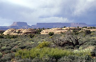
Mesa is the American English term for tableland, an elevated area of land with a flat top and sides that are usually steep cliffs. It takes its name from its characteristic table-top shape. It may also be called a table hill, table-topped hill or table mountain. It is larger than a butte, which it otherwise resembles closely.

The Interior Plains is a vast physiographic region that spreads across the Laurentian craton of central North America. The region extends from the Gulf Coast region to the Arctic Ocean along the east flank of the Rocky Mountains. In Canada the region separates the Rocky Mountains from the Canadian Shield. In the United States the plains include the Great Plains of the west and the Tallgrass prairie region to the south of the Great Lakes extending east to the Appalachian Plateau region.
Jackass Flats is a shallow alluvial basin located in the southwest portion of the Nevada National Security Site in Nye County, Nevada. The area lies east of Yucca Mountain, south of the Calico Hills and Shoshone Mountain and northwest of Skull Mountain. The valley drains to the southwest via the Tonopah and Fortymile washes into the Amargosa Valley across US Route 95 at Amargosa Valley. The "flat" covers an area of approximately 120 square miles (310 km2) and ranges in elevation from about 2,800 ft (850 m) just north of US 95 to 4,000 ft (1,200 m) at the mountain bases to the north and east.

A hill is a landform that extends above the surrounding terrain. It often has a distinct summit, although in areas with scarp/dip topography a hill may refer to a particular section of flat terrain without a massive summit.

Whiteswan Lake Provincial Park is a provincial park in British Columbia, Canada, located in the Kootenay Ranges of the Rocky Mountains, 22 km east of Canal Flats.

Elhovo is a Bulgarian town in Yambol Province, located on the left bank of the Tundzha river, between Strandzha and Sakar mountains. Second largest city in the region after Jambol, the city is located at 36 km from border checkpoint Lesovo – Hamzabeyli on the Bulgarian – Turkish border. Elhovo is the administrative center of Elhovo municipality, which includes 21 villages (municipalities). The city's population to December 15, 2014 is 10 424 inhabitants.

Frozen Head State Park and Natural Area is a state park in Morgan County, Tennessee, in the southeastern United States. The park, situated in the Crab Orchard Mountains between the city of Wartburg and the community of Petros, contains some of the highest mountains in Tennessee west of the Blue Ridge.

Savoy Mountain State Forest is a remote Massachusetts state forest located primarily in the towns of Savoy and Florida, with portions extending into neighboring Adams and North Adams. Situated along the Hoosac Mountain Range, it features four ponds, and seven hill and mountain summits, including Lewis Hill (2177 ft), Flat Rock Hill (2195 ft), Spruce Hill (2566 ft), and Borden Mountain (2505 ft). Also within the forest are at least two notable waterfalls, Parker Brook Falls and Tannery Falls, the latter of which is a 100-foot (30 m) drop. The forest is managed by the Department of Conservation and Recreation.

The West Canada Lake Wilderness Area is an Adirondack Park Forest Preserve management unit in the State of New York, USA.

Croghan Hill is the remains of an extinct volcano of the Carboniferous period and rises from the Bog of Allen in the midlands of Ireland in County Offaly. Though only 234 metres (768 ft) high it commands extensive views of the surrounding midland counties, across the flat, low-lying expanse of the Bog of Allen. The village of Croghan is located on the southern slope of the hill.
Takht-i-Suleiman is a common name for various flat-topped mountains throughout the Middle East and Central Asia.

The Mohave Mountains are a small 18-mi (29 km) long mountain range of northwest Arizona. The range is a northwest trending range in southwest Mohave County that parallels a southeast-flowing stretch of the Colorado River, the Arizona-California border. The range also forms the southwest border of a flatland region to its east and north, namely, Dutch Flat which lies east, at the south end of Sacramento Valley. Lake Havasu City, AZ on the Colorado, lays opposite the southwest flank of the range, where the London Bridge was reconstructed at Lake Havasu.

The Santa Maria Mountains are a 16-mi (26 km) long mountain range in central-northwest Arizona, and in northwest Yavapai County. The range lies in a region of mesas and mountain ranges in the northwest of Arizona's transition zone. The Santa Maria Mountains lie east of the transition zone's northwest perimeter, the parallel Aquarius and Mohon Mountains.
Jerrabattgulla Creek, a perennial stream of the Shoalhaven River catchment, is located in the Southern Tablelands region of New South Wales, Australia.

The Cooma Creek, a mostly–perennial river that is part of the Murrumbidgee catchment within the Murray–Darling basin, is located in the Monaro region of New South Wales, Australia.
The Rock Flat Creek, a watercourse that is part of the Murrumbidgee catchment within the Murray–Darling basin, is located in the Monaro region of New South Wales, Australia.
Fortification Hill is a prominence adjacent to Lake Mead in the Lake Mead National Recreation Area; it is located at the northwest terminus region of the Black Mountains (Arizona), and specifically the north region of the Black Mountains. It is near a southern section of Lake Mead, and just northeast of Hoover Dam. It can easily be seen eastward across Las Vegas Bay or from the two northern mountain terminuses of Eldorado Mountains (Nevada), or the Black Mountains (Arizona).

Red Hill is a mountain located in the Catskill Mountains of New York east-south of Frost Valley. Woodhull Mountain is located northeast of Red Hill.

Van Loan Hill is a mountain in Greene County, New York. It is located in the Catskill Mountains southwest of Maplecrest. Round Hill is located west, Elm Ridge is located north-northeast, and East Jewett Range is located south of Van Loan Hill.


