Flint, Flintshire

Last updated

Flint
St Mary's church, Flint - geograph.org.uk - 3217861.jpg
St Mary's Church, Church Street
Flintshire UK location map.svg
Red pog.svg
Flint
Location within Flintshire
Population13,736 (2021) [1] [2] [3] [4]
OS grid reference SJ243729
Community
  • Flint
Principal area
Preserved county
Country Wales
Sovereign state United Kingdom
Settlements [5] Flint, Flint Mountain, Oakenholt
Post town FLINT
Postcode district CH6
Dialling code 01352
Police North Wales
Fire North Wales
Ambulance Welsh
UK Parliament
Senedd Cymru – Welsh Parliament
Website flinttowncouncil.gov.wales
List of places
UK
Wales
Flintshire
53°14′54″N3°08′09″W / 53.2482°N 3.1358°W / 53.2482; -3.1358

Flint (Welsh : Y Fflint) is a town and community in Flintshire, Wales, lying on the estuary of the River Dee. It is the former county town of Flintshire. According to the 2001 Census, the population of the community of Flint was 12,804, [6] increasing to 12,953 at the 2011 census. [7] The urban area including Holywell and Bagillt had a population of 26,442. [8]

Contents

Geography

Flint is located in north-east Wales, adjoining the estuary of the River Dee, to the north of the town of Mold. Across the estuary, the Wirral can be seen from Flint and views to the south of the town include Halkyn Mountain. As the crow flies, Flint is located less than 12 miles from the English urban area of Liverpool, and even closer to its metro area. However, the two estuaries in between make the distance travelling on land almost twice as long.

History

Flint Castle by William Turner Joseph Mallord William Turner - Flint Castle.jpg
Flint Castle by William Turner
John Speed's map of Wales, made in 1610. The town of Flint can be seen at the top right Wales, Pays de Galles, par John Speed, 1610, BNF Gallica.jpg
John Speed's map of Wales, made in 1610. The town of Flint can be seen at the top right
Flint Town Hall Flint Town Hall (geograph 5280867).jpg
Flint Town Hall

The name refers to the stony platform on which the castle was built, and was first recorded in 1277 in the French form le Chaylou (cf modern French caillou, "gravel"). [9]

Edward I began to build Flint Castle in 1277, during his campaign to conquer Wales. Both castle and town were attacked by the forces of Madog ap Llywelyn during the revolt of 1294–95; the defenders of the town burnt it in order to deny its use to the Welsh.

Richard II was handed over to his enemy Henry Bolingbroke in the castle in 1399. As a consequence, it is the setting for Act III, Scene III of the Shakespeare play Richard II. The castle was the first of Edward I's 'iron ring' of royal castles to be built in Wales, and the design served as the basis for larger castles such as Harlech Castle and Rhuddlan Castle. Owain Glyndŵr unsuccessfully assaulted it at the commencement of his revolt in 1400.

The town did not have a wall, but a protective earthen and wooden palisaded ditch. The outline of this remained visible in the pattern of streets until the mid-1960s, and the medieval boundary can still be traced now. This can be seen in John Speed's map of Flintshire.

Flint Town Hall, the home of Flint Town Council, was erected in 1840. [10] Until 1935 the Constable of Flint Castle served ex officio as Mayor of Flint.

In 1969 Flint hosted the National Eisteddfod, and so the town has a circle of Gorsedd stones in the field adjacent to Gwynedd County Primary School. In July 2006 the stones were centre stage in the National Eisteddfod Proclamation Ceremony which formally announced Mold as the 2007 host town of the event. [11] The Urdd National Eisteddfod was held in Flint in 2016.

Governance

Flint Town Council consists of 15 councillors who are elected from four wards; 2 from Oakenholt [12] , 3 from Castle [13] and 5 each from Coleshill [14] and Trelawny [15] wards. For elections to Flintshire County Council, three councillors are elected from Flint: Coleshill and Trelawny, and one each from Flint: Castle and Flint: Oakenholt. [16] Flint is part of the Alyn and Deeside constituency and North Wales region for the Senedd, and of the Alyn and Deeside constituency for parliament.

Culture and demography

In 2001 only 18% of the local population identified as Welsh, although this census controversially had no "Welsh" tick box. [17]

In the census of 2011, 57.1% stated they had Welsh, or Welsh and other combined, identity. [18] Many people in Flint have some knowledge of the Welsh language, although competence varies. Implementation of the European Union's freedom of movement provisions has led to a noticeable increase in the numbers of Polish-language speakers in Flint. Several retail businesses display information in Polish as well as in English and Welsh and the town has a number of Polskie sklepy (Polish shops) specialising in Polish products.

The Flint accent is frequently misidentified with that of Liverpool, although it has arisen in fact as a unique blending of the speech patterns of the area's Welsh speakers, earlier Irish settlers, and the residents of nearby Cheshire, Wirral, and the wider Merseyside region. [19]

There are several songs associated with Flint. [20] The most widely sung is "The Yard". Another popular song is "Fifty German bombers over Flint", which tells the story of a wartime bombing raid over nearby Liverpool that accidentally targeted the town of Flint instead. Verses describe the arrival of the bombers over Flint, and how they were shot down by the "Bagillt Navy". Eventually, the ill-fated German aircrew were fished out by the "Greenfield Fishers". The song is often sung in a drunken, friendly manner to the accompaniment of much hand clapping and revelry.

Transport

Flint railway station lies on the North Wales Coast Line and is served by Transport for Wales services from Manchester Piccadilly to Llandudno. A north-south service between Cardiff and Holyhead also calls, [21] as do some Avanti West Coast services between London Euston and Holyhead. [22] Bus services are operated by Arriva Buses Wales.

Education

The town has three high schools: St Richard Gwyn Catholic High School, Flint High School and Ysgol Maes Hyfryd. Primary schools in Flint include the Gwynedd School, Cornist Park School, Ysgol Croes Atti (Welsh medium), St Mary's Catholic Primary School and Ysgol Pen Coch.

Community

Footplate sculpture at Flint railway station, designed by Brian Fell. Footplate sculpture at Flint Station. - geograph.org.uk - 384656.jpg
Footplate sculpture at Flint railway station, designed by Brian Fell.

Flint once had its own low-powered television relay transmitter, designed to provide improved coverage of Welsh channels in an area that would otherwise receive only English television signals. Since 2009, signals have been transmitted digitally from Storeton transmitting station on the Wirral.

Perhaps one of the town's most striking images, in addition to the castle, is the group of three tower blocks of flats near the town centre. The first two blocks were built in the 1960s and named Bolingbroke Heights and Richard Heights, with a third, Castle Heights, added shortly afterwards.

Flint's football team is Flint Town United. They play in the Cymru Premier, the top division of Welsh football following promotion from the Cymru North in 2023/24. Nicknamed "the Silkmen", they play their home games at Cae-y-Castell.

Brian Fell's sculpture footplate [23] can be seen at Flint railway station. Initially it was thought to be an imitation of the famous Monty Python foot drawn by Terry Gilliam.

The town has a library which was extensively refurbished in 2020, [24] and a leisure centre named the Jade Jones Pavilion to honour the town's Olympian. [25] As of February 2023 Flint Retail Park was undergoing expansion, [26] The town centre has been the subject of a regeneration scheme which began in 2012. [27]

A lifeboat station was established in Flint in 1966, operated by the RNLI. [28]

Notable people

Sport

Related Research Articles

<span class="mw-page-title-main">Hawarden</span> Village in Flintshire, Wales

Hawarden is a village and community in Flintshire, Wales. It is part of the Deeside conurbation on the Wales-England border and is home to Hawarden Castle. In the 2011 census the ward of the same name had a population of 1,887, whereas the community of the same name, which also includes Ewloe Mancot and Aston had a population of 13,920. The scenic wooded Hawarden Park abuts the clustered settlement in the south. Hawarden Bridge consists of distribution and industrial business premises beyond Shotton/Queensferry and the Dee. The west of the main street is called The Highway, its start marked by the crossroads with a fountain in the middle, near which are public houses, some with restaurants.

<span class="mw-page-title-main">Flintshire</span> County in Wales

Flintshire is a county in the north-east of Wales. It borders the English ceremonial counties of Merseyside and Cheshire, across the Dee Estuary to the north and by land to the east respectively, Wrexham County Borough to the south, and Denbighshire to the west. Connah's Quay is the largest town, while Flintshire County Council is based in Mold.
<span class="mw-page-title-main">Flintshire (historic)</span> Historic county of Wales

Until 1974, Flintshire, also known as the County of Flint, was an administrative county in the north-east of Wales, later classed as one of the thirteen historic counties of Wales.
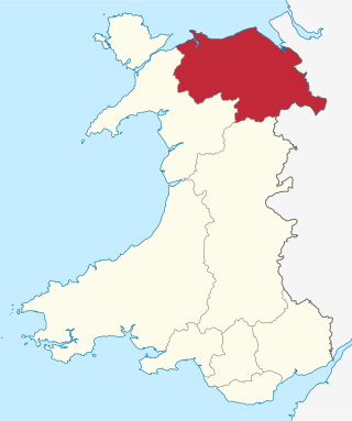
<span class="mw-page-title-main">Clwyd</span> Preserved county of Wales

Clwyd is a preserved county of Wales, situated in the north-east corner of the country; it is named after the River Clwyd, which runs through the area. To the north lies the Irish Sea, with the English ceremonial counties of Cheshire to the east and Shropshire to the south-east. Powys and Gwynedd lie to the south and west respectively. Clwyd also shares a maritime boundary with Merseyside along the River Dee. Between 1974 and 1996, a slightly different area had a county council, with local government functions shared with six district councils. In 1996, Clwyd was abolished, and the new principal areas of Conwy County Borough, Denbighshire, Flintshire and Wrexham County Borough were created; under this reorganisation, "Clwyd" became a preserved county, with the name being retained for certain ceremonial functions.

<span class="mw-page-title-main">River Dee, Wales</span> River in Wales and England

The River Dee is a river flowing through North Wales, and through Cheshire, England, in Great Britain. The length of the main section from Bala to Chester is 113 km and it is largely located in Wales. The stretch between Aldford and Chester is within England, and two other sections form the border between the two countries.
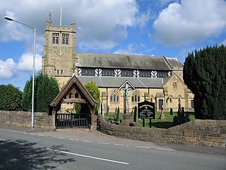
<span class="mw-page-title-main">Buckley, Flintshire</span> Town and community in Flintshire, Wales

Buckley is a town and community in Flintshire, north-east Wales, two miles (3 km) from the county town of Mold and contiguous with the villages of Ewloe, Alltami and Mynydd Isa. It is on the A549 road, with the larger A55 road passing nearby.
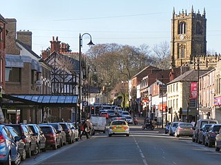
<span class="mw-page-title-main">Mold, Flintshire</span> Welsh county town

Mold is a town and community in Flintshire, Wales, on the River Alyn. It is the county town and administrative seat of Flintshire County Council, as it was of Clwyd from 1974 to 1996. According to the 2011 UK census, it had a population of 10,058. A 2019 estimate puts it at 10,123.

<span class="mw-page-title-main">Queensferry, Flintshire</span> Town in Deeside, Flintshire, Wales

Queensferry is a town and community in Flintshire, Wales, lying on the River Dee near the border. The community includes the village of Sandycroft. It is between Connah's Quay, Shotton and Saltney Ferry. Queensferry is also part of the wider Deeside conurbation.

<span class="mw-page-title-main">Shotton, Flintshire</span> Human settlement in Wales

Shotton is a town and community in Flintshire, Wales, within the Deeside conurbation along the River Dee, joined with Connah's Quay, near the border with England. It is located 5 miles (8 km) west of Chester and can be reached by road from the A548. In the 2011 census, Shotton had a population of 6,663.

<span class="mw-page-title-main">Saltney</span> Town in Wales and England

Saltney is a town straddling the counties of Flintshire and Cheshire on the England–Wales border. The local government community of Saltney lies entirely in Wales, while the English areas are unparished. The town forms part of Chester's built-up area and is around 5 miles from Deeside.

<span class="mw-page-title-main">Alyn and Deeside (UK Parliament constituency)</span> Parliamentary constituency in the United Kingdom

Alyn and Deeside is a parliamentary constituency represented in the House of Commons of the Parliament of the United Kingdom. The constituency was created in 1983, and it elects one Member of Parliament (MP) by the first-past-the-post method of election.
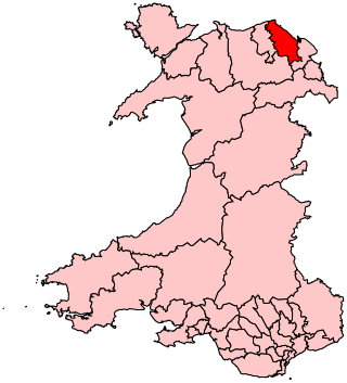
<span class="mw-page-title-main">Delyn (UK Parliament constituency)</span> UK Parliamentary constituency, 1983–2024

Delyn was a constituency last represented in the House of Commons of the UK Parliament from 2019 to 2024 by Rob Roberts, who was elected as a Conservative, but sat as an Independent following sexual harassment allegations.

<span class="mw-page-title-main">District of Delyn</span> Former district of Clwyd, Wales

Delyn was a local government district with borough status from 1974 to 1996, being one of six districts in the county of Clwyd, north-east Wales.
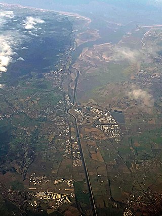
<span class="mw-page-title-main">Deeside</span> Cross-border conurbation in England and in Wales

Deeside is the name given to a predominantly industrial conurbation of towns and villages in Flintshire and Cheshire on the Wales–England border lying near the canalised stretch of the River Dee that flows from neighbouring Chester into the Dee Estuary. These include Connah's Quay, Shotton, Queensferry, Aston, Garden City, Sealand, Broughton, Bretton, Hawarden, Ewloe, Mancot, Pentre, Saltney and Sandycroft. The population is around 50,000, with a plurality (17,500) living in Connah's Quay.

<span class="mw-page-title-main">Sealand, Flintshire</span> Village in Flintshire, Wales

Sealand is a community in Flintshire and electoral ward, north-east Wales, on the edge of the Wirral peninsula. It is west of the city of Chester, England, and is part of the Deeside conurbation on the Wales-England border. At the 2001 Census, it had a population of 2,746, increasing to 2,996 at the 2011 census. The community includes the villages of Garden City and Sealand, and the settlements of Higher Ferry, Sealand Manor and Sealand Road.
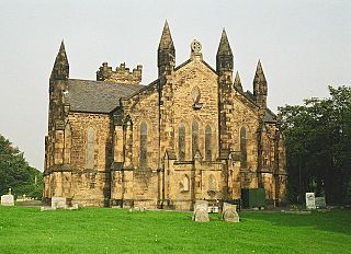
<span class="mw-page-title-main">Bagillt</span> Human settlement in Wales

Bagillt is a large village and community in Flintshire, Wales. The village overlooks the Dee Estuary and is between the towns of Holywell and Flint. At the 2001 Census the population was recorded as 3,918, increasing to 4,165 at the 2011 census. The community also includes the settlements of Coleshill, Walwen and Whelston.

<span class="mw-page-title-main">Flint Castle</span> Norman Welsh castle in ruins

Flint Castle in Flint, Flintshire, was the first of a series of castles built during King Edward I's campaign to conquer Wales.

The CH postcode area, also known as the Chester postcode area, is a group of 37 postcode districts in North West England and North East Wales. Together the districts cover west Cheshire, the Wirral part of Merseyside, and east Flintshire. Its thirteen post towns are Bagillt, Birkenhead, Buckley, Chester, Deeside, Ellesmere Port, Flint, Holywell, Mold, Neston, Prenton, Wallasey, and Wirral.
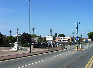
<span class="mw-page-title-main">Connah's Quay</span> Town and community in Flintshire, Wales

Connah's Quay, known locally as "The Quay" and formerly known as Wepre, is a town and community in Flintshire, on the River Dee and next to the border with England. With a population of 16,771, it is the largest town in Flintshire. The town is also part of the wider Deeside conurbation and is contiguous with Shotton, Flint and Buckley.

<span class="mw-page-title-main">Flintshire Bridge</span> Bridge in Deeside

The Flintshire Bridge is a cable-stayed bridge spanning the Dee Estuary in North Wales. The bridge links Flint and Connah's Quay to the shore north of the River Dee at the southern end of the Wirral Peninsula. The bridge cost £55 million to construct. This cost was met by the then Welsh Office and in the future, maintenance costs are expected to be the responsibility of the local authority Flintshire County Council.

References

  1. in the Flint Community; aggregated from the three electoral wards
  2. "Y Fflint: Cynswllt a Threlawny (Flint: Coleshill and Trelawny)". UK Census Data 2021. Retrieved 10 May 2023.
  3. "Y Fflint: Y Castell (Flint: Castle)". UK Census Data 2021. Retrieved 10 May 2023.
  4. "Y Fflint: Oakenholt (Flint: Oakenholt)". UK Census Data 2021. Retrieved 10 May 2023.
  5. In the Flint community
  6. 2001 Census: Flint, Office for National Statistics, archived from the original on 29 June 2011, retrieved 2 August 2009
  7. "Town population 2011". Archived from the original on 25 May 2015. Retrieved 25 May 2015.
  8. UK Census (2011). "Local Area Report – Flint Built-up area (W37000411)". Nomis. Office for National Statistics . Retrieved 21 August 2020.
  9. Hanks, Patrick; Hodges, Flavia; Mills, David; Room, Adrian (2002). The Oxford Names Companion. Oxford: the University Press. p. 1036. ISBN   0198605617.
  10. "Flint Town Hall". www.fflint.co.uk.
  11. National Eisteddfod Proclamation, BBC Wales, retrieved 27 August 2006
  12. "Oakenholt Ward". Flint Town Council. Retrieved 10 May 2023.
  13. "Castle Ward". Flint Town Council. Retrieved 10 May 2023.
  14. "Coleshill Ward". Flint Town Council. Retrieved 10 May 2023.
  15. "Trelawny Ward". Flint Town Council. Retrieved 10 May 2023.
  16. "Electoral Arrangements for Flintshire". Flintshire County Council. Retrieved 7 May 2023.
  17. "Census results 'defy tickbox row'". 30 September 2002. Retrieved 12 September 2021.
  18. UK Census (2011). "Local Area Report – Flint statistics (W04000186)". Nomis. Office for National Statistics . Retrieved 4 June 2019.
  19. The Voices Recordings: Male voice choir members, BBC, retrieved 27 August 2006
  20. "BBC - North East Wales Flintshire history - Flint songs". Archived from the original on 17 July 2011. Retrieved 16 October 2010.
  21. "Wales Railway Map and Train Routes". TfW. Retrieved 10 May 2023.
  22. "May 2023 to December 2023 timetable book" (PDF). Avanti West Coast. p. 19–27. Retrieved 10 May 2023.
  23. "Footplate". National Recording Project. Public Monuments and Sculpture Association. Archived from the original on 3 March 2016. Retrieved 1 August 2012.
  24. Craddock, Steve (3 February 2020). "Take a look inside Flint Library after £360,000 transformation". The Leader. Retrieved 1 June 2023.
  25. "Jade Jones Pavilion Leisure Centre". Aura Wales. 28 January 2021. Retrieved 1 June 2023. named in honour of the town's Tae Kwon-Do gold medal winning Olympian
  26. "Flintshire Retail Park expanding to meet growing demand for trade counters". Deeside.com. 13 February 2023. Retrieved 1 June 2023.
  27. Budden, Clare. "Regeneration - Sharp ideas for Flint". WHQ. Retrieved 1 June 2023.
  28. "RNLI: Flint" . Retrieved 16 February 2016.
  29. Press Office: Ian Puleston-Davies, Funland, BBC, retrieved 25 March 2008