
The Battle of Richmond, Kentucky, fought August 29–30, 1862, was one of the most complete Confederate victories in the war by Major General Edmund Kirby Smith against Union major general William "Bull" Nelson's forces, which were defending the town. It was the first major battle in the Kentucky Campaign. The battle took place on and around what is now the grounds of the Blue Grass Army Depot, outside Richmond, Kentucky.
Fort Donelson National Battlefield preserves Fort Donelson and Fort Heiman, two sites of the American Civil War Forts Henry and Donelson Campaign, in which Union Army Brigadier General Ulysses S. Grant and Flag Officer Andrew Hull Foote captured three Confederate forts and opened two rivers, the Tennessee River and the Cumberland River, to control by the Union Navy. The commanders received national recognition for their victories in February 1862, as they were the first major Union successes of the war. The capture of Fort Donelson and its garrison by the Union led to the capture of Tennessee's capital and industrial center, Nashville, which remained in Union hands from February 25, 1862 until the end of the war, and gave the Union effective control over much of Tennessee. This struck a major blow to the Confederacy early in the war.
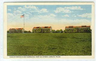
Fort McIntosh was a U.S. Army base in Laredo, Webb County, Texas, from 1849 to 1946.
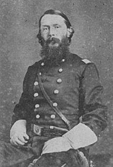
William Haines Lytle was a politician in Ohio, renowned poet, and military officer in the United States Army during both the Mexican–American War and American Civil War, where he was killed in action as a brigadier general.

The Battle of Munfordville was an engagement in Munfordville, Kentucky during the American Civil War. Victory there allowed the Confederates to temporarily strengthen their hold on the region and impair Union supply lines.

Fort Huachuca is a United States Army installation, established on 3 March 1877 as Camp Huachuca. The garrison is now under the command of the United States Army Installation Management Command. It is in Cochise County in southeast Arizona, approximately 15 miles (24 km) north of the border with Mexico and at the northern end of the Huachuca Mountains, adjacent to the town of Sierra Vista. From 1913 to 1933, the fort was the base for the "Buffalo Soldiers" of the 10th Cavalry Regiment. During the build-up of World War II, the fort had quarters for more than 25,000 male soldiers and hundreds of WACs. In the 2010 census, Fort Huachuca had a population of about 6,500 active duty soldiers, 7,400 military family members, and 5,000 civilian employees. Fort Huachuca has over 18,000 people on post during weekday work hours.

The National Register of Historic Places in the United States is a register including buildings, sites, structures, districts, and objects. The Register automatically includes all National Historic Landmarks as well as all historic areas administered by the U.S. National Park Service. Since its introduction in 1966, more than 90,000 separate listings have been added to the register.
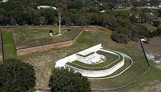
Fort Barrancas (1839) or Fort San Carlos de Barrancas is a United States military fort and National Historic Landmark in the former Warrington area of Pensacola, Florida, located physically within Naval Air Station Pensacola, which was developed later around it.

Lytle Brown was a U.S. Army officer who fought in the Spanish–American War and participated in the Mexican Expedition of 1916. Brown served as Chief of Engineers from 1929 to 1933.

Fort Hill is a promontory overlooking downtown Frankfort, Kentucky. It is the site of two earthwork forts from the American Civil War. Fort Hill is on the National Register of Historic Places and is now a public park.

Fort Boonesborough was a frontier fort in Kentucky, founded by Daniel Boone and his men following their crossing of the Kentucky River on April 1, 1775. The settlement they founded, known as Boonesborough, Kentucky, is Kentucky's second oldest European-American settlement. It served as a major frontier outpost during the American Revolutionary War, and survived into the early 19th century before its eventual abandonment. A National Historic Landmark now administered as part of Fort Boonesborough State Park, the site is one of the best-preserved archaeological sites of early westward expansion by British colonists in that period. It is located in Madison County, Kentucky off Kentucky Route 627.
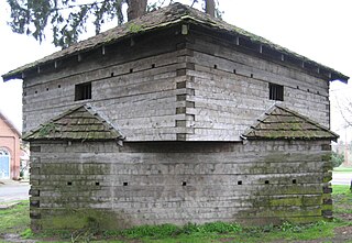
Fort Yamhill was an American military fortification in the state of Oregon. Built in 1856 in the Oregon Territory, it remained an active post until 1866. The Army outpost was used to provide a presence next to the Grand Ronde Agency Coastal Reservation. Several officers stationed at the United States Army post prior to the American Civil War would later serve as generals in that war.

The Lloyd Tilghman Memorial is an historical statue located in Paducah Kentucky, honoring native son Lloyd Tilghman, a brigadier general for the Confederate States of America who died at the Battle of Champion Hill in May 1863.
St. Mary's College was a Catholic institution established by William Byrne and George Elder in Elder's hometown of Hardin's Creek near Lebanon in Marion County, Kentucky. The community was later renamed "St. Mary" after the college. St. Mary's is now closed. It operated between 1821 and 1976. Before it closed, it was the third oldest operating Catholic college for boys in the nation.
The Fort Laramie Three-Mile Hog Ranch was built to serve as a social center away from the soldiers' post at historic Fort Laramie. Fort Laramie was a 19th-century military post in eastern Wyoming. It became notorious as a place for gambling and drinking, and for prostitution, with at least ten prostitutes always in residence. The location is notable as an example of one of only a few military bordellos still standing in the United States by 1974, the time of its nomination to the National Register of Historic Places The Fort Laramie site was one of a number of so-called "hog ranches" that appeared along trails in Wyoming.

Fort Sullivan was a 19th-century military fortification in Eastport, Maine. It lay opposite New Brunswick, Canada, and served as an important coastal defense for the easternmost United States of America during the 19th century. As part of the establishment of New Ireland during the War of 1812, British Commodore Sir Thomas Hardy, 1st Baronet conquered the fort in 1814 and renamed it Fort Sherbrooke after John Coape Sherbrooke, the Governor of Nova Scotia.

Lytle Park Historic District is a historic district in Cincinnati, Ohio, United States. Roughly bounded by 3rd, 5th, Sycamore, Commercial Sq., and Butler Sts. in downtown Cincinnati, it centers on Lytle Park.

Fort Hill is a 0.4 square mile neighborhood and historic district of Roxbury, in Boston, Massachusetts. The approximate boundaries of Fort Hill are Malcolm X Boulevard on the north, Washington Street on the southeast, and Columbus Avenue on the southwest.
The Noblit–Lytle House was a classic example of a log dog-trot house built in 1848 and located in Minor Hill, Tennessee, U.S. It was listed on the National Register of Historic Places between 2008 and 2018, when it was demolished.


