
Scotts Bluff County is a county on the western border of the U.S. state of Nebraska. As of the 2020 United States Census, the population was 36,084. Its county seat is Gering, and its largest city is Scottsbluff.

Banner County is a county in the western part of the U.S. state of Nebraska in the Great Plains region of the United States. As of the 2020 United States Census, its population was 674. Its county seat is the unincorporated community of Harrisburg; there are no incorporated municipalities within the county.

Columbus is a city in and the county seat of Platte County, in the state of Nebraska in the Midwestern United States. The population was 24,028 at the 2020 census, making it the 10th most populous city in Nebraska.
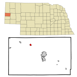
Mitchell is a city in Scotts Bluff County, Nebraska, United States. It is part of the Scottsbluff, Nebraska Micropolitan Statistical Area. The population was 1,548 at the 2020 census.

Scotts Bluff National Monument is located west of the City of Gering in western Nebraska, United States. This National Park Service site protects over 3,000 acres of historic overland trail remnants, mixed-grass prairie, rugged badlands, towering bluffs and riparian area along the North Platte River. The park boasts over 100,000 annual visitors.

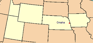
The Territory of Nebraska was an organized incorporated territory of the United States that existed from May 30, 1854, until March 1, 1867, when the final extent of the territory was admitted to the Union as the state of Nebraska. The Nebraska Territory was created by the Kansas–Nebraska Act of 1854. The territorial capital was Omaha. The territory encompassed areas of what is today Nebraska, Wyoming, South Dakota, North Dakota, Colorado, and Montana.

The Nebraska panhandle is an area in the western part of the state of Nebraska and one of several U.S. state panhandles, or elongated geographical regions that extend from their main political entity.

Fort Kearny was a historic outpost of the United States Army founded in 1848 in the western U.S. during the middle and late 19th century. The fort was named after Col. and later General Stephen Watts Kearny. The outpost was located along the Oregon Trail near Kearney, Nebraska. The town of Kearney took its name from the fort. The "e" was added to Kearny by postmen who consistently misspelled the town name. A portion of the original site is preserved as Fort Kearny State Historical Park by the Nebraska Game and Parks Commission.

The Wildcat Hills are an escarpment between the North Platte River and Pumpkin Creek in the western Panhandle, in the state of Nebraska in the Great Plains region of the United States. Located in Banner, Morrill, and Scotts Bluff counties, the high tableland between the streams has been eroded by wind and water into a region of forested buttes, ridges and canyons that rise 150 to 300 m above the surrounding landscape.

Fort Fetterman was constructed in 1867 by the United States Army on the Great Plains frontier in Dakota Territory, approximately 11 miles northwest of present-day Douglas, Wyoming. Located high on the bluffs south of the North Platte River, it served as a major base for the start of several United States military expeditions against warring Native American tribes. The fort is listed on the National Register of Historic Places.

Nebraska Highway 92 is a highway that enters the state from Nebraska's western border at the Wyoming state line west of Lyman, Nebraska, to the state's eastern border on the South Omaha Veterans Memorial Bridge over the Missouri River in Omaha, where it enters Iowa. Nebraska Highway 92 passes, follows, or runs through a number of the state's principal attractions, including Scotts Bluff National Monument, the Oregon Trail, Chimney Rock National Historic Site, Ash Hollow State Historical Park, Lake McConaughy, the Nebraska Sand Hills, and the City of Omaha. Nebraska Highway 92 is the longest state route in the state at a total of 489.1 miles (787.1 km), and is part of a continuous 886-mile (1,426 km) four-state "Highway 92" which begins in Torrington, Wyoming, goes through Nebraska and Iowa and ends in La Moille, Illinois. It is the only Nebraska Highway to run from the west border to the east border of Nebraska; along the way it crosses the Platte River or its tributary North Platte River a total of five times.
The history of the U.S. state of Nebraska dates back to its formation as a territory by the Kansas–Nebraska Act, passed by the United States Congress on May 30, 1854. The Nebraska Territory was settled extensively under the Homestead Act of 1862 during the 1860s, and in 1867 was admitted to the Union as the 37th U.S. state. The Plains Indians are the descendants of a long line of succeeding cultures of indigenous peoples in Nebraska who occupied the area for thousands of years before European arrival and continue to do so today.
The Department of the Platte was a military administrative district established by the U.S. Army on March 5, 1866, with boundaries encompassing Iowa, Nebraska, Dakota Territory, Utah Territory and a small portion of Idaho. With headquarters in Omaha, the district commander oversaw the army's role initially along the Overland route to Salt Lake City, then later the construction route of the Union Pacific Railroad. The district also included the Montana road through eastern Wyoming. The district was discontinued when the Army's command was reorganized in 1898.

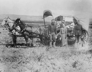
The Great Platte River Road was a major overland travel corridor approximately following the course of the Platte River in present-day Nebraska and Wyoming that was shared by several popular emigrant trails during the 19th century, including the Trapper's Trail, the Oregon Trail, the Mormon Trail, the California Trail, the Pony Express route, and the military road connecting Fort Leavenworth and Fort Laramie. The road, which extended nearly 370 miles (600 km) from the Second Fort Kearny to Fort Laramie, was utilized primarily from 1841 to 1866. In modern times it is often regarded as a sort of superhighway of its era, and has been referred to as "the grand corridor of America's westward expansion".

Robidoux Pass, also known as Roubadeau Pass, Roubedeau Pass, Roubideau Pass, Roubidoux Pass and Roubadeau Pass Gap, is a gap passing through the Wildcat Hills near Scottsbluff, Nebraska about 9 miles (14 km) west of Gering, Nebraska. The gap was on the Great Platte River Road section of the historic Oregon or Emigrant Trail. It is at an elevation of 4,554 feet (1,388 m). Used by thousands of emigrants to the west from 1843-1851, the pass is a National Historic Landmark.

Fort McPherson, originally called Cantonment McKean and popularly known as Fort Cottonwood and Post Cottonwood, was an Indian Wars-era U.S. Army installation in the Nebraska Territory, located near the site of present-day North Platte, Nebraska.

Fort Sidney is a historic fort located in Sidney, Nebraska, United States. The 37th Infantry Regiment established "Sidney Station" at a point midway between the Platte Rivers, where the modern community of Sidney, Nebraska, now stands. Initially the installation was a block house on a bluff with soldiers residing in tents nearby. That Spring, Fort Sedgewick, Colorado, was abandoned and the wooden buildings moved by mule train to a location beneath the bluffs and on the Lodgepole creek. This new garrison was named Sidney Barracks and would remain so until 1879, when it was designated Fort Sidney.

Mitchell Pass is a gap through the bluffs near Scottsbluff and Gering, Nebraska. Beginning in 1851, two of the Westward Expansion Trails passed through the gap, as did the Pony Express in the early 1860s. Today the area is protected as part of Scotts Bluff National Monument.

The Battle of Mud Springs took place February 4–6, 1865, in Nebraska between the U.S. army and warriors of the Lakota Sioux, Cheyenne, and Arapaho tribes. It was part of a series of retaliations by the Native American alliance after the U.S. army committed the Sand Creek Massacre. The battle was inconclusive, although the Indians succeeded in capturing some Army horses and a herd of several hundred cattle. Mud Springs is located 8 mi northwest of Dalton, Nebraska, and is today a National Historic Site.

O'Fallons Bluff is a section of bluffs about 20 miles (32 km) long that run along the south side of the Platte river near Sutherland in Lincoln County, Nebraska. The Oregon and California trails ran up and over these bluffs. They were characterized by American pioneers heading west to Oregon and California as sparse in vegetation with a number of violent incidents involving Native Americans. In the early 1860s, a Pony Express station was located about 5 miles (8 km) west of where the wagon trails went up the bluff. During construction of Interstate 80, the steep part of the bluffs were cut away but wagon ruts remained, which are marked by iron hoops signifying wagon wheels. It was listed in the National Register of Historic Places in 1974.


