Gordon Parish, New Brunswick

Last updated

Gordon
Victoria County NB - Gordon Parish.PNG
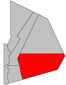
Location within Victoria County, New Brunswick.
Coordinates: 46°50′15″N67°22′57″W / 46.8375°N 67.3825°W / 46.8375; -67.3825
Country Flag of Canada (Pantone).svg  Canada
Province Flag of New Brunswick.svg  New Brunswick
County Victoria
Erected1864
Area
[1]
  Land1,430.19 km2 (552.20 sq mi)
Highest elevation
651 m (2,136 ft)
Lowest elevation
95 m (312 ft)
Population
 (2021) [1]
  Total1,559
  Density1.1/km2 (3/sq mi)
  Change 2016-2021
Increase2.svg 4.4%
  Dwellings
776
Time zone UTC-4 (AST)
  Summer (DST) UTC-3 (ADT)
Figures do not include portion within the village of Plaster Rock

Gordon is a geographic parish in Victoria County, New Brunswick, Canada. [2]

Contents

Prior to the 2023 governance reform, for governance purposes it was divided between the village of Plaster Rock and the local service district of the parish of Gordon, [3] both of which were members of the Western Valley Regional Service Commission (WVRSC). [4]

Origin of name

The parish was named in honour of Arthur Hamilton-Gordon, Lieutenant Governor of New Brunswick at the time. [5]

History

Gordon was erected in 1864 from Grand Falls, Perth, and Saint-Léonard Parishes. [6] Three months later the Carleton County line was restored to its pre-1854 course, [7] removing part of Gordon.

In 1871 all of Gordon north of a line true east and west from the southern end of Long Island in the Tobique River was erected as Lorne Parish. [8]

In 1896 the boundary with Lorne was altered. [9]

Boundaries

Gordon Parish is bounded: [2] [10] [11]

Communities

Communities at least partly within the parish. [10] [11] [16] bold indicates an incorporated municipality; italics indicate a name no longer in official use

Bodies of water

Bodies of water [lower-alpha 4] at least partly within the parish. [10] [11] [16]

Other notable places

Parks, historic sites, and other noteworthy places at least partly within the parish. [10] [11] [16] [17]

Demographics

Parish population totals do not include Plaster Rock

See also

Notes

  1. The actual wording is "the foot of Long Island" but both cadastral and highway maps show the boundary running south of Long Island. Long Island and the two unnamed islands south of it are all wetlands, so Long Island probably broke up after it was first used as a boundary point in 1871.
  2. The Royal Road is now traceable on maps only by the parish line. The remainder of the Royal Road and similar roads can be seen in an 1878 map of Victoria County. [12]
  3. By the magnet of 1896, [13] when declination in the area was between 20º and 21º west of north. [14] The Territorial Division Act clause referring to magnetic direction bearings was omitted in the 1952 [15] and 1973 Revised Statutes. [2]
  4. Not including brooks, ponds or coves.

Related Research Articles

<span class="mw-page-title-main">Waterborough Parish, New Brunswick</span> Parish in New Brunswick, Canada

Waterborough is a geographic parish in Queens County, New Brunswick, Canada.

<span class="mw-page-title-main">Kingsclear Parish, New Brunswick</span> Parish in New Brunswick, Canada

Kingsclear is a geographic parish in York County, New Brunswick, Canada.

<span class="mw-page-title-main">Addington Parish, New Brunswick</span> Parish in New Brunswick, Canada

Addington is a geographic parish in Restigouche County, New Brunswick, Canada.

<span class="mw-page-title-main">Blissville Parish, New Brunswick</span> Parish in New Brunswick, Canada

Blissville is a geographic parish in Sunbury County, New Brunswick, Canada.

<span class="mw-page-title-main">Dumfries Parish, New Brunswick</span> Parish in New Brunswick, Canada

Dumfries is a geographic parish in York County, New Brunswick, Canada.

<span class="mw-page-title-main">Eldon Parish, New Brunswick</span> Parish in New Brunswick, Canada

Eldon is a geographic parish in Restigouche County, New Brunswick, Canada.

<span class="mw-page-title-main">Saint-Basile Parish, New Brunswick</span> Parish in New Brunswick, Canada

Saint-Basile is a geographic parish in Madawaska County, New Brunswick, Canada.

<span class="mw-page-title-main">Saint-Léonard Parish, New Brunswick</span> Parish in New Brunswick, Canada

Saint-Léonard is a geographic parish in Madawaska County, New Brunswick, Canada.

<span class="mw-page-title-main">Drummond Parish, New Brunswick</span> Parish in New Brunswick, Canada

Drummond is a geographic parish in Victoria County, New Brunswick, Canada.

<span class="mw-page-title-main">Denmark Parish, New Brunswick</span> Parish in New Brunswick, Canada

Denmark is a geographic parish in Victoria County, New Brunswick, Canada.

<span class="mw-page-title-main">Lorne Parish, New Brunswick</span> Parish in New Brunswick, Canada

Lorne is a geographic parish in Victoria County, New Brunswick, Canada.

<span class="mw-page-title-main">Perth Parish, New Brunswick</span> Parish in New Brunswick, Canada

Perth is a geographic parish in Victoria County, New Brunswick, Canada.

<span class="mw-page-title-main">Grand Falls Parish, New Brunswick</span> Parish in New Brunswick, Canada

Grand Falls is a geographic parish in Victoria County, New Brunswick, Canada; the legal name in French is Grand-Sault, the only parish with different legal English and French names.

<span class="mw-page-title-main">Prince William Parish, New Brunswick</span> Parish in New Brunswick, Canada

Prince William is a geographic parish in York County, New Brunswick, Canada.

<span class="mw-page-title-main">Stanley Parish, New Brunswick</span> Parish in New Brunswick, Canada

Stanley is a geographic parish in York County, New Brunswick, Canada.

<span class="mw-page-title-main">Harvey Parish, New Brunswick</span> Parish in New Brunswick, Canada

Harvey is a geographic parish in southern Albert County, New Brunswick, Canada.

<span class="mw-page-title-main">Lepreau Parish, New Brunswick</span> Parish in Canada

Lepreau is a geographic parish in Charlotte County, New Brunswick, Canada, west of Saint John.

<span class="mw-page-title-main">Burton Parish, New Brunswick</span> Parish in New Brunswick, Canada

Burton is a geographic parish in Sunbury County, New Brunswick, Canada.

<span class="mw-page-title-main">Saint Croix Parish, New Brunswick</span> Parish in Canada

Saint Croix is a geographic parish in Charlotte County, New Brunswick, Canada, straddling Route 1 to the north of the original town of Saint Andrews.

<span class="mw-page-title-main">Saint Stephen Parish, New Brunswick</span> Parish in Canada

Saint Stephen is a geographic parish in Charlotte County, New Brunswick, Canada, located in the southwestern corner of the province.

References

  1. 1 2 "Census Profile". Statistics Canada. 26 October 2022. Retrieved 29 October 2022.
  2. 1 2 3 "Chapter T-3 Territorial Division Act". Government of New Brunswick. Retrieved 13 November 2020.
  3. "New Brunswick Regulation 84-168 under the Municipalities Act (O.C. 84-582)". Government of New Brunswick. Retrieved 23 July 2020.
  4. "Communities in each of the 12 Regional Service Commissions (RSC) / Les communautés dans chacune des 12 Commissions de services régionaux (CSR)" (PDF), Government of New Brunswick, July 2017, retrieved 1 February 2021
  5. Ganong, William F. (1896). A Monograph of the Place-Nomenclature of the Province of New Brunswick. Royal Society of Canada. p. 236. Retrieved 17 March 2021.
  6. "26 Vic. c. 44 An Act to erect parts of the Parishes of Grand Falls, Perth, and Saint Leonard, in the County of Victoria, into a separate Town or Parish.". Acts of the General Assembly of Her Majesty's Province of New Brunswick, Passed in the Month of April, 1863. Fredericton: Government of New Brunswick. 1863. p. 101. Retrieved 27 March 2021.
  7. "27 Vic. c. 27 An Act to define the Boundaries between the Counties of Carleton and Victoria.". Acts of the General Assembly of Her Majesty's Province of New Brunswick, Passed in the Month of April 1864. Fredericton: Government of New Brunswick. 1864. pp. 50–51. Retrieved 27 March 2021.
  8. "34 Vic. c. 29 An Act to erect part of the Parish of Gordon, in the County of Victoria, into a separate Town or Parish.". Acts of the General Assembly of Her Majesty's Province of New Brunswick. Passed in the Month of May 1871. Fredericton: Government of New Brunswick. 1871. pp. 168–169. Available as a free ebook from Google Books.
  9. "59 Vic. c. 8 An Act to Revise and Codify an Act to Provide for the Division of the Province into Counties, Towns and Parishes.". Acts of the General Assembly of Her Majesty's Province of New Brunswick. Passed in the Month of March, 1896. Fredericton: Government of New Brunswick. 1896. pp. 86–123. Available as a free ebook from Google Books.
  10. 1 2 3 4 "No. 63". Provincial Archives of New Brunswick. Department of Natural Resources and Energy Development. Retrieved 23 June 2021. Remainder of parish on maps 64–66, 72–75, and 82 at same site.
  11. 1 2 3 4 "194" (PDF). Transportation and Infrastructure. Government of New Brunswick. Retrieved 23 June 2021. Remainder of parish on mapbooks 195–198, 209–213, 224–227, 240, and 241 at same site.
  12. Roe, A. D.; Roe, W. B. (1878). Atlas of the Maritime Provinces of the Dominion of Canada. Saint John, New Brunswick: Roe Brothers. p. 27. Copies can be found at several websites.
  13. "59 Vic. c. 8 An Act to Revise and Codify an Act to Provide for the Division of the Province into Counties, Towns and Parishes.". Acts of the General Assembly of Her Majesty's Province of New Brunswick. Passed in the Month of March, 1896. Fredericton: Government of New Brunswick. 1896. pp. 86–123. Available as a free ebook from Google Books.
  14. "Historical Magnetic Declination". National Oceanic and Atmospheric Administration. Retrieved 30 April 2021.
  15. "Chapter 227 Territorial Division Act". The Revised Statutes of New Brunswick 1952 Volume III. Fredericton: Government of New Brunswick. 1952. pp. 3725–3771.
  16. 1 2 3 "Search the Canadian Geographical Names Database (CGNDB)". Government of Canada. Retrieved 3 July 2021.
  17. "Explore New Brunswick's Protected Natural Areas". GeoNB. Retrieved 3 July 2021.
  18. "New Brunswick Regulation 94-43 under the Fish and Wildlife Act (O.C. 94-231)". Government of New Brunswick. 5 June 2006. Retrieved 8 July 2021.
  19. Statistics Canada: 1996, 2001, 2006, 2021 census
  20. 2011 Statistics Canada Census Profile: Gordon Parish, New Brunswick
  21. 1 2 "Census Profile, 2016 Census: Gordon, Parish [Census subdivision], New Brunswick". Statistics Canada. Retrieved 2 October 2019.


46°50′15″N67°22′57″W / 46.83750°N 67.38250°W / 46.83750; -67.38250 (Gordon Parish, New Brunswick)