Related Research Articles
The Brecon Beacons are a mountain range in South Wales. In a narrow sense, the name refers to the range of Old Red Sandstone peaks which lie to the south of Brecon. Sometimes referred to as "the central Beacons" they include South Wales' highest mountain, Pen y Fan. The range forms the central section of the Brecon Beacons National Park, a designation which also encompasses ranges both to the east and the west of "the central Beacons". This much wider area is also commonly referred to as "the Brecon Beacons", and it includes the Black Mountains to the east as well as the similarly named but quite distinct Black Mountain to the west. The highest peaks include Fan Brycheiniog to the west and Pen y Fan in the central part. They share the same basic geology as the central range, and so exhibit many similar features, such as the north-facing escarpment and glacial features such as lakes and cwms (cirques)
Llanelly is the name of a parish and coterminous community in the principal area of Monmouthshire, within the historic boundaries of Brecknockshire, south-east Wales. It roughly covers the area of the Clydach Gorge. The population of the parish and ward at the 2011 census was 3,899.
The Brecon Beacons National Park is one of three national parks in Wales, and is centred on the Brecon Beacons range of hills in southern Wales. It includes the Black Mountain in the west, Fforest Fawr and the Brecon Beacons in the centre and the Black Mountains in the east.

Vaynor is a village and community in Merthyr Tydfil County Borough in Wales, United Kingdom. The population of the community at the 2011 census was 3,551.
Llanddeusant is a community in the Black Mountain (range) of the Brecon Beacons National Park in Carmarthenshire, Wales. It is about 5 miles southeast of Llangadog.

Govilon is a small Welsh village located between Llanfoist and Gilwern near Abergavenny in north Monmouthshire. It is part of the community of Llanfoist Fawr.
The Afon Senni is a river in Powys, Wales which rises in the Fforest Fawr section of the Brecon Beacons National Park and flows northwards for 11 kilometres (7 mi) to a confluence with the River Usk at Sennybridge.
Heol Senni is a hamlet in the valley of the Afon Senni just north of the Fforest Fawr section of the Brecon Beacons National Park. It lies within the community of Maescar in the county of Powys, Wales. The Welsh name means the 'road by Senni' and reflects its position near the crossing of the river by the minor road running from the A4067 to the A4215 road. This route was, and to some extent still is, an important link between Brecon and the upper Swansea Valley.

The Afon Cennen is a river in the county of Carmarthenshire, south Wales. It rises on the northern slopes of the Black Mountain to the east of the summit of Tair Carn Uchaf and flows north to Blaencennen Farm, then westwards past Carreg Cennen Castle, continuing through the village of Trap where it exits the Brecon Beacons National Park. Near the hamlet of Derwydd it turns northwest for a mile then northeast to run through the village of Ffairfach to its confluence with the River Towy/Afon Tywi opposite Llandeilo.
Trap,, is a hamlet in the county of Carmarthenshire in southwest Wales, located on the western border of the Brecon Beacons National Park, around four miles southeast of the town of Llandeilo. It is unclear whether the name – which often appears as Trapp on maps, although the spelling with a single p is generally preferred locally – refers to a fish-trap, a water-trap (mill-leat), or, given that the village is in Cwm Lladron, an ambush point.
Crai is a village in the Brecon Beacons National Park in the county of Powys, Wales and the historic county of Breconshire. The population of Cray at the 2011 census was 241. It gives its name to the community of Cray, within which are the hamlet of Felin-Crai and many dispersed farms around the valley of the Afon Crai. The river is dammed 2 km / 1.5 mi southwest of the village to form Cray Reservoir. Crai means fresh, raw water. The famous Llywel Stone was found close to the Crai/Trecastle boundary. A history of the village is contained in Lewis, D. Craionog: Hanes plwyf Defynog : yn cynnwys y rhanbarthau cynlynol; Crai, Glyntawy, Senni, Glyntarell, a Maescar. Merthyr Tydfil : H. W. Southey a'i Feibion, Cyf, Argrffwyr, 1911.

Llangattock is a village, community and electoral ward in the Brecon Beacons National Park in Powys, Wales. It lies in the Usk Valley just across the river from the town of Crickhowell. The Monmouthshire and Brecon Canal passes through the village en route between Brecon and Pontypool. It is in the historic county of Breconshire.

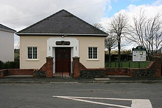
Libanus is a village in the Brecon Beacons National Park, in the county of Powys, Mid-Wales, United Kingdom. Presumably, the name of the village derives from Mount Lebanon, also known as the Lebanon Mountains, the ancient name for which was Libanus, a common name for chapels in Wales.

Pontsticill is a village within the county borough of Merthyr Tydfil in South Wales. It lies within the valley of the Taf Fechan on the southern edge of the Brecon Beacons National Park. The village lies within the community of Vaynor in an area that was, until the local government re-organisation of 1974, within the historic county of Brecknockshire.
Tretower is a hamlet in the community of Llanfihangel Cwmdu with Bwlch and Cathedine in the southern part of the county of Powys in Wales. It lies on the A479 road within the Brecon Beacons National Park at the foot of the Black Mountains just off the Usk Valley. Tretower is frequented by tourists visiting the impressive Tretower Court and the nearby ruins of Tretower Castle, both of which are now managed by Cadw. Cadw own the Court whilst ownership of the Castle lies with the owner of Tyllys Farm in the centre of the village.
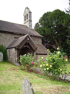
Llanspyddid is a small village just west of Brecon within the Brecon Beacons National Park. It lies within the valley of the River Usk in the community of Glyn Tarell in the county of Powys, Wales. Llanspyddid sits on the A40 trunk road between Brecon and Llandovery. The Welsh name signifies the 'church of Saint Ysbyddyd', though the village church is in fact dedicated to Saint Cadog.

Llanfrynach is a village and community in the county of Powys, Wales, and the historic county of Brecknockshire. The population of the community as taken at the 2011 census was 571. It lies just to the southeast of Brecon in the Brecon Beacons National Park. The village sits astride the Nant Menasgin, a right bank tributary of the River Usk. The B4558 passes just to its north and the Monmouthshire and Brecon Canal also passes around the village. The Welsh name signifies the 'church of Brynach'. The community includes the hamlets of Llanhamlach and Groesffordd.

Tawe-Uchaf is a community in Powys, Wales. Situated north-east of Ystradgynlais in the upper valley of the Afon Tawe, it includes the villages of Caehopkin, Coelbren, Glyntawe, Pen-y-cae, and Ynyswen. It had a population in 2001 of 1,516, increasing at the 2011 Census to 1,562.
Cradoc is a small village, about two miles northwest of Brecon, Wales. It lies within the administrative community of Yscir and partly within the Brecon Beacons National Park. Its principal attractions are Cradoc Golf Course and the nearby hill of Pen-y-crug topped by an impressive Iron Age hillfort.
Pencelli is a small village within the community of Llanfrynach in the county of Powys, Wales, and the historic county of Brecknockshire. The Welsh name signifies the 'end of (a) grove'. It lies just to the southeast of Brecon in the Brecon Beacons National Park. The village sits near the confluence of the Nant Menasgin with the River Usk. Both the B4558 and the Monmouthshire and Brecon Canal pass through the village. There is a pub - the Royal Oak, an outdoor education centre and a campsite within the village. Pencelli Castle is likely a late eleventh century fortification which fell into disuse in the thirteenth century.
References
- ↑ Owen, H.W. & Morgan, R. 2007 'Dictionary of the Place-names of Wales' Gomer Press, Ceredigion
- ↑ Ordnance Survey Explorer map OL12 'Brecon Beacons National Park: western area'
- ↑ "Community population 2011" . Retrieved 10 November 2015.
