
Apache Junction is a city in Pinal and Maricopa counties in the state of Arizona. As of the 2020 census, the population was 38,499, most of whom lived in Pinal County. It is named for the junction of the Apache Trail and Old West Highway. The area where Apache Junction is located used to be known as Youngberg. Superstition Mountain, the westernmost peak of the Superstition Mountains, is to the east.

Gila Bend, founded in 1872, is a town in Maricopa County, Arizona, United States. The town is named for an approximately 90-degree bend in the Gila River, which is near the community's current location. As of the 2020 census, the population of the town was 1,892.

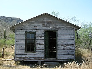
Dewey–Humboldt is a town in Yavapai County, Arizona, United States. The population of the town was 3,894 according to the 2010 census. The Dewey–Humboldt area was a census-designated place (CDP) at the 2000 census, at which time its population was 6,295.

Prescott Valley is a town located in Yavapai County, Arizona, United States, approximately 8 miles (13 km) east of Prescott. According to the 2020 United States Census, Prescott Valley has a population of 46,785 residents.

Organ Pipe Cactus National Monument is a U.S. national monument and UNESCO biosphere reserve located in extreme southern Arizona that shares a border with the Mexican state of Sonora. The park is the only place in the United States where the senita and organ pipe cactus grow wild. Along with this species, many other types of cacti and other desert flora native to the Yuma Desert section of the Sonoran Desert region grow in the park. Organ Pipe Cactus National Monument is 517 sq mi (1,340 km2) in size. In 1976 the monument was declared a Biosphere Reserve by UNESCO, and in 1977 95% of Organ Pipe Cactus was declared a wilderness area.

The following is an alphabetical list of articles related to the U.S. state of Arizona.

The Vulture Mine was a gold mine and settlement in Maricopa County, Arizona, United States. The mine began in 1863 and became the most productive gold mine in Arizona history. From 1863 to 1942, the mine produced 340,000 ounces of gold and 260,000 ounces of silver. Historically, the mine attracted more than 5,000 people to the area, and is credited with founding the town of Wickenburg, Arizona. The town that served the mine was known as Vulture City.

The Growler Mountains is a 23-mile, (37-km) long north-south trending mountain range of far western Pima County, Arizona that lies 12 miles (19 km) west of Ajo, Arizona. This desert region of southern Arizona lies in the north and central Sonoran Desert, and is one of the drier desert areas of North America.
The Growler Valley is a valley of south-central Arizona west of Ajo, Arizona.
The Bates Well Ranch, also known as the Bates Well, Growler Well, Gray Ranch and El Veit, was one of the fifteen ranches and line camps in the Gray family cattle business in the Sonoran Desert country north of the US-Mexico border in Pima County, Arizona. Operating for nearly 60 years, the ranch is now part of Organ Pipe Cactus National Monument.

Pearce, Arizona, and Sunsites, Arizona, are adjacent unincorporated communities in the Sulphur Springs Valley of Cochise County, Arizona, United States. The two communities are often referred to as Pearce–Sunsites, Pearce/Sunsites, or Pearce Sunsites.

U.S. Route 80 (US 80) also known as the Ocean-to-Ocean Highway, the Broadway of America and the Jefferson Davis Memorial Highway was a major transcontinental highway that existed in the U.S. state of Arizona from November 11, 1926, to October 6, 1989. At its peak, US 80 traveled from the California border in Yuma to the New Mexico state line near Lordsburg. US 80 was an important highway in the development of Arizona's car culture. Like its northern counterpart, US 66, the popularity of travel along US 80 helped lead to the establishment of many unique road side businesses and attractions, including many iconic motor hotels and restaurants. US 80 was a particularly long highway, reaching a length of almost 500 miles (800 km) within the state of Arizona alone for most of the route's existence.

Sunflower is a region of Maricopa County, Arizona, United States adjacent to the Mazatzal Wilderness, west of Tonto National Forest and northwest of Roosevelt Reservoir. Formerly a mercury-mining district, Sunflower is now a destination for hikers, campers and off-road vehicle tours. Sunflower is located near Arizona State Route 87, 22.8 miles (36.7 km) northeast of Fountain Hills. Route 87 near Sunflower is called the Beeline Highway.

The Mineral Park mine is a large open pit copper mine located in the Cerbat Mountains 14 miles northwest of Kingman, Arizona, in the southwestern United States. A 2013 report said that Mineral Park represented one of the largest copper reserves in the United States and in the world, having estimated reserves of 389 million tonnes of ore grading 0.14% copper and 31 million oz of silver.

Vulture City is a ghost town situated at the site of the defunct Vulture Mine in Maricopa County, Arizona, United States.

A jail tree is any tree used to incarcerate a person, usually by chaining the prisoner up to the tree. Jail trees were used on the American frontier in the Territory of Arizona, in the late 19th and early 20th centuries; jail trees were also used in Australia. A few jail trees survive to this day.

