Related Research Articles

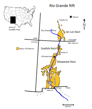
The Rio Grande rift is a north-trending continental rift zone. It separates the Colorado Plateau in the west from the interior of the North American craton on the east. The rift extends from central Colorado in the north to the state of Chihuahua, Mexico, in the south. The rift zone consists of four basins that have an average width of 50 kilometres (31 mi). The rift can be observed on location at Rio Grande National Forest, White Sands National Park, Santa Fe National Forest, and Cibola National Forest, among other locations.

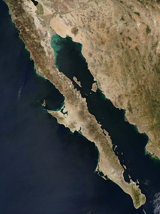
The Baja California peninsula is a peninsula in northwestern Mexico. It separates the Gulf of California from the Pacific Ocean. The peninsula extends from Mexicali, Baja California, in the north to Cabo San Lucas, Baja California Sur, in the south.

The San Andreas Fault is a continental right-lateral strike-slip transform fault that extends roughly 1,200 kilometers (750 mi) through the U.S. state of California. It forms part of the tectonic boundary between the Pacific plate and the North American plate. Traditionally, for scientific purposes, the fault has been classified into three main segments, each with different characteristics and a different degree of earthquake risk. The average slip rate along the entire fault ranges from 20 to 35 mm per year.

The Basin and Range Province is a vast physiographic region covering much of the inland Western United States and northwestern Mexico. It is defined by unique basin and range topography, characterized by abrupt changes in elevation, alternating between narrow faulted mountain chains and flat arid valleys or basins. The physiography of the province is the result of tectonic extension that began around 17 million years ago in the early Miocene epoch.

The North American plate is a tectonic plate containing most of North America, Cuba, the Bahamas, extreme northeastern Asia, and parts of Iceland and the Azores. With an area of 76 million km2 (29 million sq mi), it is the Earth's second largest tectonic plate, behind the Pacific plate.
This is a list of articles related to plate tectonics and tectonic plates.

The Imperial Fault Zone is a system of geological faults located in Imperial County in the Southern California region, and adjacent Baja California state in Mexico. It cuts across the border between the United States and Mexico.
The Brawley Seismic Zone (BSZ), also known as the Brawley fault zone, is a predominantly extensional tectonic zone that connects the southern terminus of the San Andreas Fault with the Imperial Fault in Southern California. The BSZ is named for the nearby town of Brawley in Imperial County, California, and the seismicity there is characterized by earthquake swarms.
Cerro Prieto is a volcano located approximately 29 km (18 mi) SSE of Mexicali in the Mexican state of Baja California. The volcano lies astride a spreading center associated with the East Pacific Rise. This spreading center is also responsible for a large geothermal field, which has been harnessed to generate electric power by the Cerro Prieto Geothermal Power Station.
The Cerro Prieto Fault is a transform fault located in far northern Baja California. It runs between the Cerro Prieto spreading center located southwest of Mexicali, and the Wagner Basin, another spreading center which lies under the Gulf of California. These spreading centers are part of the East Pacific Rise, the northern leg of which has formed the Gulf of California by steadily rifting the Baja California peninsula away from the mainland of Mexico.
The Guaymas Fault, named for the city of Guaymas, Sonora, Mexico, is a major right lateral-moving transform fault which runs along the seabed of the Gulf of California. It is an integral part of the Gulf of California Rift Zone, the northern extremity of the East Pacific Rise. The Guaymas Fault runs from the San Pedro Martir Basin located at the southern end of the San Lorenzo Fault, and extends southward to the Guaymas Basin, a heavily sedimented rift which includes both continental and oceanic crust and contains numerous hydrothermal vents.
The Farallon Fault is a right lateral-moving transform fault located on the seafloor of the southern Gulf of California. It links the Carmen Basin to the north with the Farallon Basin to the south. All these features are part of the Gulf of California Rift Zone, the northern extension of the East Pacific Rise.
The Atl Fault is a right lateral-moving transform fault located on the seafloor of the southern Gulf of California. It links the Farallon Basin to the north with the Pescadero Basin to the south. All these features are part of the Gulf of California Rift Zone, the northern extension of the East Pacific Rise.
The Farallon Basin is a submarine depression located on the seabed at the southern end of the Gulf of California. The basin results from the activity of one of the several spreading centers in the Gulf. The basin is linked to the Atl Fault to the south, and the Farallon Fault in the north.

The Salton Trough is an active tectonic pull-apart basin, or graben. It lies within the Imperial, Riverside, and San Diego counties of southeastern California and extends south of the Mexico–United States border into the state of Baja California.

The San Quintín Volcanic Field is a collection of ten or eleven volcanic cinder cones situated along the Pacific coast of the Baja California peninsula in Mexico. The field formed by repeated eruptions beginning in the Pleistocene and ending about 3000 years ago. It is one of several known Quaternary period volcanic fields in Baja. The lava shields appear to have first grown as subaqueous volcanoes that emerged as islands.

La Reforma is a Plio-Pleistocene caldera on the Baja California Peninsula in Mexico. It is part of eleven volcanoes in Baja California, which formed with the Gulf of California during the Miocene, about ten million years ago. Previously, a volcanic arc had existed on the peninsula. The caldera's basement consists of granites and monzonites, formed between the Cretaceous and the Middle Miocene.
The 1981 Westmorland earthquake occurred at 05:09 Pacific Daylight Time on April 26. The moderate strike-slip shock took place in the Imperial Valley of Southern California, just north of the Mexico–United States border. No injuries or deaths occurred, but damage was estimated at $1–3 million. With a Mercalli intensity of VII, this was one of fifteen intensity VII or greater shocks in the Imperial Valley that were observed in the 20th century up until April 1981. The region experiences large stand-alone events and earthquake swarms due to its position in an area of complex conditions where faulting transitions from strike-slip movement to the north and divergence to the south.
The 1915 Imperial Valley earthquakes were two destructive shocks centered near El Centro, California on June 22. The earthquakes measured Ms 6.25 and occurred nearly one hour apart at 19:59 and 20:57 PST. Both shocks were assigned VIII (Severe) on the Modified Mercalli intensity scale. Heavy damage occurred in the areas of Mexicali and El Centro, amounting to $900,000. At least six people were killed in the earthquakes.
References
- Clayton, W.R. & Trampert, J. & Rebollar, C. & Ritsema, Jeroen & Persaud, Patricia & Paulssen, J.A.M. & Pérez-Campos, Xyoli & Wettum, A. & Perez-Vertti, A. & DiLuccio, F.. (2004). The NARS-Baja seismic array in the Gulf of California rift zone. MARGINS Newslett. 13.