Gwespyr | |
---|---|
Gwespyr Village sign | |
Location within Flintshire | |
OS grid reference | SJ1083 |
Principal area | |
Country | Wales |
Sovereign state | United Kingdom |
Post town | HOLYWELL |
Postcode district | CH8 |
Dialling code | 01745 |
Police | North Wales |
Fire | North Wales |
Ambulance | Welsh |
UK Parliament | |
Senedd Cymru – Welsh Parliament | |
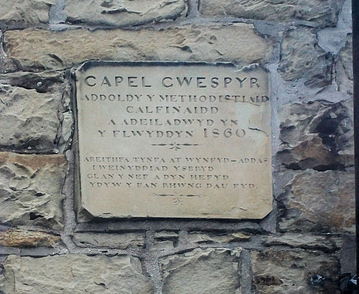
Gwespyr is a village in Flintshire on the north coast of Wales in the community of Llanasa. Gwespyr had a population of 289 people in the United Kingdom 2001 census. [1] It overlooks Point of Ayr on the west side of the River Dee estuary and its sandy beaches with dunes. The hills of the Clwydian Range behind the village form the eastern boundary of the Vale of Clwyd. Gwespyr also looks respectively Welsh but is an alien name. It represents Old English for 'West-bury' which came to be interpreted as the 'west fort' meaning the westernmost fort in Mercia. Originally, it is thought to have been a strategic Mercian lookout which was reduced in importance with the development of a fortified Rhuddlan. [2]
Gwespyr stone has been quarried in quantity from Roman times and shipped to the rest of the UK and abroad. "Gwespyr Stone" was commercially successful for its grain, colour, and quality of cutting and shaping. It was used for many buildings around Gwespyr, and was also used to build the ancient Maen Achwyfan Cross at Whitford, the chapel at St Winefride's Well in Holywell, stone carvings in Rhuddlan Castle and Denbigh Castle, St Asaph Cathedral, The Talacre Arms Public house in Gwespyr and Basingwerk Abbey in Greenfield, Flintshire.[ citation needed ] Gwespyr stone was also found on sites such as Prestatyn Castle and the Roman bath house in Prestatyn. [3] There is evidence of the stone industry in Gwespyr prevalent even today, though all but one quarry is disused. The quarry in use today is home to Delyn Metal. [4]
Gwespyr is home to two caravan parks. Tree Tops Caravan Park on New Road. [5] won its category in Wales in Bloom since 1992. [6] "Sea View Caravan Park" is located on Gwespyr Hill and up until the late 1990s was owned by the Reynolds family. Since its take over by Talacre Beach Leisure it has undergone regeneration. The site is a "sister park" to Talacre Beach Caravan park located in nearby Talacre and they share leisure and entertainment facilities. [7]
Gwespyr has been home to at least three Chapels during its history. Only two remain standing today, but they are now private houses. [8] Gwespyr's chapels are listed as Calvinistic Methodist and Wesleyan. [9] "Gwespyr Chapel", located in on Tanrallt Road, was Calvinistic Methodist and built in 1860. [10] It had a congregation averaging 136 people between 1911 - 1960. "Wesley's Memorial Chapel" is also located on Tanrallt Road and was Wesleyan by denomination. The chapel was built in 1841 and was attended by an average of 140 worshipers between 1911 - 1960; services at the chapel where conducted in the Welsh language. [9] Another chapel belonging to the Church in Wales was built during the 1960s in a stunning location perched on the top of Gwespyr Hill opposite the Reservoir. The structure was built out of tin and was nicknamed "The Tin Chapel" by the locals. The church was opened after the closure of its counterparts on Tanrallt Road but closed in the late 1970s and the congregation was moved to nearby Llanasa Parish Church. [9] Church services were also held every other Sunday at Gwespyr Village Hall by the Minister from Llanasa to aid the elderly community who could not make the journey to nearby Llanasa. These services ceased due to falling numbers and changes at the Village Hall in 2001. [11]
Gwespyr Village Hall was built in 1952. It was used initially by the local people as a meeting place and a variety of clubs where subsequently formed and based at the Hall, including a Bowls Club, Indoor Shooting range club, Bingo, a Youth club and a Snooker club. The Village Hall could be rented by local residents for parties and events. In the 1980s, two extensions were built, funded by Local government grants. A sub Post office was introduced at that time. The Village Hall was also home to Gwespyr Sounds Productions between 1998 - 2004 for its bands and music acts to rehearse. [12] The Village Hall became redundant in 2004. A new committee was formed in June 2010 and registered as a Charitable organization and work began to regenerate the building. New events and openings began in May 2011. [13] The Village Hall once again became redundant during the COVID-19 pandemic. A new committee was formed and the hall is undergoing a period of surveys and renovations in the hopes of once again opening its doors. [14]
Gwespyr War Memorial sits in a small memorial garden near the top of Gwespyr Hill and was designed by R.Bruce Esq of Talacre. It commemorates all of those men who fought in World War I, together with the one soldier who died in action. One soldier killed in World War II is commemorated. The memorial was originally erected by Sir Pyres William Mostyn Baronet to commemorate Queen Victoria's diamond jubilee 14 August 1897.
Frank Nicholson of Gwespyr was a Welsh baritone, a National Eisteddfod winner, and a wireless singer, who was attacked and killed by a stallion while walking home on a footpath leading from Talacre Abbey (known by the locals as "the park") to Gwespyr on Monday 8 October 1928. Three weeks later a woman was seriously injured by the stallion at the same place. [15]
The village is home to two public houses. "The Masons Arms" is located near the top of Gwespyr Hill. The pub was owned by Allied Breweries and served Ansells beer until the mid-1990s when the pub was bought by private owners. The pub is still open today. [16]
"The Talacre Arms" was situated midway up Gwespyr Hill. The pub was popular during the 1960s when it was owned by Marston's Brewery until the mid-1990s when it was bought by private owners; it closed in May 2011 and is now a residential building.
There is a play area across from the Masons Arms public house that is maintained by Flintshire County Council. The play area has a top and bottom part. The top is home to typical play equipment white the bottom area is one of many empty quarries - this is now home to a basketball court. [16]
The Village shop was located on Tanrallt Road but closed in the early 1990s and became a private residence. The village shop prior to it closing was very traditional selling groceries. It also served as the Village Post Office until its closure. At the bottom of Gwespyr Hill on the A548 coast road is the local garage and shop 'Lobitos', which started life in the 1950s as a general car repair garage, fuel station and cafe serving the locality and holiday traffic along the North Wales coast. [17]
Bus services are provided by Arriva Buses Wales. There are two bus stops serving the village, one on Tanrallt Road across from the former shop and the other on the A548 coast road next to the old Cam Gas Store.
Denbighshire is a county in the north-east of Wales. It borders the Irish Sea to the north, Flintshire to the east, Wrexham to the southeast, Powys to the south, and Gwynedd and Conwy to the west. Rhyl is the largest town, and Ruthin is the administrative centre. Its borders differ from the historic county of the same name.
Flintshire is a county in the north-east of Wales. It has a maritime border with Merseyside along the Dee Estuary to the north, and land borders with Cheshire to the east, Wrexham County Borough to the south, and Denbighshire to the west. Connah's Quay is the largest town, while Flintshire County Council is based in Mold.
Until 1974, Flintshire, also known as the County of Flint, was an administrative county in the north-east of Wales, later classed as one of the thirteen historic counties of Wales.
Clwyd is a preserved county of Wales, situated in the north-east corner of the country; it is named after the River Clwyd, which runs through the area. To the north lies the Irish Sea, with the English ceremonial counties of Cheshire to the east and Shropshire to the south-east. Powys and Gwynedd lie to the south and west respectively. Clwyd also shares a maritime boundary with Merseyside along the River Dee. Between 1974 and 1996, a slightly different area had a county council, with local government functions shared with six district councils. In 1996, Clwyd was abolished, and the new principal areas of Conwy County Borough, Denbighshire, Flintshire and Wrexham County Borough were created; under this reorganisation, "Clwyd" became a preserved county, with the name being retained for certain ceremonial functions.
Flintshire County Council is the unitary local authority for the county of Flintshire, one of the principal areas of Wales. It is based at County Hall in Mold.
Delyn was a local government district with borough status from 1974 to 1996, being one of six districts in the county of Clwyd, north-east Wales.
Talacre is a village in Flintshire on the north coast of Wales in the community of Llanasa and the electoral ward of Ffynnongroyw, and is the northernmost mainland settlement in Wales. The village itself has a population of 347 as of the 2011 census.
Bagillt is a large village and community in Flintshire, Wales. The village overlooks the Dee Estuary and is between the towns of Holywell and Flint. At the 2001 Census the population was recorded as 3,918, increasing to 4,165 at the 2011 census. The community also includes the settlements of Coleshill, Walwen and Whelston.
The Borough of Rhuddlan was a local government district with borough status from 1974 to 1996, being one of six districts in the county of Clwyd, north-east Wales.
Trefin, formerly anglicised as Trevine, is a village in North Pembrokeshire, south-west Wales. The village lies within the parish and community of Llanrhian, which has a significant Welsh-speaking population.
Gwernymynydd is a village outside the market town of Mold in Flintshire, Wales. It forms part of the Gwernymynydd and Cadole community. At its highest point it is 1000 feet above sea level. It has two pubs and a once-busy garage, now a coach depot, home to Eagles & Crawford. Gwernymynydd is also home to a farm, a community centre, and a village primary school. Neighbouring communities include Gwernaffield, Llanferres, Nercwys, and Mold. The population at the 2011 census was 1,141.
Brynford is a village and community in Flintshire, Wales. It is located to the south west of the town of Holywell and near the A55 road. Brynford had a population of 1,059 at the 2011 census.
Greenfield is a village in the community of Holywell, Flintshire, north-east Wales, on the edge of the River Dee estuary. At the time of the 2001 census it had a population of 2,741, which remained unchanged in the 2011 census.
Dyserth is a village, community and electoral ward in Denbighshire, Wales. Its population at the 2011 United Kingdom census was 2,269 and was estimated by the Office for National Statistics as 2,271 in 2019. It lies within the historic county boundaries of Flintshire. Features include quarrying remains, waterfalls and the mountain Moel Hiraddug. Its railway line, once part of the London and North Western Railway, finally closed in 1973 and is now a footpath.
This is a list of High Sheriffs of Flintshire.
Holywell Green is a village in the civil parish of Stainland and District, in the Calderdale, district, in the county of West Yorkshire, England. The village is situated approximately 1.4 miles (2 km) south-west of Elland, 3.3 miles (5 km) south of Halifax and 3.9 miles (6 km) north-west of Huddersfield. Holywell Green is part of the Greetland and Stainland Ward of Calderdale Council.
Llanasa is a village and community in the county of Flintshire, north-east Wales. Llanasa is described as one of the ancient parishes of Flintshire. It originally comprised the townships of Gronant, Gwespyr, Kelston, Golden Grove, Picton, Trewaelod, Axtyn and Trelogan. The modern community also includes Ffynnongroyw and Glan yr afon.
Ffynnongroyw is a village in Flintshire, north Wales. It is situated on the A548 road, near the Dee Estuary coast, near Prestatyn.
Dyserth railway station served the village of Dyserth, Flintshire, Wales. It was the southern terminus of the 2 miles 70 chains (4.6 km) Dyserth branch, most of which is now a public footpath. At its peak Dyserth had passengers in the thousands. In 1930 the line and station closed for passengers in the face of road competition. At one point fourteen trains a day had shuttled along the line. Although the station has long been demolished, a crane from the station has been installed at the end of the walk as a feature of historical interest, as have two pieces of track at Chapel Street.
Flintshire is a county in the north-east of Wales. It covers an area of 437.5 km2 (168.9 sq mi) and in 2021 the population was approximately 155,100.