
The Kal-Haven Trail, formally known as the Kal-Haven Trail Sesquicentennial State Park, is a rail trail that originally ran 33.5 miles (55 km) between South Haven, Michigan, to a point just west of the city of Kalamazoo, Michigan, where there is a trailhead. In 2008 the trail was extended east from the trailhead to downtown Kalamazoo as part of the Kalamazoo River Valley Trail.
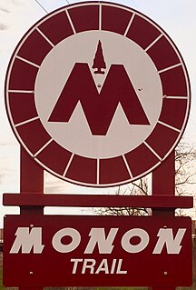
The Monon Trail is a rail trail located entirely within the state of Indiana. The Monon Railroad was a popular railroad line connecting the cities of Chicago and Indianapolis, with stops at major settlements along its route. After the decline of railroad travel and the sale of the company in 1987, the portion of the line between Indianapolis and Delphi, Indiana, was abandoned.

The Elroy-Sparta Bike Trail is a 32-mile (51 km) rail trail between Elroy and Sparta, Wisconsin. Considered to be the first rail trail when it opened in 1967, it was designed for foot, bicycle, equestrian and light motorized traffic. Designated a multiuse trail, it offers recreational access to the routes and is open to the public.

The Torrey C. Brown Rail Trail (TCB), the official name of the Northern Central Railroad (NCR) Trail, is a rail trail that runs along an abandoned railroad corridor where the Northern Central Railway once operated. The trail extends 20 miles from Ashland Road in Cockeysville, Maryland to the boundary with Pennsylvania. At the Pennsylvania line, the Torrey C. Brown Trail becomes the York County Heritage Rail Trail and continues to the city of York.

Fred Meijer White Pine Trail State Park is a 92-mile (148 km) long linear state park in the U.S. state of Michigan.

Hartwick Pines State Park is a 9,762 acres (3,951 ha) state park in the U.S. state of Michigan, located in Crawford County near Grayling and Interstate 75. It is the third largest state park on Michigan's Lower Peninsula and the state's fifth-biggest park overall. The park contains an old-growth forest of white pines and red pines that resembles the appearance of all of Northern Michigan prior to the logging era.
Lakelands Trail State Park, officially the Mike Levine Lakelands Trail State Park since January 20, 2017, is a state park in Michigan that runs east-west from Stockbridge to Hamburg Township, Michigan. It is a multi-use trail converted from abandoned railroad corridors. According to the Michigan DNR web site, the north side of the trail is for hiking and biking, and the south side is for horseback riding. The trail is 20 miles (32 km) long with the surface from Stockbridge to Pinckney compose of crushed limestone. 6 miles (9.7 km) are paved in Hamburg Township.

Ludington State Park is a state park located just north of Ludington, Michigan between the shores of Lake Michigan and Hamlin Lake. The park encompasses nearly 5,300 acres (2,100 ha) and contains several ecosystems, including: forests, sand dunes, a dam, a Great Lake, and a river.

The Cape Cod Rail Trail (CCRT) is a 22-mile (35 km) paved rail trail located on Cape Cod in Massachusetts. The trail route passes through the towns of Dennis, Harwich, Brewster, Orleans, Eastham, and Wellfleet. It connects to the 6-plus mile (10 km) Old Colony Rail Trail leading to Chatham and 8 miles (13 km) of trails within Nickerson State Park. Short side trips on roads lead to national seashore beaches including Coast Guard Beach at the end of the Nauset Bike Trail in Cape Cod National Seashore.

The Calumet Trail is an east-west bicycle and multiuse recreational trail in the Calumet region of northwestern Indiana, United States. It runs roughly parallel to U.S. Route 12 and the right-of-way of the South Shore line, along the NIPSCO easement. Other names by which the trail, or parts of it, are popularly known include "Hancock/Calumet Trail", "Jack Stevens Trail" and "Snowmobile Trail #17".

The Detroit International Riverfront is a tourist attraction and landmark of Detroit, Michigan extending from the Ambassador Bridge in the west to Belle Isle in the east, for a total of 5.5 miles. The International Riverfront encompasses a cruise ship passenger terminal and dock, a marina, a multitude of parks, restaurants, retail shops, skyscrapers, and high rise residential areas along with Cobo Center. The Marriott at the Renaissance Center and the Robert's Riverwalk Hotel are also situated along the International Riverfront. Private companies and foundations together with the city, state, and federal government have contributed several hundred million dollars toward the riverfront development. Key public spaces in the International Riverfront, such as the RiverWalk, Dequindre Cut Greenway and Trail, William G. Milliken State Park and Harbor, and a cruise ship passenger terminal and dock at Hart Plaza complement the architecture of the area. The area provides a venue for a variety of annual events and festivals including the Detroit Electronic Music Festival, Detroit Free Press International Marathon, the Detroit International Jazz Festival, Motor City Pride, the North American International Auto Show, and River Days.

The Pine Creek Rail Trail is a rail trail in the Appalachian Mountains of north-central Pennsylvania.
The Musketawa Trail is a rail trail in Western Michigan along the former Muskegon, Grand Rapids and Indiana Railroad line. Stretching 25 miles (40 km) from Marne to Muskegon, the trail passes through the towns of Conklin and Ravenna. Trail development came from the Michigan Department of Natural Resources and the Friends of the Musketawa Trail.

Root River State Trail is a 60-mile (97 km) paved multi-use rail trail system in southeast Minnesota. The trail system consists of two main segments, the Root River segment, and Harmony-Preston Valley segment. The trails are used mainly for bicycling, hiking, and inline skating in the summer, and for cross country skiing in the winter. Much of the trail, especially the Root River segment, is built along a former Milwaukee Road railbed following the contours of the Root River valley. The trail was originally paved in the 1980s, and repaved by June 2008.

Detroit is a popular city for cycling. It is flat with an extensive road network with a number of recreational and competitive opportunities and is, according to cycling advocate David Byrne, one of the top eight biking cities in the world. The city has invested in greenways and bike lanes and other bicycle-friendly infrastructure. Bike rental is available from the riverfront and tours of the city's architecture can be booked.

This is a list of trails and greenways in Detroit.
Mount Peter is a 1,220-foot (370 m) mountain located in the New York – New Jersey Highlands, Bellvale Mountain, in the U.S. state of New York. The peak is located along the Appalachian Trail in the Town of Warwick, just south of New York State Route 17A, 38 miles (61 km) northwest of New York City, 2 miles (3.2 km) east of Bellvale, New York and north northwest of Greenwood Lake, New York.

The Conewago Recreation Trail is a public recreational rail trail that follows the once Cornwall-Lebanon Railroad rail corridor for a total of slightly over 5.0 miles. The trail stretches from Elizabethtown, PA to the Lebanon County Line, PA, at which point it links up to the Lebanon Valley Rail Trail which continues for another 15.0 miles. The Conewago Recreation Trail runs adjacent to the Conewago Creek running through quiet farmland and forested areas.


