Council Bluffs is a city in and the county seat of Pottawattamie County, Iowa, United States. It is the most populous city in Southwest Iowa, as well as the third largest and a primary city of the Omaha-Council Bluffs Metropolitan Area. It is located on the east bank of the Missouri River, across from Omaha, Nebraska. Until about 1853 Council Bluffs was known as Kanesville. Kanesville was the historic starting point of the Mormon Trail. Kanesville is also the northernmost anchor town of the other emigrant trails because there was a steam-powered boat which ferried the settlers' wagons and cattle across the Missouri River. In 1869, the first transcontinental railroad to California was connected to the existing U.S. rail network at Council Bluffs.

The Broad Street Historic District encompasses a well-preserved 19th-century residential area in Middletown, Connecticut, USA. Centered on Broad and Pearl Streets west of Main Street, the area was developed residential in response to local economic development intended to revitalize the city, whose port was in decline. The district includes the city's largest concentration of Greek Revival houses, and was listed on the National Register of Historic Places in 1988.

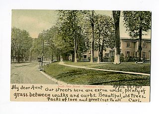
Located in Middletown, Connecticut, the Middletown South Green Historic District was created to preserved the historic character of the city's South Green and the historic buildings that surround it. It is a 90-acre (36 ha) historic district that includes a concentration of predominantly residential high-quality architecture from the late 19th century. It was listed on the National Register of Historic Places in 1975.

The city of Davenport, Iowa, United States has neighborhoods dating back to the 1840s. The Davenport Plan and Zoning Commission divided the city into five areas: downtown, central, east end, near north, and northwest and west end. The neighborhoods contain many architectural designs, including Victorian, Queen Anne, and Tudor Revival. Many of the original neighborhoods were first inhabited by German settlers.

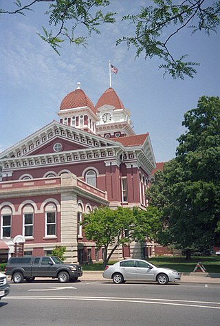
Crown Point Courthouse Square Historic District is a historic district in Crown Point, Indiana, that dates back to 1873. It was listed on the National Register of Historic Places in 2004. Its boundaries were changed in 2005, and it was increased in 2007 to include a Moderne architecture building at 208 Main Street. The late nineteenth- and early twentieth-century commercial and public buildings represent a period of economic and political growth. The Lake County Courthouse stands in the center of the district. Designed by architect John C. Cochrane in 1878, this brick building is a combination of Romanesque Revival and Classical styles. Enlarged in 1909 with the addition of north and south wings, designed by Beers and Beers. Continued growth in the county required second enlargement in 1928. This local landmark was placed in the National Register of Historic Places in 1973.

The Riverview Terrace Historic District is a 15.2-acre (6.2 ha) historic district in Davenport, Iowa, United States, that was listed on the National Register of Historic Places in 1984. It was listed on the Davenport Register of Historic Properties in 1993. The neighborhood was originally named Burrow's Bluff and Lookout Park and contains a three-acre park on a large hill.

The Hamburg Historic District, also known as the Gold Coast, is a residential neighborhood located on a bluff northwest of downtown Davenport, Iowa, United States. It is listed on the National Register of Historic Places in 1983. In 1999, it was listed on the Davenport Register of Historic Properties The historic district is where the city's middle and upper-income German community built their homes in the 19th and early 20th centuries. Germans were the largest ethnic group to settle in Davenport.

The Provo Downtown Historic District is a 25-acre (10 ha) historic area located in Provo, Utah, United States. It is listed on the National Register of Historic Places.

The Fifth Street Bluff Historic District is a nationally recognized historic district located in Ottumwa, Iowa, United States. It was listed on the National Register of Historic Places in 1998. At the time of its nomination it contained 67 resources, which included 40 contributing buildings, three contributing structures, and 24 non-contributing buildings.

Court Hill Historic District is a historic district located in Ottumwa, Iowa, United States. It is a residential area of large homes with a few small homes in between. The district was listed on the National Register of Historic Places in 1998 as a part of Ottumwa MPS. At the time of its nomination it contained 84 resources, which included 56 contributing buildings, two contributing structures, 25 non-contributing buildings, and one non-contributing site.

The Barre Downtown Historic District encompasses the historic commercial and civic heart of the city of Barre, Vermont. Extending along Main Street from City Park to Depot Square, this area was developed quite rapidly in the 1880s and 1890s, when the area experienced rapid growth due to the expansion of the nearby granite quarries. It was listed on the National Register of Historic Places in 1979.

The City Hall Park Historic District encompasses one of the central economic, civic, and public spaces of the city of Burlington, Vermont. Centered on City Hall Park, the area's architecture encapsulates the city's development from a frontier town to an urban commercial center. The district was listed on the National Register of Historic Places in 1983.

The McGregor Commercial Historic District is a nationally recognized historic district located in McGregor, Iowa, United States. It was listed on the National Register of Historic Places in 2002. At the time of its nomination the district consisted of 60 resources, including 51 contributing buildings, one contributing site, one contributing structure, and seven noncontributing buildings. Unlike most river towns in Iowa the central business district does not follow along the Mississippi River, but moves away from it. It is linear in shape, following Main Street, which runs from the southwest to the northeast in a narrow valley between two 400-foot (120 m) bluffs. The narrow valley ends at the river.

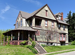
The Willow–Bluff–3rd Street Historic District is a nationally recognized historic district located in Council Bluffs, Iowa, United States. It was listed on the National Register of Historic Places in 2005. At the time of its nomination the district consisted of 260 resources, including 162 contributing buildings, 56 contributing structures, 36 non-contributing buildings, and six non-contributing structures. The district is primarily a residential area that is adjacent to the central business district to the west. Part of the district is in Jackson's Addition, which is the first addition to the original town of Council Bluffs. It also sits along the base of the loess bluffs to the east.
The Boyne City Central Historic District is a commercial historic district located along the 100 and 200 blocks of Water and Lake Streets and adjacent parts of Main Street and South Park in Boyne City, Michigan. The district also contains the residential structures in the local Pearl Street Historic District to the east of the downtown area. It was listed in the National Register of Historic Places in 2012.

Eagar Townsite Historic District is a section of the town of Eagar, Arizona which has been designated a National Historic Place. Sitting on roughly 54 acres, the site contains 37 structures, 21 of which have historical significance. The period of significance is from 1886, the year the townsite was founded, through 1942, which represents the significant period of development of the town. The site was added to the Register on July 23, 1993.

The Bay City Downtown Historic District is a primarily commercial historic district, located in Bay City, Michigan and roughly bounded by the Saginaw River, Second Street, Adam Street, and Center Avenue. It was listed on the National Register of Historic Places in 1985.

The Bridge Street-Broad Street Historic District is a primarily commercial historic district located along three central blocks of Broad Street and two intersecting blocks of Bridge Street in Linden, Michigan. It was listed on the National Register of Historic Places in 1982.

Downtown Vermillion Historic District is a historic district in downtown Vermillion, South Dakota, consisting of 34 contributing buildings all constructed between 1880 and 1942. The district was added to the National Register of Historic Places in 2003 and reflects a period of substantial economic growth in Vermillion, as well as for its representation of late 19th and early 20th century architectural styles.


