2020 census
As of the 2020 census, Healdton had a population of 2,328. The median age was 39.6 years. 25.5% of residents were under the age of 18 and 18.3% of residents were 65 years of age or older. For every 100 females there were 90.8 males, and for every 100 females age 18 and over there were 88.6 males age 18 and over. [13] [14]
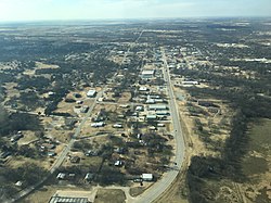
0% of residents lived in urban areas, while 100.0% lived in rural areas. [15]
There were 960 households in Healdton, of which 33.1% had children under the age of 18 living in them. Of all households, 45.0% were married-couple households, 18.2% were households with a male householder and no spouse or partner present, and 29.5% were households with a female householder and no spouse or partner present. About 28.6% of all households were made up of individuals and 13.1% had someone living alone who was 65 years of age or older. [13]
There were 1,163 housing units, of which 17.5% were vacant. Among occupied housing units, 69.1% were owner-occupied and 30.9% were renter-occupied. The homeowner vacancy rate was 1.9% and the rental vacancy rate was 8.0%. [13]
2000 census
As of the 2000 census, 2,786 people, 1,132 households, and 776 families were residing in the city. The population density was 197.4 inhabitants per square mile (76.2/km2). The 1,369 housing units had an average density of 97.0 per square mile (37.5/km2). The racial makeup of the city was 87.08% White, 0.93% African American, 7.47% Native American, 0.11% Asian, 0.90% from other races, and 3.52% from two or more races. Hispanics or Latinos of any race were 1.54% of the population. [3]
Of the 1,132 households, 29.9% had children under 18 living with them, 54.7% were married couples living together, 10.8% had a female householder with no husband present, and 31.4% were not families. About 28.4% of all households were made up of individuals, and 15.1% had someone living alone who was 65 or older. The average household size was 2.39 and the average family size was 2.92.
In the city, the age distribution was 24.0% under 18, 9.0% from 18 to 24, 25.9% from 25 to 44, 22.8% from 45 to 64, and 18.4% who were 65 or older. The median age was 40 years. For every 100 females, there were 90.8 males. For every 100 females 18 and over, there were 88.7 males.
The median income for a household in the city was $23,550, and for a family was $29,363. Males had a median income of $25,636 versus $20,865 for females. The per capita income for the city was $12,842. About 16.8% of families and 21.5% of the population were below the poverty line, including 28.1% of those under 18 and 13.2% of those 65 or over.