Irupana | |
|---|---|
Municipality | |
 Irupana | |
 Irupana Location within Bolivia | |
| Coordinates: 16°30′S67°30′W / 16.500°S 67.500°W | |
| Country | |
| Department | La Paz Department |
| Province | Sud Yungas Province |
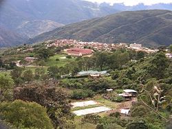
| Seat | Irupana |
| Government | |
| • Mayor | Clemente Mamani Condorena (2007) |
| Elevation | 5,900 ft (1,800 m) |
| Population (2001) | |
• Total | 11,383 |
| Time zone | UTC-4 (BOT) |

Irupana Municipality or Villa de Lanza Municipality is the second municipal section of the Sud Yungas Province in the La Paz Department, Bolivia. Its seat is Irupana.
