Quiabaya Municipality | |
|---|---|
Municipality | |
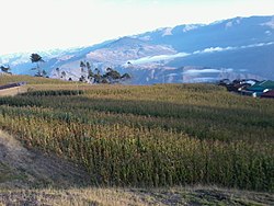 The village Tarata in the Quiabaya Municipality | |
 Quiabaya Municipality Location of the Quiabaya Municipality within Bolivia | |
| Coordinates: 15°37′00″S68°46′00″W / 15.6167°S 68.7667°W | |
| Country | |
| Department | La Paz Department |
| Province | Larecaja Province |
| Seat | Quiabaya |
| Government | |
| • Mayor | Jorge Callisaya Peralta (2007) |
| • President | Aurelio Machicado Miranda (2007) |
| Area | |
• Total | 51 sq mi (132 km2) |
| • | 50 sq mi (120 km2) |
| Elevation | 10,000 ft (3,000 m) |
| Population (from 2012 census) | |
• Total | 2,684 |
| • Urban density | 980/sq mi (378/km2) |
| Time zone | UTC-4 (BOT) |
Quiabaya Municipality is the fourth municipal section of the Larecaja Province in the La Paz Department, Bolivia. Its seat is Quiabaya.
