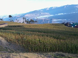
Omasuyos or Uma Suyu is a province in the La Paz Department in Bolivia. Its capital is Achacachi.

Tacacoma Municipality is the third municipal section of the Larecaja Province in the La Paz Department, Bolivia. Its seat is Tacacoma.

Quiabaya Municipality is the fourth municipal section of the Larecaja Province in the La Paz Department, Bolivia. Its seat is Quiabaya.

Ancoraimes or Janq'u Laymi (Aymara) is the second municipal section of the Omasuyos Province in the La Paz Department, Bolivia. Its seat is Ancoraimes.

Chearoco, Chiaraco or Chiaroco is a mountain in the Cordillera Real in the Andes of Bolivia. It has a height of about 6,127 m (20,102 ft). It is situated in the La Paz Department, Larecaja Province, Guanay Municipality, southeast of the peak of Aman Pata. Chearoco lies between Qalsata in the northwest and Chachakumani in the southeast.

Tacacoma is a location in the La Paz Department in Bolivia. It is the seat of the Tacacoma Municipality, the third municipal section of the Larecaja Province.

Phallata is a mountain north of the Cordillera Real in the Andes of Bolivia which reaches a height of approximately 4,780 m (15,680 ft). It is located in the La Paz Department, Larecaja Province, Sorata Municipality. It lies at a lake of that name (Pallada).

Achachi Qala is a mountain north of the Cordillera Real in the Andes of Bolivia which reaches a height of approximately 4,760 m (15,620 ft). It is located in the La Paz Department, Larecaja Province, Quiabaya Municipality. Achachi Qala lies southwest of Saywani, northeast of Quriwani and east of Mitalani.

Saywani is a mountain north of the Cordillera Real in the Andes of Bolivia which reaches a height of approximately 4,760 m (15,620 ft). It is located in the La Paz Department, Larecaja Province, Quiabaya Municipality. Saywani lies northeast of Achachi Qala. The little lake south of Saywani is named Ch'uxña Quta.

Jichu Quta is a mountain north of the Cordillera Real in the Andes of Bolivia which reaches a height of approximately 4,560 m (14,960 ft). It is located in the La Paz Department, Larecaja Province, Sorata Municipality, at the border with the Quiabaya Municipality. Jichu Quta lies south of Saywani at a lake named Quriwari. The Wayllani Jawira originates near the mountain. It flows to the west.

Qullpani is a mountain in the Bolivian Andes which reaches a height of approximately 3,660 m (12,010 ft). It is located in the La Paz Department, Loayza Province, Luribay Municipality, northeast of Luribay.

Janq'u Willk'i is a 3,762-metre-high (12,343 ft) mountain in the Bolivian Andes. It is located in the La Paz Department, Loayza Province, Luribay Municipality. Janq'u Willk'i lies west of Kuntur Jiwaña.

Qutani is a mountain in the Bolivian Andes which reaches a height of approximately 3,740 m (12,270 ft). It is located in the La Paz Department, Loayza Province, Luribay Municipality, northwest of Luribay. Qutani lies southeast of Wila Quta.

Chullpani is a mountain in the Bolivian Andes which reaches a height of approximately 3,900 m (12,800 ft). It is located in the La Paz Department, Loayza Province, Luribay Municipality. Chullpani lies northeast of Ch'apini.

Jach'a Ch'uñu Uma is a mountain in the Bolivian Andes which reaches a height of approximately 3,960 m (12,990 ft). It is located in the La Paz Department, Loayza Province, Luribay Municipality. Jach'a Ch'uñu Uma lies north of a river named Ch'uñu Uma.

Janq'u Qala is a mountain in the Bolivian Andes which reaches a height of approximately 3,900 m (12,800 ft). It is located in the La Paz Department, Loayza Province, Luribay Municipality. Janq'u Qala lies southeast of Jach'a Ch'uñu Uma and Mula Jalanta.

Jisk'a Uma is a mountain in the Bolivian Andes which reaches a height of approximately 3,940 m (12,930 ft). It is located in the La Paz Department, Loayza Province, Luribay Municipality. Jisk'a Uma lies northwest of Nasa Q'ara and southeast of Ch'apini.

Ch'utu Qullu is a mountain in the Bolivian Andes which reaches a height of approximately 3,820 m (12,530 ft). It is located in the La Paz Department, Loayza Province, Luribay Municipality, southeast of Janchallani.

Jukumarini is a 3,662-metre-high (12,014 ft) mountain in the Bolivian Andes. It is located in the La Paz Department, Loayza Province, Luribay Municipality.

Liqiliqini is a 3,928-metre-high (12,887 ft) mountain in the Bolivian Andes. It is located in the La Paz Department, Loayza Province, Cairoma Municipality, southwest of the village of Wila Pampa. Liqiliqini lies northwest of Wayra Willk'i, Wanuni and Uyuyuni.


