County Armagh is one of the six counties of Northern Ireland and one of the traditional thirty-two counties of Ireland. It is located in the province of Ulster and adjoins the southern shore of Lough Neagh. It borders the Northern Irish counties of Tyrone to the west and Down to the east. The county borders Louth and Monaghan to the south and southwest, which are in the Republic of Ireland. It is named after its county town, Armagh, which derives from the Irish Ard Mhacha, meaning "Macha's height". Macha was a sovereignty goddess in Irish mythology and is said to have been buried on a wooded hill around which the town of Armagh grew. County Armagh is colloquially known as the "Orchard County" because of its many apple orchards.

County Down is one of the six counties of Northern Ireland, one of the nine counties of Ulster and one of the traditional thirty-two counties of Ireland. It covers an area of 961 sq mi (2,490 km2) and has a population of 552,261. It borders County Antrim to the north, the Irish Sea to the east, County Armagh to the west, and County Louth across Carlingford Lough to the southwest.
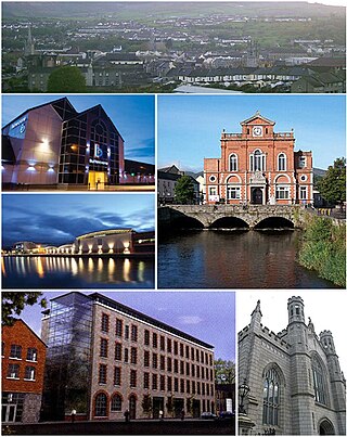
Newry is a city in Northern Ireland, standing on the Clanrye river in counties Down and Armagh. It is near the border with the Republic of Ireland, on the main route between Belfast and Dublin. The population was 27,913 in 2021.

Portadown is a town in County Armagh, Northern Ireland. The town sits on the River Bann in the north of the county, about 24 miles (39 km) southwest of Belfast. It is in the Armagh City, Banbridge and Craigavon Borough Council area and had a population of about 32,000 at the 2021 Census. For some purposes, Portadown is treated as part of the "Craigavon Urban Area", alongside Craigavon and Lurgan.

Warrenpoint is a small port town and civil parish in County Down, Northern Ireland. It sits at the head of Carlingford Lough, south of Newry, and is separated from the Republic of Ireland by a narrow strait. The town is beside the village of Rostrevor and is overlooked by the Mournes and Cooley Mountains. Warrenpoint sprang up within the townland of Ringmackilroy, and is locally nicknamed "The Point", which also represents the town's full name in Irish, An Pointe".

Armagh is the county town of County Armagh and a city in Northern Ireland, as well as a civil parish. It is the ecclesiastical capital of Ireland – the seat of the Archbishops of Armagh, the Primates of All Ireland for both the Roman Catholic Church and the Church of Ireland. In ancient times, nearby Navan Fort was a pagan ceremonial site and one of the great royal capitals of Gaelic Ireland. Today, Armagh is home to two cathedrals and the Armagh Observatory, and is known for its Georgian architecture.

Newry and Mourne District Council was a local council in Northern Ireland. It merged with Down District Council in May 2015 under local government reorganisation in Northern Ireland to become Newry, Mourne and Down District Council.
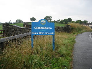
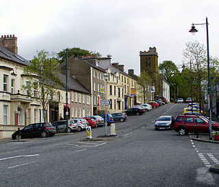
Crossmaglen is a village and townland in County Armagh, Northern Ireland. It had a population of 1,610 in the 2011 Census and is the largest village in South Armagh. The village centre is the site of a large Police Service of Northern Ireland base and formerly of an observation tower.
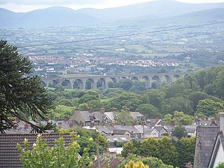
Bessbrook is a village in County Armagh, Northern Ireland. It lies about three miles (5 km) northwest of Newry and near the Newry bypass on the main A1 Belfast-Dublin road and Belfast-Dublin railway line. Today the village of Bessbrook straddles the three townlands of Maghernahely, Clogharevan and Maytown. Bessbrook is near Newry railway station. It had a population of 2,892 at the 2021 Census. The model village of Bessbrook, County Armagh is a visible memorial to the commercial endeavours of the Richardson family over a number of generations.
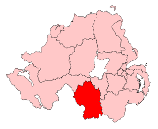
Newry and Armagh is a parliamentary constituency in the United Kingdom House of Commons. The current MP is Dáire Hughes of Sinn Féin who was first elected at the 2024 election.

Tandragee is a town in County Armagh, Northern Ireland. It is built on a hillside overlooking the Cusher River, in the civil parish of Ballymore and the historic barony of Orior Lower.

Annalong is a seaside village in County Down, Northern Ireland at the foot of the Mourne Mountains. Annalong is in the civil parish of Kilkeel, the barony of Mourne, and the Newry and Mourne District Council area. It had a population of 1,805 at the 2011 Census. The village formerly exported dressed granite and is now a fishing and holiday resort.

Mayobridge is a village within County Down, Northern Ireland. It lies on the small river Clanrye, which divides the townlands of Mayo and Bavan, 4.4 miles (7.1 km) east of Newry. It had a population of 1,069 as at 2011. Administratively, it is within the Newry and Mourne District Council area, and falls within the parish of Clonallan, and historically within the barony of Iveagh Upper, Upper Half.

Lurganare is a small village and townland in County Down, Northern Ireland, four miles north of Newry. It had a population of 195 at the 2001 census. It lies within the Newry, Mourne and Down District Council area. The local primary school, St Mary's Primary School, had an enrolment of 118 pupils as of 2011.

The Newry Canal is an abandoned canal in Northern Ireland. Opened in 1742, it was built to link the Tyrone coalfields to the Irish Sea. The navigable route ran from Lough Neagh via the Upper Bann river to Portadown, then approximately 20 miles from Portadown via the canal proper to Newry, terminating in the Albert Basin.
Richhill is a large village and townland in County Armagh, Northern Ireland. It lies between Armagh and Portadown. It had a population of 2,738 people in the 2021 Census.

The Belfast–Newry line operates from Belfast Grand Central in County Antrim to Newry in County Down, Northern Ireland. The manager for this line is based at Portadown railway station, although the line extends to the border to include the Scarva and Poyntzpass halts and Newry. Newry is on the fringe of the network, being the last stop before the border with the Republic of Ireland. The line follows the route of the northern half of the main Dublin–Belfast line.

Belleeks is a small village and townland in south County Armagh, Northern Ireland. In the 2011 Census it had a reported population of 375. It lies within the Newry, Mourne and Down District Council area and the historic barony of Upper Fews.

Mullaghglass is a small village and townland north of Newry in County Armagh, Northern Ireland. It was named after the nearby townland of Mullaghglass, although the village itself is within the townland of Latt. In the 2001 Census it had a population of 135. It is within the Newry and Mourne District Council area.

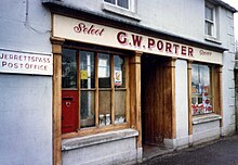
Poyntzpass is a small village on the border between southern County Armagh and County Down in Northern Ireland. It is situated in the civil parish of Ballymore and the historic barony of Orior Lower within the Armagh City, Banbridge and Craigavon area. It had a population of 552 people in the 2011 census. It was a part of the South Armagh constituency and is now part of the Newry and Armagh constituency.