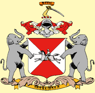
Jhinjhuvada

Last updated

Jhinjhuvada is a former non-salute princely state on Saurashtra peninsula, in Gujarat, western India.

Princely state Type of vassal state

A princely state, also called native state, feudatory state or Indian state, was a vassal state under a local or regional ruler in a subsidiary alliance with the British Raj. Though the history of the princely states of the subcontinent dates from at least the classical period of Indian history, the predominant usage of the term princely state specifically refers to a semi-sovereign principality on the Indian subcontinent during the British Raj that was not directly governed by the British, but rather by a local ruler, subject to a form of indirect rule on some matters. In actual fact, the imprecise doctrine of paramountcy allowed the government of British India to interfere in the internal affairs of princely states individually or collectively and issue edicts that applied to all of India when it deemed it necessary.

Saurashtra (region) Region in Gujarat, India

Saurashtra, also known as Sorath or Kathiawar, is a peninsular region of Gujarat, India, located on the Arabian Sea coast. It covers about a third of Gujarat state, notably 11 districts of Gujarat, including Rajkot District.
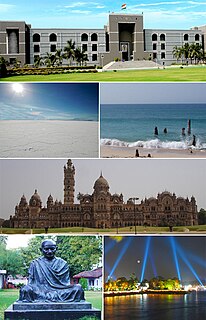
Gujarat State in India

Gujarat is a state on the western coast of India with a coastline of 1,600 km (990 mi) – most of which lies on the Kathiawar peninsula – and a population in excess of 60 million. It is the sixth largest Indian state by area and the ninth largest state by population. Gujarat is bordered by Rajasthan to the northeast, Daman and Diu to the south, Dadra and Nagar Haveli and Maharashtra to the southeast, Madhya Pradesh to the east, and the Arabian Sea and the Pakistani province of Sindh to the west. Its capital city is Gandhinagar, while its largest city is Ahmedabad. The Gujarati-speaking people of India are indigenous to the state. The economy of Gujarat is the fifth-largest state economy in India with 14.96 lakh crore (US$210 billion) in gross domestic product and a per capita GDP of 157,000 (US$2,200).

Contents

History

The princely state in Jhalawar prant was ruled by Kshatriya Koli [1] Chieftains.[ citation needed ]

Jhalawar was the northernmost of the four prants into which the many feudal units of Kathiawar on Saurashtra peninsula in present Gujarat were divided, the others being Halar (west), Gohelwar (southeast) and Sorath (south).

Kshatriya is one of the four varna of the Hindu society. The Sanskrit term kṣatriyaḥ is used in the context of Vedic society wherein members were organised into four classes: kshatriya, brahmin, vaishya and shudra. As per the caste system, after Brahmin, Kshatriya is regarded as the second highest caste. Traditionally, the kshatriya constituted the ruling and military class. Their role was to protect their interests by fighting in wartime and governing in peacetime.

Koli people Kshatriya Koliya

The Koli people are an ethnic Indian group native to Rajasthan, Himachal Pradesh, Gujarat, Maharashtra, Uttar Pradesh, Haryana, Karnataka and Jammu and Kashmir states.

In 1901 it comprised 18 villages, covering 165 square miles, with a population of 11,732, yielding 73,343 Rupees state revenue (1903-4, mostly from land), paying 11,075 Rupees tribute to the British. [1]

Related Research Articles

Pali(y)ad is a town and former 21 guns salute princely state on Saurashtra peninsula in Gujarat, western India.

Chamardi is a village and former petty Rajput princely state in Valabhipur Taluka of Bhavnagar district, Gujarat, western India.

Akadia or Ankadia is a village and former Rajput petty princely state on Saurashtra peninsula.

Bhadli is a village and former princely state on Saurashtra peninsula in Gujarat, western India.

Bharejda or Bhanejda, also corrupted to Bharejra, is a village and former princely state, now in Chuda Taluka of Surendranagar district in Gujarat, western India.

Jakhan is a village and former Hindu princely state on the Saurashtra peninsula, in Gujarat, western India.

Jalia Devani is a former Hindu Rajput non-salute princely state on Saurashtra peninsula, in Gujarat, western India.

Halaria is a town and former Rajput non-salute princely state on Saurashtra peninsula, in Gujarat, western India.

Iatariya is a town and former Rajput non-salute princely state on Saurashtra peninsula, in Gujarat, western India.

Bhathan is a village and former princely state in Limbdi Taluka of Surendranagar District, Gujarat, India.

Khambhlav is a village and former minor Rajput princely state on Saurashtra peninsula in Gujarat, western India.

Likhi is a village and former non-salute princely state in Gujarat, western India.

Kadoli is a village and former non-salute princely state in Gujarat, western India.

Hadol is a village and former non-salute princely state in Gujarat, western India.

Chhalala is a village in Chuda Taluka of Surendranagar district, Gujarat, India. It was formerly Rajput princely state.

Chachana is a village and former Rajput princely state in Chuda Taluka of Surendranagar district, on the Saurashtra peninsula in Gujarat, India.

Charkha is a village in Dhari Taluka of Amreli district on Saurashtra peninsula in Gujarat, western India. It was formerly minor princely state.

Bhojavadar is a village and former Rajput princely state Umrala Taluka of Bhavnagar district, Gujarat, India.

Bhoika is a village and former Rajput princely state in Limbadi Taluka of Surendranagar district, on Saurashtra in Gujarat, India.

Bhimora is a village and former Rajput-Kathi princely state in Chotila Taluka of Surendranagar district, Gujarat, India.

References

Coordinates: 23°21′00″N71°42′00″E / 23.3500°N 71.7000°E / 23.3500; 71.7000

Geographic coordinate system Coordinate system

A geographic coordinate system is a coordinate system that enables every location on Earth to be specified by a set of numbers, letters or symbols. The coordinates are often chosen such that one of the numbers represents a vertical position and two or three of the numbers represent a horizontal position; alternatively, a geographic position may be expressed in a combined three-dimensional Cartesian vector. A common choice of coordinates is latitude, longitude and elevation. To specify a location on a plane requires a map projection.