Muttippalam is a small town near Manjeri in the Malappuram District of Kerala in India. It is on the Manjeri–Malappuram road, about 3 km away from Manjeri.
Moorkanad is a village in Malappuram district in the state of Kerala, India.
Pariapuram is a dhesam situated near Angadipuram village of the Malappuram District of Kerala in the country of India. The nearest town is Perintalmanna.
Vadakkangara is a village in Malappuram district in the state of Kerala, India.
Valapuram is a small village which exists as a part of Kuruvambalam village. It is in Pulamanthole grama panchayath of Malappuram District, Kerala. It is situated on the banks of the Kunthipuzha River. The river separates Malappuram and Palakkad districts. 41 people were martyred from Valapuram and Kuruvambalam regions in the Wagon Massacre, also known as the Wagon tragedy which was part of the Malabar rebellion of 1921.The nearest towns are Perinthalmanna(18 km), Valanchery (16 km), Pattambi (17 km), Pulamanthol (6 km), and Kulathur (5 km).

Mudikkode is a small village located in the Malappuram district in the state of Kerala. It is situated in Anakkayam Panchayath. Mudikkode is 17 km from the district headquarters of Malappuram. Nearby cities are Manjeri (10 km) and Pandikkad (6 km). The Kadalundi river is a presence in the village. Agriculture is a major source of income. Mudikkode is unique in Kerala for its diverse mix of religions; 95 percent of Mudikkode residents are Muslims and the remaining 5 percent are Hindus.
Pacheeripara is a village situated in Malappuram District, Kerala, India. Pacheeripara is a place with many rocks.
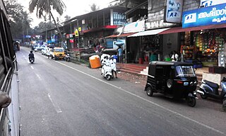
Kidangazhi is a location in Manjeri municipality in Malappuram district of Kerala State of south India Thousands of people lead their life with peace and unanimity. it is a beautiful place. here situates two jumua masjids.
Chettiyangadi is a location in Manjeri Municipality in Malappuram district of Kerala State of south India.
Chullakkad is a location in Manjeri Municipality in Malappuram district of Kerala State of south India.
Mangalasseri is a location in Manjeri Municipality in Malappuram district of Kerala State of south India.
Pilakkal is a location in Payyanad of Manjeri Municipality in Malappuram district of Kerala State of south India.
Santhigram is a location in Manjeri municipality in Malappuram district of Kerala State of south India.
Veembur is a location in Manjeri Municipality in Malappuram district of Kerala State of south India.
Paravakkal is a town in the Kadungapuram village of the Puzhakkattiri panchayath, located in the Malappuram district, in the state of Kerala, southeast India. It was the homeland of Valluvanad, an erstwhile kingdom in Malabar. Perinthalmanna, Malappuram, and Kottakkal are some of the major towns nearby.
Pang is a village in Malappuram district in the state of Kerala, India.
Payyanad is a place located in Manjeri municipality of Malappuram district of Kerala. Payyanad football stadium is located in Payyanad.
Cholakkulam is a village in Malappuram district of Kerala. It is situated in Melattur. The name Cholakkulam came from the Malayalam words 'Chola' (Stream), 'Kulam' (Pond); i.e., 'Place where there is a pond with a stream'. The village is well connected to Perinthalmanna (17 km), Mannarkkad (24 km), Manjeri (23 km) and Karuvarakundu (11 km). The shortest route connecting Kozhikode with Palakkad passes through this village.
Pooppalam is a small village in Malappuram district, Kerala, India.
Valenchery is a small town in Morayur Gram panchayat in Malappuram in Malappuram district of state of Kerala. Valenchery is divided into four Areas, they are Village Road, Colony Road, Madrasa Road and Hilltop Area.Four Wards from Morayur Panchayath partly belongs to Valenchery. Nearest places are Valluvambram Junction, Mongam, Morayur, Arimbra and Pookkottur. Nearest tourist spot is Mini Ooty.


