Kincora, Virginia

Last updated
Kincora, Virginia
USA Virginia Northern location map.svg
Red pog.svg
Kincora
USA Virginia location map.svg
Red pog.svg
Kincora
Usa edcp location map.svg
Red pog.svg
Kincora
Coordinates: 39°2′32″N77°26′9″W / 39.04222°N 77.43583°W / 39.04222; -77.43583 Coordinates: 39°2′32″N77°26′9″W / 39.04222°N 77.43583°W / 39.04222; -77.43583
Country United States
State Virginia
County Loudoun
Area
[1]
  Total0.54 sq mi (1.39 km2)
  Land0.54 sq mi (1.39 km2)
  Water0.0 sq mi (0.0 km2)
Elevation
235 ft (72 m)
Time zone UTC−5 (Eastern (EST))
  Summer (DST) UTC−4 (EDT)
FIPS code 51-42501
GNIS feature ID2804164

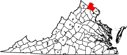
Kincora is a census-designated place in Loudoun County, Virginia, United States. The CDP was first drawn prior to the 2020 census.

Geography

Kincora is in eastern Loudoun County, between Virginia State Route 28 to the east and Broad Run to the west. It extends north to Virginia State Route 7 and south to Gloucester Parkway. Russell Branch Parkway runs north–south through the center of the CDP. Kincora is bordered to the east by Dulles Town Center and to the north, west, and south by Ashburn. It is 8 miles (13 km) north of Dulles International Airport and 28 miles (45 km) northwest of Washington, D.C.

According to the U.S. Census Bureau, the Kincora CDP has a total area of 0.54 square miles (1.4 km2), of which 0.06 acres (259 m2), or 0.02%, are water. [1] Via north-flowing Broad Run, the community is part of the Potomac River watershed.

Related Research Articles

Loudoun County, Virginia County in Virginia

Loudoun County is located in the northern part of the Commonwealth of Virginia in the United States. In 2019, the population was estimated at 413,538, making it Virginia's third-most populous county. Loudoun County's seat is Leesburg. Loudoun County is part of the Washington–Arlington–Alexandria, DC–VA–MD–WV Metropolitan Statistical Area.

Centreville, Virginia Census-designated Place in Virginia, United States

Centreville is a census-designated place (CDP) in Fairfax County, Virginia, United States and a suburb of Washington, D.C. The population was 71,135 at the 2010 census. Centreville is approximately 20 miles (32 km) west of Washington, D.C.

Chantilly, Virginia CDP in Virginia, United States

Chantilly is a census-designated place (CDP) in western Fairfax County, Virginia, United States. The population was 23,039 at the 2010 census. Chantilly is named after an early-19th-century mansion and farm, which in turn took the name of an 18th-century plantation that was located in Westmoreland County, Virginia. The name "Chantilly" originated in France with the Château de Chantilly, about 28 miles north of Paris.

Wolf Trap, Virginia Census-designated place in Virginia, United States

Wolf Trap is an affluent census-designated place (CDP) in Fairfax County, Virginia, United States. The population was 16,131 at the 2010 census. Wolf Trap National Park for the Performing Arts is located in the CDP.

Leesburg, Virginia Town in Virginia

Leesburg is the county seat of Loudoun County, Virginia. It was built in 1740 and is named for the Lee family, early leaders of the town and ancestors of Robert E. Lee. In the War of 1812, it became the temporary seat of the United States government, and in the Civil War, it changed hands several times.

Sterling, Virginia Census-designated place in Virginia

Sterling, Virginia refers most specifically to a census-designated place (CDP) in Loudoun County, Virginia. The population of the CDP as of the 2010 United States Census was 27,822. The CDP boundaries are confined to a relatively small area between Virginia State Route 28 on the west and Virginia State Route 7 on the northeast, excluding areas near SR 606 and the Dulles Town Center.

Ashburn, Virginia Census-designated place in Virginia

Ashburn is a census-designated place (CDP) in Loudoun County, Virginia, United States. As of the 2010 United States Census, its population was 43,511, up from 3,393 twenty years earlier. It is 30 miles (48 km) northwest of Washington, D.C., and part of the Washington metropolitan area.

South Riding, Virginia Census-designated place in Virginia

South Riding is a census-designated place and planned community in Loudoun County, Virginia. South Riding was founded as a homeowner association in January 1995 to provide services to the community. Neighboring U.S. Route 50 and State Route 28 provide access to the Dulles/Reston/Tysons Corner technology corridor and other major employment centers in Northern Virginia and Washington, D.C.

Brambleton, Virginia Census-designated place in Virginia

Brambleton is a census-designated place in Loudoun County, Virginia, off the Dulles Greenway. The population as of the 2010 United States Census was 9,845. In 2017, Brambleton, VA had a population of 19.9k people with a median age of 34.3 and a median household income of $173,690. Between 2016 and 2017 the population of Brambleton, VA grew from 17,063 to 19,876, a 16.5% increase and its median household income grew from $164,321 to $173,690, a 5.7% increase. Construction started on the Brambleton community in 2001. Brambleton is located 9 miles south of Leesburg and 1.3 mi (2.1 km) northwest of Washington Dulles International Airport.

Arcola, Virginia Census-designated place in Virginia

Arcola is a census-designated place in Loudoun County, Virginia, United States. The population as of the 2010 United States Census was 233.

Dranesville, Virginia Census-designated place in Virginia, United States

Dranesville is a census-designated place (CDP) in Fairfax County, Virginia, United States. Dranesville is located on the Leesburg Pike at its intersection with Georgetown Pike. The U.S. Census Bureau defines Dranesville as a census-designated place (CDP) with a population of 11,921 as of 2010.

Fair Lakes, Virginia Census-designated place in Virginia, United States

Fair Lakes is a census-designated place (CDP) and business park located west of Fairfax in Fairfax County, Virginia, United States. Fair Lakes had a population of 7,942 in 2010.

Ruckersville, Virginia Census-designated place in Virginia, United States

Ruckersville is a census-designated place (CDP) in Greene County, Virginia, United States, located in a rural area north of Charlottesville. The population as of the 2010 census was 1,141. The community lies amidst hills, mountain views, trees, and farmland. It is located at the intersection of two major highways, north–south U.S. Route 29 and east–west U.S. Route 33. It was founded by the same family that established Ruckersville, Georgia.

Floris, Virginia Census-designated place in Virginia, United States

Floris is a census-designated place (CDP) located within the Oak Hill area of Fairfax County, Virginia, United States. The population as of the 2010 census was 8,375.

Sugarland Run is a planned community and census-designated place in Loudoun County, Virginia. The population as of the 2010 United States Census was 11,799. In 2020, it was estimated to be 12,956. Sugarland Run is part of the Washington metropolitan area and is 22 miles west of Washington, D.C.

McNair, Virginia Census-designated place in Virginia, United States

McNair is a census-designated place located in the Oak Hill section of Fairfax County, Virginia, United States. It is directly to the east of Washington Dulles International Airport. The population as of the 2010 census was 17,513. Much of the population resides in the McNair Farms planned community. The community has a school called McNair Elementary.

Newington Forest, Virginia Census-designated place in Virginia, United States

Newington Forest is a census-designated place in Fairfax County, Virginia, United States. The population as of the 2010 census was 12,442. It is part of the Washington metropolitan area. It includes the Newington Forest subdivision and several nearby neighborhoods of southern Springfield and northern Lorton.

South Run, Virginia Census-designated place in Virginia, United States

South Run is a census-designated place in Fairfax County, Virginia, United States. The population as of the 2010 census was 6,389.

Frizzleburg, Pennsylvania Census-designated place in Pennsylvania, United States

Frizzleburg is an unincorporated community and census-designated place (CDP) in Lawrence County, Pennsylvania, United States. The population was 602 at the 2010 census.

Goose Creek Village, Virginia Census-designated place in Virginia, United States

Goose Creek Village is a census-designated place (CDP) in Loudoun County, Virginia, United States. It was first drawn as a CDP prior to the 2020 census.

References

  1. 1 2 "2020 U.S. Gazetteer Files –Virginia". United States Census Bureau. Retrieved February 19, 2021.