Lacona, New York

Last updated

Lacona, New York
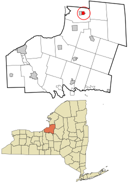
Oswego County New York incorporated and unincorporated areas Lacona highlighted.svg
Location in Oswego County and the state of New York.
Coordinates: 43°38′38″N76°4′7″W / 43.64389°N 76.06861°W / 43.64389; -76.06861
Country United States
State New York
County Oswego
Area
[1]
  Total1.11 sq mi (2.89 km2)
  Land1.11 sq mi (2.88 km2)
  Water0.00 sq mi (0.01 km2)
Elevation
558 ft (170 m)
Population
 (2020)
  Total657
  Density590.83/sq mi (228.05/km2)
Time zone UTC-5 (Eastern (EST))
  Summer (DST) UTC-4 (EDT)
ZIP code
13083
Area code 315
FIPS code 36-40200
GNIS feature ID0954867

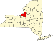
Lacona is a village in Oswego County, New York, United States. The population was 582 at the 2010 census. The village is inside the town of Sandy Creek, halfway between Syracuse and Watertown.

Contents

History

The village was founded around 1803. Lacona was incorporated as a village in 1880.[ clarification needed ]

The Smith H. Barlow House, First National Bank of Lacona, Lacona Clock Tower, Lacona Railroad Station and Depot, Charles M. Salisbury House, Matthew Shoecraft House, Fred Smart House, and Newman Tuttle House are listed on the National Register of Historic Places. [2]

Geography

Lacona is located at 43°38′38″N76°4′7″W / 43.64389°N 76.06861°W / 43.64389; -76.06861 (43.643791, -76.068562). [3]

According to the United States Census Bureau, the village has a total area of 1.0 square mile (2.6 km2), all land.

The village is east of Interstate 81. Little Sandy Creek flows westward through the village and the adjacent village of Sandy Creek.

Demographics

Historical population
CensusPop.Note
1880 378
1890 333−11.9%
1900 38816.5%
1910 44314.2%
1920 4614.1%
1930 54618.4%
1940 413−24.4%
1950 54030.8%
1960 5563.0%
1970 5560.0%
1980 5824.7%
1990 5931.9%
2000 590−0.5%
2010 582−1.4%
2020 65712.9%
U.S. Decennial Census [4]

As of the census [5] of 2000, there were 590 people, 243 households, and 156 families residing in the village. The population density was 576.7 inhabitants per square mile (222.7/km2). There were 271 housing units at an average density of 264.9 per square mile (102.3/km2). The racial makeup of the village was 98.64% White, 0.17% African American, 0.34% Asian, and 0.85% from two or more races. Hispanic or Latino of any race were 1.19% of the population.

There were 243 households, out of which 34.6% had children under the age of 18 living with them, 42.8% were married couples living together, 15.6% had a female householder with no husband present, and 35.8% were non-families. 27.2% of all households were made up of individuals, and 11.5% had someone living alone who was 65 years of age or older. The average household size was 2.43 and the average family size was 2.97.

In the village, the population was spread out, with 29.0% under the age of 18, 6.4% from 18 to 24, 30.7% from 25 to 44, 23.4% from 45 to 64, and 10.5% who were 65 years of age or older. The median age was 36 years. For every 100 females, there were 91.6 males. For every 100 females age 18 and over, there were 85.4 males.

The median income for a household in the village was $32,222, and the median income for a family was $41,111. Males had a median income of $37,500 versus $27,955 for females. The per capita income for the village was $16,418. About 19.3% of families and 24.6% of the population were below the poverty line, including 35.9% of those under age 18 and 18.2% of those age 65 or over.

Related Research Articles

<span class="mw-page-title-main">Island Falls, Maine</span> Town in the state of Maine, United States

Island Falls is a town in Aroostook County, Maine, United States. The population was 758 at the 2020 census. The primary village of Island Falls in the town is situated at a falls in the West Branch Mattawamkeag River.

<span class="mw-page-title-main">Rock Creek, Minnesota</span> City in Minnesota, United States

Rock Creek is a city in Pine County, Minnesota, United States. The population was 1,628 at the 2010 census. Portions of the Mille Lacs Indian Reservation are located within Rock Creek.

<span class="mw-page-title-main">Saddle Butte, Montana</span> Census-designated place in Montana, United States

Saddle Butte is a census-designated place (CDP) in Hill County, Montana, United States. The population was 128 at the 2010 census.

<span class="mw-page-title-main">Alexandria, Nebraska</span> Village in Thayer County, Nebraska, United States

Alexandria is a village in Thayer County, Nebraska, United States. The population was 146 at the 2020 census.

<span class="mw-page-title-main">Mattydale, New York</span> Census-designated place in New York, United States

Mattydale is a hamlet in Onondaga County, New York, United States. The population was 6,446 at the 2010 census.

<span class="mw-page-title-main">Red Creek, New York</span> Village in New York, United States

Red Creek is a village in Wayne County, New York, United States. The population was 495 at the 2020 census.

<span class="mw-page-title-main">Sodus Point, New York</span> Village in New York, United States

Sodus Point is a village in Wayne County, New York, United States. The population was 900 at the 2010 census. However, the last official US Census in 2020 recorded the population at 822. The name is derived from a nearby body of water, Sodus Bay. It is considered to be within the larger Rochester metropolitan area.

Sandy Creek is a town in Brunswick County, North Carolina, United States. The population was 260 at the 2010 census. It is part of the Wilmington, NC Metropolitan Statistical Area.

<span class="mw-page-title-main">Tiro, Ohio</span> Village in Ohio, United States

Tiro is a village in Crawford County, Ohio, United States. The population was 219 at the 2020 census.

Lebanon South is an unincorporated area and census-designated place (CDP) in Lebanon County, Pennsylvania, United States. The population was 2,270 at the 2010 census.

<span class="mw-page-title-main">Hunlock Township, Pennsylvania</span> Township in Pennsylvania, United States

Hunlock Township is a township in Luzerne County, Pennsylvania, United States. The population was 2,215 at the 2020 census.

<span class="mw-page-title-main">Worcester Township, Pennsylvania</span> Township in Pennsylvania, United States

Worcester Township is a township in Montgomery County, Pennsylvania, United States. The population was 9,750 at the 2010 census.

Adams is a village in the town of Adams in Jefferson County, New York, United States. The population was 1,775 at the 2010 census. The village is named after President John Adams.

<span class="mw-page-title-main">Adams, New York</span> Town in New York, United States

Adams is a town in Jefferson County, New York, United States. Named after President John Adams, the town had a population of 5,143 at the 2010 census. The town contains a village also named Adams. The village and town are south of Watertown.

Ellisburg is a village in Jefferson County, New York, United States. The population was 244 at the 2010 census. The village is named after two brothers who were the original landowners. It is located near the middle of the town of Ellisburg and is southwest of Watertown.

<span class="mw-page-title-main">Vernon (village), New York</span> Village in New York, United States

Vernon is a village in Oneida County, New York, United States. The population was 1,172 at the 2010 census.

<span class="mw-page-title-main">Hannibal (village), New York</span> Village in New York, United States

Hannibal is a village in Oswego County, New York, United States. The population was 555 at the 2010 census. The village is named after Hannibal, the hero of ancient Carthage, and is located in the western part of the town of Hannibal on New York State routes 3 and 104, and Oswego County Route 34.

<span class="mw-page-title-main">Sandy Creek (village), New York</span> Village in New York, United States

Sandy Creek is a village in Oswego County, New York, United States. The population was 771 at the 2010 census.

<span class="mw-page-title-main">Sandy Creek, New York</span> Town in New York, United States

Sandy Creek is a town in Oswego County, New York, United States. The population was 3,939 at the time of the 2010 census. The name is derived from a creek in the area.

<span class="mw-page-title-main">Brooklyn (village), Wisconsin</span> Place in Wisconsin, United States

Brooklyn is a village in Dane and Green counties in Wisconsin, United States. The population was 1,524 at the 2020 census, with 1,026 residents in Dane County and 498 in Green County.

References

  1. "ArcGIS REST Services Directory". United States Census Bureau. Retrieved September 20, 2022.
  2. "National Register Information System". National Register of Historic Places . National Park Service. March 13, 2009.
  3. "US Gazetteer files: 2010, 2000, and 1990". United States Census Bureau. February 12, 2011. Retrieved April 23, 2011.
  4. "Census of Population and Housing". Census.gov. Retrieved June 4, 2015.
  5. "U.S. Census website". United States Census Bureau . Retrieved January 31, 2008.