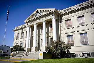
Elko County is a county in the northeastern corner of Nevada, United States. As of the 2020 census, the population was 53,702. Its county seat is Elko. The county was established on March 5, 1869, from Lander County.

Elko is the largest city in and county seat of Elko County, Nevada, United States. With a 2020 population of 20,564, Elko is currently growing at a rate of 0.31% annually and its population has increased by 11.86% since the 2010 Census, which recorded a population of 18,297. Elko serves as the economic hub of the Ruby Valley, a region with a population of over 55,000. Elko is 21 miles (34 km) from Lamoille Canyon and the Ruby Mountains, dubbed the Swiss Alps of Nevada, providing year round access to recreation including hiking, skiing, hunting, and more than 20 alpine lakes. The city straddles the Humboldt River. Spring Creek, Nevada, serves as a bedroom community 6 miles (9.7 km) from the city with a population of 13,805.

Spring Creek is a census-designated place (CDP) in central Elko County, in northeastern Nevada in the western United States. It mainly serves as a bedroom community for the businesses and industries in and around the nearby city of Elko. It is part of the Elko Micropolitan Statistical Area. The population was 12,361 at the 2010 census.

The Humboldt–Toiyabe National Forest (HTNF) is the principal U.S. National Forest in the U.S. state of Nevada, and has a smaller portion in Eastern California. With an area of 6,289,821 acres (25,454.00 km2), it is the largest U.S. National Forest outside of Alaska.
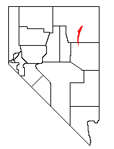
The Ruby Mountains are a mountain range, primarily located within Elko County with a small extension into White Pine County, in Nevada, United States. Most of the range is included within the Humboldt-Toiyabe National Forest. The range reaches a maximum elevation of 11,387 feet (3,471 m) on the summit of Ruby Dome. To the north is Secret Pass and the East Humboldt Range, and from there the Rubies run south-southwest for about 80 miles (130 km). To the east lies Ruby Valley, and to the west lie Huntington and Lamoille Valleys. The Ruby Mountains are the only range of an introduced bird, the Himalayan snowcock, in North America.

Lamoille is a rural census-designated place in Elko County in the northeastern section of the state of Nevada in the western United States. As of the 2020 census it had a population of 276. It is located 19 miles (31 km) southeast of Elko at the base of the Ruby Mountains at an elevation of 5,889 feet (1,795 m) and is part of the Elko Micropolitan Statistical Area.
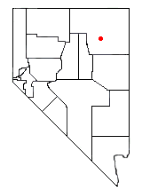
Lamoille Canyon is the largest valley in the Ruby Mountains, located in the central portion of Elko County in the northeastern section of the state of Nevada, in the western United States. Approximately 12 miles (19 km) in length, it was extensively sculpted by glaciers in previous ice ages.

Dollar Lakes are a group of three glacial tarns in the Ruby Mountains of Elko County, Nevada, United States. They are within the Ruby Mountains Ranger District of the Humboldt-Toiyabe National Forest. The lakes are located near the head of Lamoille Canyon at approximately 40°35′30″N115°23′6″W, and at an elevation of 9,626 feet (2,934 m). They have a combined area of approximately 3 acres, and an estimated depth of up to 15 feet (4.6 m). The Ruby Crest National Recreation Trail runs along the western shore of the lakes.
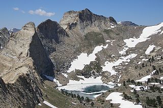
Verdi Lake is a glacial tarn in the Ruby Mountains of Elko County, Nevada, United States. It is within the Ruby Mountains Wilderness, which is administered by the Ruby Mountains Ranger District of the Humboldt-Toiyabe National Forest. The lake is located at the head of Talbot Canyon at approximately 40°38.9′N115°21.2′W, and at an elevation of 10,184 feet (3,104 m). Directly to the south rises Verdi Peak. It has an area of approximately 6 acres, and a depth of up to 86 feet (26 m).

Lamoille Lake is a glacial tarn in the Ruby Mountains of Elko County, Nevada, United States. It is within the Ruby Mountains Ranger District of the Humboldt-Toiyabe National Forest. The lake is located at the head of Lamoille Canyon, at approximately 40°34.6′N115°23.7′W, and at an elevation of 9,747 feet. It has an area of approximately 13.6 acres. It is a popular destination for day hikers and fishing, as the Ruby Crest National Recreation Trail passes its eastern shore before beginning a steep climb to Liberty Pass.

Island Lake is a glacial tarn in the Ruby Mountains of Elko County, Nevada, United States. It is within the Ruby Mountains Ranger District of the Humboldt-Toiyabe National Forest. The lake is a hanging valley at the end of a 2-mile (3.2 km) trail that begins at a parking lot at the end of Lamoille Canyon Road. The lake surface is 9,665 feet (2,946 m) above sea level, about 910 feet (280 m) above the parking lot.
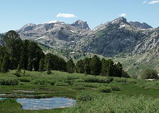
The Ruby Mountains Wilderness is a protected wilderness area in the Ruby Mountains of Elko County, Nevada, United States. It covers an area of approximately 90,000 acres (36,000 ha), and is administered by the Humboldt–Toiyabe National Forest.

Thomas Peak is the second highest named mountain in both the Ruby Mountains and Elko County, in Nevada, United States. It is the thirty-fourth highest mountain in the state. The peak is located about 24 miles (39 km) southeast of the city of Elko in the Ruby Mountains Wilderness, within the Ruby Mountains Ranger District of the Humboldt-Toiyabe National Forest. One of the most voluminous mountains in the range, its base makes up most of the east wall of Thomas Canyon, as well as the west wall of the long curved section of upper Lamoille Canyon.

Mount Fitzgerald is the fourth-highest named mountain in the Ruby Mountains and the fifth-highest in Elko County, in the U.S. state of Nevada. It is the thirty-ninth-highest mountain in the state. It rises from the heads of both Thomas and Right Fork Canyons, and is also part of the north wall of Box Canyon, making it a true glacial horn. The summit is a high-level ridge and is located about 24 miles (39 km) southeast of the community of Elko, within the Ruby Mountains Wilderness of the Ruby Mountains Ranger District in the Humboldt-Toiyabe National Forest.
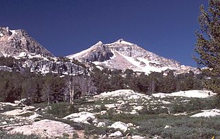
Liberty Peak is the name given to the officially unnamed mountain peak west of Liberty Pass in the Ruby Mountains of Elko County, Nevada, United States. It is located within the Ruby Mountains Wilderness of the Humboldt-Toiyabe National Forest. The peak rises from the head of Lamoille Canyon, and is a major part of the view at the Road's End Trailhead. To the southeast are Liberty Lake and Kleckner Canyon, while to the northwest is Box Canyon. It is located about 26 miles (42 km) southeast of the community of Elko.

The Verdi Peaks, officially just Verdi Peak, are a group of three mountain peaks in the Ruby Mountains of Elko County, Nevada, United States. The highest peak is the fiftieth-highest in the state. The peaks are located on the edge of the Ruby Mountains Wilderness, within the Ruby Mountains Ranger District of the Humboldt-Toiyabe National Forest. They rise from the head of Talbot Canyon above Verdi Lake, and are a prominent part of the east wall of Lamoille Canyon above the Terraces Picnic Area. The two southern summits are directly on the Ruby Crest 5,000 feet (1,500 m) above the Ruby Valley to the east. The central summit is the highest of the three and is located about 25 miles (40 km) southeast of the city of Elko.

Snow Lake Peak is the fifth-highest named mountain of the Ruby Mountains and the seventh highest in Elko County, in Nevada, United States. It is the forty-second-highest mountain in the state. It rises from the head of Box Canyon, is part of the headwall of Thomas Canyon, and is a prominent part of the west wall of Lamoille Canyon above Lamoille and Dollar Lakes. The peak is located within the Ruby Mountains Wilderness of the Ruby Mountains Ranger District in the Humboldt-Toiyabe National Forest.

Mount Gilbert is the sixth-highest named mountain of the Ruby Mountains and the eighth-highest in Elko County, in Nevada, United States. It is the forty-third-highest mountain in the state. The peak is a spectacular part of the view from State Route 227 in Lamoille Valley, rising over 5,300 feet (1,620 m) above the valley floor at Lamoille. It rises from the head of Seitz Canyon, and is part of the west wall of Right Fork Canyon. The summit is a high glacial horn, located about 22 miles (35 km) southeast of the community of Elko within the Ruby Mountains Ranger District of the Humboldt-Toiyabe National Forest.

List of Registered Historic Places in Elko County, Nevada, USA:
Lamoille Canyon Road, also known as Lamoille Canyon Scenic Byway, is a 12-mile-long (19 km) National Forest Scenic Byway in Elko County, Nevada in the western United States. The road traverses Lamoille Canyon in the Ruby Mountains of northeastern Nevada, and it is administered by the Ruby Mountains Ranger District of the Humboldt-Toiyabe National Forest.


