Les Lilas

Last updated • 1 min readFrom Wikipedia, The Free Encyclopedia
Les Lilas
Mairielilas1.JPG
Les Lilas town hall
Blason Les Lilas 93.svg
Les Lilas map.svg
Paris and inner ring departments
Location of Les Lilas
Les Lilas
France location map-Regions and departements-2016.svg
Red pog.svg
Les Lilas
Ile-de-France region location map.svg
Red pog.svg
Les Lilas
Coordinates: 48°53′N2°25′E / 48.88°N 2.42°E / 48.88; 2.42 Coordinates: 48°53′N2°25′E / 48.88°N 2.42°E / 48.88; 2.42
Country France
Region Île-de-France
Department Seine-Saint-Denis
Arrondissement Bobigny
Canton Bagnolet
Intercommunality Grand Paris
Government
  Mayor (20202026) Lionel Benharous [1]
Area
1
1.26 km2 (0.49 sq mi)
Population
 (Jan. 2019) [2]
23,447
  Density19,000/km2 (48,000/sq mi)
Time zone UTC+01:00 (CET)
  Summer (DST) UTC+02:00 (CEST)
INSEE/Postal code
93045 /93260
1 French Land Register data, which excludes lakes, ponds, glaciers > 1 km2 (0.386 sq mi or 247 acres) and river estuaries.

Les Lilas (French pronunciation:  [le lila] ( Loudspeaker.svg listen )) is a commune in the northern-eastern suburbs of Paris, France. It is located 5.7 km (3.5 mi) from the centre of Paris.

Contents

History

The commune of Les Lilas (literally "the lilacs") was created on 24 July 1867 by detaching a part of the territory of Romainville and merging it with a part of the territory of Pantin and a part of the territory of Bagnolet.

Heraldry

Arms of Les Lilas Blason Les Lilas 93.svg
Arms of Les Lilas
The arms of Les Lilas are blazoned  :
Or fretty vert, semy (in the spaces) of lilacs proper.

motto : J'étais fleur, je suis cité (Once a flower, now a city)


Population

Historical population
YearPop.±% p.a.
1872 3,699    
1876 4,411+4.50%
1881 5,690+5.22%
1886 5,887+0.68%
1891 6,417+1.74%
1896 7,438+3.00%
1901 8,925+3.71%
1906 10,470+3.24%
1911 11,654+2.17%
1921 14,599+2.28%
1926 18,109+4.40%
1931 19,500+1.49%
YearPop.±% p.a.
1936 19,467−0.03%
1946 17,685−0.96%
1954 18,590+0.63%
1962 17,721−0.60%
1968 15,817−1.88%
1975 20,054+3.45%
1982 20,354+0.21%
1990 20,118−0.15%
1999 20,226+0.06%
2007 22,324+1.24%
2012 22,920+0.53%
2017 23,045+0.11%
Source: EHESS [3] and INSEE (1968-2017) [4]

Transport

Les Lilas is served by Mairie des Lilas station on Paris Métro Line 11.

Notable residents

Les Lilas is known for the hit 1958 song by Serge Gainsbourg, "Le Poinçonneur des Lilas", about a ticket puncher at the Porte des Lilas Métro station. This Métro station is actually in Paris, one stop away from the Mairie des Lilas Métro station which is in Les Lilas.

Education

Primary schools: [5]

Public secondary schools:

There is also a public library, Bibliothèque André-Malraux. [8]

See also

Related Research Articles

Saint-Cyr-lÉcole Commune in Île-de-France, France

Saint-Cyr-l'École is a commune in the western suburbs of Paris, France. It is located 21.4 km (13.3 mi) from the centre of Paris.

Bondy Commune in Île-de-France, France

Bondy is a commune in the northeastern suburbs of Paris, France. It is located 10.9 km (6.8 mi) from the centre of Paris.

Pantin Commune in Île-de-France, France

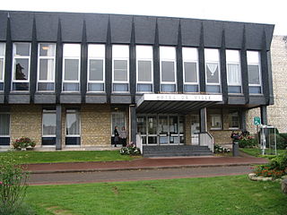
Pantin is a commune in the northeastern suburbs of Paris, France. It is located 6.4 km (4.0 mi) from the centre of Paris. In 2019 its population was estimated to be 59,846. Pantin is located on the edge of the city of Paris and is mainly formed by a plain crossed by national roadway 2 and 3, the Paris–Strasbourg railway line and the canal de l'Ourcq.

Bagneux, Hauts-de-Seine Administrative division of Paris, France

Bagneux is a commune in the Hauts-de-Seine department, in the southern suburbs of Paris, France. It is located 7.7 km (4.8 mi) from the center of Paris.

Orly Commune in Île-de-France, France

Orly is a commune in the southern suburbs of Paris, Île-de-France. It is located 12.7 km (7.9 mi) from the center of Paris.

Bagnolet Commune in Île-de-France, France

Bagnolet is a commune in the eastern suburbs of Paris, France. It is located 5.2 km (3.2 mi) from the center of Paris.

Fresnes, Val-de-Marne Commune in Île-de-France, France

Fresnes is a commune in the Val-de-Marne department in the southern suburbs of Paris, France. It is located 11.2 km (7.0 mi) from the center of Paris, next to Antony, Sceaux and Rungis. It is drained by the River Bièvre.

Clichy-sous-Bois Commune in Île-de-France, France

Clichy-sous-Bois is a commune in the eastern suburbs of Paris, France. It is located 15 kilometres (9.3 mi) from central Paris.

Alfortville Commune in Île-de-France, France

Alfortville is a commune in the Val-de-Marne department in the southeastern suburbs of Paris, France. It is located 7.6 km (4.7 mi) from the center of Paris.

Nogent-sur-Marne Subprefecture and commune in Île-de-France, France

Nogent-sur-Marne is a commune in the eastern suburbs of Paris, France. It is located 10.6 km (6.6 mi) from the centre of Paris. Nogent-sur-Marne is a sous-préfecture of the Val-de-Marne département, being the seat of the Arrondissement of Nogent-sur-Marne.

Romainville Commune in Île-de-France, France

Romainville is a commune in the Seine-Saint-Denis department and in the eastern suburbs of Paris, France.

Villeneuve-la-Garenne Commune in Île-de-France, France

Villeneuve-la-Garenne is a commune in the northern suburbs of Paris, France. It is located 9.2 km (5.7 mi) from the center of Paris in the Hauts-de-Seine department in the Île-de-France region.

Dugny Commune in Île-de-France, France

Dugny is a commune in the northeastern suburbs of Paris, France. It is located 12.4 km (7.7 mi) from the centre of Paris.

Chelles, Seine-et-Marne Commune in Île-de-France, France

Chelles is a commune in the eastern suburbs of Paris, France. It is located in the Seine-et-Marne department in the Île-de-France region 18 km (11 mi) from the center of Paris.

Le Chesnay Part of Le Chesnay-Rocquencourt in Île-de-France, France

Le Chesnay is a former commune in the Yvelines department in the Île-de-France region in north-central France. On 1 January 2019, it was merged into the new commune Le Chesnay-Rocquencourt. It is located in the western suburbs of Paris, 16.7 km (10.4 mi) from the center of Paris.

Le Perreux-sur-Marne Commune in Île-de-France, France

Le Perreux-sur-Marne is a commune in the Val-de-Marne department in the eastern suburbs of Paris, France. It is located 11.7 km (7.3 mi) from the center of Paris.

Saint-Maurice, Val-de-Marne Commune in Île-de-France, France

Saint-Maurice is a commune in the southeastern suburbs of Paris, France. It is located 6.8 km (4.2 mi) from the center of Paris. The insane asylum Charenton was located in Saint-Maurice; it is now a psychiatric hospital.

Bonneuil-sur-Marne Commune in Île-de-France, France

Bonneuil-sur-Marne is a commune in the Val-de-Marne department in the southeastern suburbs of Paris, France. It is located 13.4 km (8.3 mi) from the center of Paris.

Limeil-Brévannes Commune in Île-de-France, France

Limeil-Brévannes is a commune in the southeastern suburbs of Paris, France. It is located 15.3 km (9.5 mi) from the center of Paris.

Saint-Thibault-des-Vignes Commune in Île-de-France, France

Saint-Thibault-des-Vignes is a commune in the Seine-et-Marne department in the Île-de-France region in north-central France.

References

  1. "Répertoire national des élus: les maires". data.gouv.fr, Plateforme ouverte des données publiques françaises (in French). 2 December 2020.
  2. "Populations légales 2019". The National Institute of Statistics and Economic Studies. 29 December 2021.
  3. Des villages de Cassini aux communes d'aujourd'hui: Commune data sheet Les Lilas, EHESS. (in French)
  4. Population en historique depuis 1968, INSEE
  5. "Annuaire." Les Lilas. Retrieved on September 9, 2016.
  6. "Collège Marie-Curie." Les Lilas. Retrieved on September 9, 2016.
  7. "Lycée polyvalent Paul-Robert." Les Lilas. Retrieved on September 9, 2016.
  8. "Bibliothèque André-Malraux." Les Lilas. Retrieved on September 9, 2016.