List of international lakes

Last updated

Heaven Lake China North Korea Baitou Mountain Tianchi.jpg
Heaven Lake Flag of the People's Republic of China.svg  China Flag of North Korea.svg  North Korea

Lakes with international borders include

Africa

RiverBordering countries
Lake Abbe Flag of Djibouti.svg  Djibouti/Flag of Ethiopia.svg  Ethiopia
Lake Albert Flag of the Democratic Republic of the Congo.svg  Democratic Republic of the Congo/Flag of Uganda.svg  Uganda
Lake Chad Flag of Cameroon.svg  Cameroon/Flag of Chad.svg  Chad/Flag of Niger.svg  Niger/Flag of Nigeria.svg  Nigeria
Lake Chew Bahir Flag of Ethiopia.svg  Ethiopia/Flag of Kenya.svg  Kenya
Lake Chiuta Flag of Malawi.svg  Malawi/Flag of Mozambique.svg  Mozambique
Lake Cohoha Flag of Burundi.svg  Burundi/Flag of Rwanda.svg  Rwanda
Lake Edward Flag of the Democratic Republic of the Congo.svg  Democratic Republic of the Congo/Flag of Uganda.svg  Uganda
Lake Fianga Flag of Cameroon.svg  Cameroon/Flag of Chad.svg  Chad
Lake Kariba Flag of Zambia.svg  Zambia/Flag of Zimbabwe.svg  Zimbabwe
Lake Kivu Flag of the Democratic Republic of the Congo.svg  Democratic Republic of the Congo/Flag of Rwanda.svg  Rwanda
Lake Malawi (Lake Nyasa in Tanzania and Lago Niassa in Mozambique)Flag of Malawi.svg  Malawi/Flag of Mozambique.svg  Mozambique/Flag of Tanzania.svg  Tanzania
Lake Mweru Flag of the Democratic Republic of the Congo.svg  Democratic Republic of the Congo/Flag of Zambia.svg  Zambia
Lake Nasser (Arabic: بحيرة ناصر Boħēret Nāṣer; Sudanese: Lake Nubia)Flag of Egypt.svg  Egypt/Flag of Sudan.svg  Sudan
Lake Rweru Flag of Burundi.svg  Burundi/Flag of Rwanda.svg  Rwanda
Lake Sélingué (artificial lake)Flag of Mali.svg  Mali/Flag of Guinea.svg  Guinea
Lake Tanganyika Flag of Tanzania.svg  Tanzania/Flag of the Democratic Republic of the Congo.svg  Democratic Republic of the Congo/Flag of Burundi.svg  Burundi/Flag of Zambia.svg  Zambia
Lake Turkana Flag of Ethiopia.svg  Ethiopia/Flag of Kenya.svg  Kenya
Lake Victoria Flag of Kenya.svg  Kenya/Flag of Tanzania.svg  Tanzania/Flag of Uganda.svg  Uganda

Asia

RiverBordering countries
Ayke Flag of Kazakhstan.svg  Kazakhstan/ Flag of Russia.svg  Russia
Aral Sea Flag of Kazakhstan.svg  Kazakhstan/ Flag of Uzbekistan.svg  Uzbekistan
Barun-Torey Lake Flag of Mongolia.svg  Mongolia/ Flag of Russia.svg  Russia
Botkul Flag of Kazakhstan.svg  Kazakhstan/ Flag of Russia.svg  Russia
Buir Lake Flag of the People's Republic of China.svg  China/ Flag of Mongolia.svg  Mongolia
Caspian Sea Flag of Azerbaijan.svg  Azerbaijan/ Flag of Iran.svg  Iran/ Flag of Kazakhstan.svg  Kazakhstan/ Flag of Russia.svg  Russia/ Flag of Turkmenistan.svg  Turkmenistan
Dead Sea Flag of Israel.svg  Israel/ Flag of Jordan.svg  Jordan
Heaven Lake (Chosŏn'gŭl: 천지, Ch'ŏnji or Cheonji; Chinese: 天池, Tiānchí; Manchu: Tamun omo or Tamun juce)Flag of the People's Republic of China.svg  China/ Flag of North Korea.svg  North Korea
Kartsakhi Lake (Georgian: კარწახის ტბა, karts'akhis tba), or Lake Khozapini (Georgian: ხოზაფინის ტბა, khozap'inis tba; Turkish: Hazapin Gölü), or Lake Aktaş (Turkish: Aktaş Gölü)Flag of Georgia.svg  Georgia/ Flag of Turkey.svg  Turkey
Lake Khanka (Russian: о́зеро Ха́нка) or Lake Xingkai (simplified Chinese: 兴凯湖; traditional Chinese: 興凱湖; pinyin: Xīngkǎi Hú)Flag of the People's Republic of China.svg  China/ Flag of Russia.svg  Russia
Pangong Tso or Pangong Lake (Tibetan: སྤང་གོང་མཚོ, Wylie: spang gong mtsho; Hindi: पांगोंग त्सो; Chinese: 班公错; pinyin: Bāngōng Cuò)Flag of the People's Republic of China.svg  China/ Flag of India.svg  India
Sabkhat Matti (dry)Flag of the United Arab Emirates.svg  United Arab Emirates/ Flag of Saudi Arabia.svg  Saudi Arabia
Sarygamysh Lake Flag of Uzbekistan.svg  Uzbekistan/ Flag of Turkmenistan.svg  Turkmenistan
Supung Lake (artificial)Flag of the People's Republic of China.svg  China/ Flag of North Korea.svg  North Korea
Tore-Khol Lake Flag of Mongolia.svg  Mongolia/ Flag of Russia.svg  Russia
Uvs Lake Flag of Mongolia.svg  Mongolia/ Flag of Russia.svg  Russia
Zorkul Flag of the Taliban.svg  Afghanistan/ Flag of Tajikistan.svg  Tajikistan

Europe

RiverBordering country
Båvrojávrre Flag of Norway.svg  Norway/ Flag of Sweden.svg  Sweden
Bilećko Lake Flag of Bosnia and Herzegovina.svg  Bosnia and Herzegovina/ Flag of Montenegro.svg  Montenegro
Lac des Brenets (Swiss name) or Lac de Chaillexon (French name)Flag of Switzerland (Pantone).svg  Switzerland/ Flag of France.svg  France
Lake Constance Flag of Switzerland (Pantone).svg  Switzerland/ Flag of Germany.svg  Germany/ Flag of Austria.svg  Austria
Cuciurgan Reservoir (artificial lake)Flag of Moldova.svg  Moldova/ Flag of Ukraine.svg  Ukraine
Doiran Lake or Doiran Lake (Macedonian: Дојранско Езеро, Dojransko Ezero; Greek: Λίμνη Δοϊράνη, Límni Dhoïráni)Flag of Greece.svg  Greece/ Flag of North Macedonia.svg  North Macedonia
Lake Drūkšiai or Lake Drysviaty, Lake Drysvyaty, Drisvyaty (Belarusian: Дрысвяты; Russian: Дрисвяты)Flag of Belarus.svg  Belarus/ Flag of Lithuania.svg  Lithuania
Gaładuś Lake (Lithuanian: Galadusys)Flag of Lithuania.svg  Lithuania/ Flag of Poland.svg  Poland
Gautelisvatnet Flag of Norway.svg  Norway/ Flag of Sweden.svg  Sweden
Lake Geneva Flag of Switzerland (Pantone).svg  Switzerland/ Flag of France.svg  France
Great St Bernard Lake Flag of Switzerland (Pantone).svg  Switzerland/ Flag of Italy.svg  Italy
Gresvatnet Flag of Norway.svg  Norway/ Flag of Sweden.svg  Sweden
Holderen Flag of Norway.svg  Norway/ Flag of Sweden.svg  Sweden
Lake Kilpisjärvi Flag of Finland.svg  Finland/ Flag of Sweden.svg  Sweden
Kingen Flag of Norway.svg  Norway/ Flag of Sweden.svg  Sweden
Kjårdavatnet Flag of Norway.svg  Norway/ Flag of Sweden.svg  Sweden
Klistervatnet Flag of Norway.svg  Norway/ Flag of Russia.svg  Russia
Langvatnet Flag of Norway.svg  Norway/ Flag of Sweden.svg  Sweden
Lago di Lei (artificial lake)Flag of Italy.svg  Italy/ Flag of Switzerland (Pantone).svg  Switzerland
Leinavatn Flag of Norway.svg  Norway/ Flag of Sweden.svg  Sweden
Leirvatnet Flag of Norway.svg  Norway/ Flag of Sweden.svg  Sweden
Litlumvatnet Flag of Norway.svg  Norway/ Flag of Sweden.svg  Sweden
Lago di Livigno Flag of Switzerland (Pantone).svg  Switzerland/ Flag of Italy.svg  Italy
Lake Lugano Flag of Switzerland (Pantone).svg  Switzerland/ Flag of Italy.svg  Italy
Lake Maggiore Flag of Switzerland (Pantone).svg  Switzerland/ Flag of Italy.svg  Italy
Lough Melvin Flag of the United Kingdom.svg  United Kingdom/ Flag of Ireland.svg  Ireland
Lac de Moron Flag of France.svg  France/ Flag of Switzerland (Pantone).svg  Switzerland
Narva Reservoir (artificial lake)Flag of Estonia.svg  Estonia/ Flag of Russia.svg  Russia
Lake Neusiedl (German: Neusiedler See) or Fertő (Hungarian: Fertő tó; Croatian: Nežidersko jezero, Niuzaljsko jezero; Slovene: Nežidersko jezero; Slovak: Neziderské jazero)Flag of Austria.svg  Austria/ Flag of Hungary.svg  Hungary
Nowe Warpno Bay (Polish: Zatoka Nowowarpieńska)Flag of Germany.svg  Germany/ Flag of Poland.svg  Poland
Lake Nuijamaa Flag of Finland.svg  Finland/ Flag of Russia.svg  Russia
Lake Ohrid Flag of Albania.svg  Albania/ Flag of North Macedonia.svg  North Macedonia
Onkamojärvi Flag of Albania.svg  Albania/ Flag of North Macedonia.svg  North Macedonia
Lake Ormož Flag of Croatia.svg  Croatia/ Flag of Slovenia.svg  Slovenia
Överuman Flag of Finland.svg  Finland/ Flag of Russia.svg  Russia
Lake Peipus (Estonian: Peipsi|-Pihkva järv; Russian: Псковско|-Чудское озеро, lit. 'Pskovsko|-Chudskoe lake', German: Peipussee)Flag of Estonia.svg  Estonia/ Flag of Russia.svg  Russia
Pitelis Flag of Latvia.svg  Latvia/ Flag of Russia.svg  Russia
Lake Prespa Flag of Albania.svg  Albania/ Flag of Greece.svg  Greece/ Flag of North Macedonia.svg  North Macedonia
Small Prespa Lake Flag of Albania.svg  Albania/ Flag of Greece.svg  Greece
Pyhäjärvi Flag of Finland.svg  Finland/ Flag of Russia.svg  Russia
Rannasee or Rannastausee (artificial)Flag of Austria.svg  Austria/ Flag of Germany.svg  Germany
Ranseren or Bije|-Ransarn (Swedish) or Bijjie Raentsere (Southern Sami)Flag of Norway.svg  Norway/ Flag of Sweden.svg  Sweden
Rengen Flag of Norway.svg  Norway/ Flag of Sweden.svg  Sweden
Rogen Flag of Norway.svg  Norway/ Flag of Sweden.svg  Sweden
Rostojávri Flag of Norway.svg  Norway/ Flag of Sweden.svg  Sweden
Siiddašjávri Flag of Norway.svg  Norway/ Flag of Sweden.svg  Sweden
Lake Skadar (Montenegrin: Skadarsko jezero, Скадарско језеро; Albanian: Liqeni i Shkodrës, ) — or Lake Scutari, Lake Shkodër and Lake ShkodraFlag of Albania.svg  Albania/ Flag of Montenegro.svg  Montenegro
Stora Le Flag of Norway.svg  Norway/ Flag of Sweden.svg  Sweden
Svanevatn Flag of Norway.svg  Norway/ Flag of Russia.svg  Russia
Szczecin Lagoon or Stettin Lagoon, Bay of Szczecin, Stettin Bay (Polish: Zalew Szczeciński, German: Stettiner Haff), also Oder lagoon (German: Oderhaff)Flag of Germany.svg  Germany/ Flag of Poland.svg  Poland
Unna Guovdelisjávri Flag of Norway.svg  Norway/ Flag of Sweden.svg  Sweden
Lake Virmayarvi Flag of Finland.svg  Finland/ Flag of Russia.svg  Russia
Lake Vištytis (Lithuanian: Vištyčio ežeras, German: Wystiter See, Russian: Виштынецкое озеро)Flag of Lithuania.svg  Lithuania/ Flag of Russia.svg  Russia
Vuolep Sårjåsjávrre Flag of Norway.svg  Norway/ Flag of Sweden.svg  Sweden

North America

RiverState/ProvinceBordering country
Lake Champlain (French: Lac Champlain; Abenaki: Pitawbagok; Mohawk: Kaniatarakwà:ronte)Flag of Quebec.svg  Quebec /Flag of Vermont.svg  Vermont/ Flag of New York.svg  New York Flag of Canada (Pantone).svg  Canada Flag of the United States (23px).png  United States
Lake Erie Flag of Ontario.svg  Ontario /Flag of Michigan.svg  Michigan/Flag of Ohio.svg  Ohio/Flag of Pennsylvania.svg  Pennsylvania/ Flag of New York.svg  New York
Lake Huron Flag of Ontario.svg  Ontario / Flag of Michigan.svg  Michigan
Lake Memphremagog (French: Lac Memphrémagog)Flag of Quebec.svg  Quebec / Flag of Vermont.svg  Vermont
Lake Ontario Flag of Ontario.svg  Ontario / Flag of New York.svg  New York
Lake St. Clair Flag of Ontario.svg  Ontario / Flag of Michigan.svg  Michigan
Lake Superior (French: lac Supérieur; Ojibwe: ᑭᑦᒉᐁ-ᑲᒣᐁ, romanized: Gitchi-Gami)Flag of Ontario.svg  Ontario / Flag of Minnesota.svg  Minnesota/Flag of Wisconsin.svg  Wisconsin / Flag of Michigan.svg  Michigan
Beau Lake Flag of Quebec.svg  Quebec/Flag of Maine.svg  Maine
Boundary Lake Flag of Manitoba.svg  Manitoba/Flag of North Dakota.svg  North Dakota
Chiputneticook Lakes (consisting of East Grand Lake, North Lake, Mud Lake, Spednic Lake, and Palfrey Lake)Flag of New Brunswick.svg  New Brunswick/Flag of Maine.svg  Maine
East Grand Lake Flag of New Brunswick.svg  New Brunswick /Flag of Maine.svg  Maine
Hanging Lake Flag of British Columbia.svg  British Columbia/Flag of Washington.svg  Washington
Lake Koocanusa (artificial)Flag of British Columbia.svg  British Columbia/Flag of Montana.svg  Montana
Lake of the Woods Flag of Ontario.svg  Ontario / Flag of Manitoba.svg  Manitoba/Flag of Minnesota.svg  Minnesota
Osoyoos Lake Flag of British Columbia.svg  British Columbia/Flag of Washington.svg  Washington
Rainy Lake Flag of Minnesota.svg  Minnesota/ Flag of Ontario.svg  Ontario
Ross Lake Flag of British Columbia.svg  British Columbia/Flag of Washington.svg  Washington
Saganaga Lake Flag of Ontario.svg  Ontario /Flag of Minnesota.svg  Minnesota
Spednic Lake Flag of New Brunswick.svg  New Brunswick/Flag of Maine.svg  Maine
Waterton Lake Flag of Alberta.svg  Alberta/Flag of Montana.svg  Montana
Amistad National Recreation Area Flag of Tamaulipas.svg  Tamaulipas/Flag of Texas.svg  Texas Flag of Mexico.svg  Mexico Flag of the United States (23px).png  United States
Etang Saumâtre Flag of Haiti.svg  Haiti Flag of the Dominican Republic.svg  Dominican Republic
Falcon International Reservoir (artificial)Flag of Coahuila.svg  Coahuila /Flag of Texas.svg  Texas Flag of Mexico.svg  Mexico Flag of the United States (23px).png  United States
Lake Güija Flag of El Salvador.svg  El Salvador Flag of Guatemala.svg  Guatemala
Simpson Bay Lagoon Flag of France.svg  Saint Martin / Flag of Sint Maarten.svg  Sint Maarten Flag of France.svg  France Flag of the Netherlands.svg  Netherlands

South America

RiverBordering countries
Cami Lake Flag of Argentina.svg  Argentina/ Flag of Chile.svg  Chile
Cochrane/Pueyrredón Lake Flag of Argentina.svg  Argentina/ Flag of Chile.svg  Chile
La Gaiba Lake (Span. Laguna La Gaiba)Bandera de Bolivia (Estado).svg  Bolivia/ Flag of Brazil.svg  Brazil
General Carrera Lake (Argentine side: Lake Buenos Aires)Flag of Argentina.svg  Argentina/ Flag of Chile.svg  Chile
Mandioré Lake (Spanish: Laguna Mandioré)Bandera de Bolivia (Estado).svg  Bolivia/ Flag of Brazil.svg  Brazil
Marfil Lake (Baia Grande)Bandera de Bolivia (Estado).svg  Bolivia/ Flag of Brazil.svg  Brazil
Lagoon Mirim Flag of Brazil.svg  Brazil/ Flag of Uruguay.svg  Uruguay
Mirim Lake / Lagoon Mirim Bandera de Bolivia (Estado).svg  Bolivia/ Flag of Brazil.svg  Brazil
O'Higgins/San Martín Lake Flag of Argentina.svg  Argentina/ Flag of Chile.svg  Chile
Lake Parinacota Bandera de Bolivia (Estado).svg  Bolivia/ Flag of Peru.svg  Peru
Suches Lake or Lago SuchesBandera de Bolivia (Estado).svg  Bolivia/ Flag of Peru.svg  Peru
Lake Titicaca Bandera de Bolivia (Estado).svg  Bolivia/ Flag of Peru.svg  Peru
Uberaba Lake Bandera de Bolivia (Estado).svg  Bolivia/ Flag of Brazil.svg  Brazil
Vintter Lake or Palena Lake (Arg.: Lago Palena)Flag of Argentina.svg  Argentina/ Flag of Chile.svg  Chile

See also

Commons-logo.svg Media related to International lakes at Wikimedia Commons
Contents

Related Research Articles

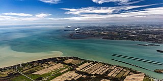
<span class="mw-page-title-main">Detroit River</span> River connecting Lake Huron with Lake Erie

The Detroit River flows west and south for 24 nautical miles from Lake St. Clair to Lake Erie as a strait in the Great Lakes system. The river divides the metropolitan areas of Detroit, Michigan, and Windsor, Ontario—an area collectively referred to as Detroit–Windsor—and forms part of the border between Canada and the United States. The Ambassador Bridge, the Detroit–Windsor Tunnel, and the Michigan Central Railway Tunnel connect the cities.
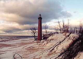
<span class="mw-page-title-main">Lower Peninsula of Michigan</span> Michigan in the United States

The Lower Peninsula of Michigan – also known as Lower Michigan – is the larger, southern and less elevated of the two major landmasses that make up the U.S. state of Michigan; the other being the Upper Peninsula, which is separated by the Straits of Mackinac. It is surrounded by water on all sides except its southern border, which it shares with Indiana and Ohio. Although the Upper Peninsula is commonly referred to as "the U.P.", it is uncommon for the Lower Peninsula to be called "the L.P."
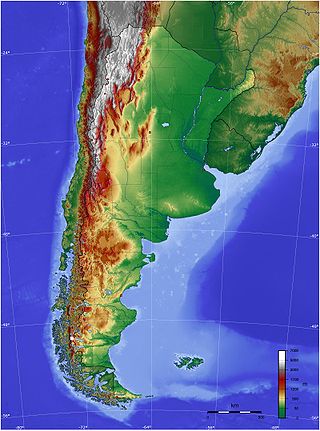
<span class="mw-page-title-main">Geography of Argentina</span>

The geography of Argentina is heavily diverse, consisting of the Andes Mountains, pampas, and various rivers and lakes. Bordered by the Andes in the west and the South Atlantic Ocean to the east, its neighbouring countries are Chile to the west, Bolivia and Paraguay to the north, and Brazil and Uruguay to the northeast.

<span class="mw-page-title-main">Red River of the North</span> River in the United States and Canada

The Red River, also called the Red River of the North to differentiate it from the Red River in the south of the continent, is a river in the north-central United States and central Canada. Originating at the confluence of the Bois de Sioux and Otter Tail rivers between the U.S. states of Minnesota and North Dakota, it flows northward through the Red River Valley, forming most of the border of Minnesota and North Dakota and continuing into Manitoba. It empties into Lake Winnipeg, whose waters join the Nelson River and ultimately flow into Hudson Bay.
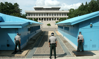
<span class="mw-page-title-main">Border</span> Geographic boundaries of political entity

Borders are usually defined as geographical boundaries, imposed either by features such as oceans and terrain, or by political entities such as governments, sovereign states, federated states, and other subnational entities. Political borders can be established through warfare, colonization, or mutual agreements between the political entities that reside in those areas.

<span class="mw-page-title-main">Canada–United States border</span> International border in North America

The Canada–United States border is the longest international border in the world. The boundary is 8,891 km (5,525 mi) long. The land border has two sections: Canada's border with the contiguous United States to its south, and with the U.S. state of Alaska to its west. The bi-national International Boundary Commission deals with matters relating to marking and maintaining the boundary, and the International Joint Commission deals with issues concerning boundary waters. The agencies responsible for facilitating legal passage through the international boundary are the Canada Border Services Agency (CBSA) and U.S. Customs and Border Protection (CBP).

<span class="mw-page-title-main">Rainy River (Minnesota–Ontario)</span> River forming part of the border between Ontario (Canada) and Minnesota (US)

The Rainy River is a river, approximately 137 miles (220 km) long, forming part of the Canada–United States border separating Northwestern Ontario and northern Minnesota.

<span class="mw-page-title-main">Connecticut Lakes</span> Group of four lakes in northern New Hampshire, United States

The Connecticut Lakes are a group of lakes in Coos County, northern New Hampshire, United States, situated along the headwaters of the Connecticut River. They are accessed via the northernmost segment of U.S. Route 3, between the village of Pittsburg and the Canada port of entry south of Chartierville, Quebec. The lakes are located within the boundaries of Pittsburg, but are far from the town center. Connecticut Lakes State Forest adjoins them.

<span class="mw-page-title-main">International border states of the United States</span> States in the U.S. that border either Canada, Mexico, Cuba, or Russia

The international border states are those states in the U.S. that border either the Bahamas, Canada, Cuba, Mexico, or Russia. With a total of eighteen of such states, thirteen lie on the U.S.–Canada border, four lie on the U.S.–Mexico border, and one has maritime borders with Cuba and The Bahamas.

<span class="mw-page-title-main">Area code 218</span> Area code for northern Minnesota

Area code 218 is a telephone area code in the North American Numbering Plan (NANP) for the northern part of the U.S. state of Minnesota. It is assigned to the largest of Minnesota's original two numbering plan areas (NPAs), although its geographical boundaries have been modified since inception. It comprises roughly the northern half of the state, and includes the cities of Duluth, Hibbing, Brainerd, Bemidji, Fergus Falls, and Moorhead.
<span class="mw-page-title-main">Tripoint</span> Geographical point at which the boundaries of three countries or subnational entities meet

A triple border, tripoint, trijunction, triple point, or tri-border area is a geographical point at which the boundaries of three countries or subnational entities meet. There are 175 international tripoints as of 2020. Nearly half are situated in rivers, lakes or seas. On dry land, the exact tripoints may be indicated by markers or pillars, and occasionally by larger monuments.
<span class="mw-page-title-main">Pohénégamook</span> City in Quebec, Canada

Pohénégamook, Quebec is a Canadian town on the Canada–United States border in Quebec's Témiscouata Regional County Municipality.

<span class="mw-page-title-main">Falcon International Reservoir</span> Hydroelectric reservoir in Tamaulipas, Mexico

Falcon International Reservoir, commonly called Falcon Lake, is a reservoir on the Rio Grande 40 miles (64 km) southeast of Laredo, Texas, United States, and Nuevo Laredo, Tamaulipas, Mexico. The huge lake is bounded by Starr and Zapata Counties on the Texas side of the international border and the municipality and city of Nueva Ciudad Guerrero on the Tamaulipas side. The reservoir was formed by the construction of the Falcon Dam to provide water conservation, irrigation, flood control, and hydroelectricity to the area.

<span class="mw-page-title-main">Territorial evolution of Canada</span>

The history of post-confederation Canada began on July 1, 1867, when the British North American colonies of Canada, New Brunswick, and Nova Scotia were united to form a single Dominion within the British Empire. Upon Confederation, the United Province of Canada was immediately split into the provinces of Ontario and Quebec. The colonies of Prince Edward Island and British Columbia joined shortly after, and Canada acquired the vast expanse of the continent controlled by the Hudson's Bay Company, which was eventually divided into new territories and provinces. Canada evolved into a fully sovereign state by 1982.

<span class="mw-page-title-main">Saint Francis River (Canada–United States)</span> River forming part of the Canada–US boundary

The St. Francis River is a river roughly 75 miles (120 km) long, which forms part of the Canada–United States border. The river rises in a lake of the same name located 12 miles (20 km) east of the Rivière du Loup in Quebec. The portion that forms the boundary starts at the bottom of Lake Pohenegamook at the very northernmost point of New England between Estcourt Station, Maine, and Estcourt, Quebec. The river along the international boundary flows south and then south-east through two deep, narrow lakes to its mouth on the Saint John River at St. Francis, Maine/Saint-François-de-Madawaska, New Brunswick.

<span class="mw-page-title-main">Lake Skadar</span> Lake in Albania and Montenegro

Lake Skadar – also called Lake Scutari, Lake Shkodër and Lake Shkodra – lies on the border of Albania and Montenegro, and is the largest lake in Southern Europe. It is named after the city of Shkodër which lies at its southeastern coast. It is a karst lake.

The Great Lakes Region is one of ten United States regions that currently sends teams to the Little League World Series, the largest youth baseball competition in the world. The region's participation in the LLWS dates back to 1957, when it was known as the Central Region. However, when the LLWS was expanded in 2001 from eight teams to 16 teams, the Central Region was split into the Great Lakes and Midwest Regions.

The Koochiching State Forest is a state forest located near International Falls in Itasca, Koochiching, and Saint Louis counties, Minnesota. The forest borders the Pine Island State Forest to the west, the Big Fork State Forest and George Washington State Forest to the south, the Nett Lake Indian Reservation and the Kabetogama State Forest to the east. A leg of the forest touches Rainy Lake to the north, which forms part of the international border with Ontario. Of the 565,500 acres (2,288 km2), 344,300 acres (1,393 km2) are managed by the Minnesota Department of Natural Resources, making it one of the largest forests in the Minnesota state system.