
The Mississippi River is the primary river of the largest drainage basin in the United States. From its traditional source of Lake Itasca in northern Minnesota, it flows generally south for 2,340 miles (3,766 km) to the Mississippi River Delta in the Gulf of Mexico. With its many tributaries, the Mississippi's watershed drains all or parts of 32 U.S. states and two Canadian provinces between the Rocky and Appalachian mountains. The river either borders or passes through the states of Minnesota, Wisconsin, Iowa, Illinois, Missouri, Kentucky, Tennessee, Arkansas, Mississippi, and Louisiana. The main stem is entirely within the United States; the total drainage basin is 1,151,000 sq mi (2,980,000 km2), of which only about one percent is in Canada. The Mississippi ranks as the world's tenth-largest river by discharge flow, and the largest in North America.

The Illinois Waterway system consists of 336 miles (541 km) of navigable water from the mouth of the Calumet River at Chicago to the mouth of the Illinois River at Grafton, Illinois. Based primarily on the Illinois River, it is a system of rivers, lakes, and canals that provide a shipping connection from the Great Lakes to the Gulf of Mexico via the Illinois and Mississippi rivers.

Melvin Price Locks and Dam is a dam and two locks at river mile 200.78 on the Upper Mississippi River, about 17 miles (27 km) north of Saint Louis, Missouri. The collocated National Great Rivers Museum, explains the structure and its engineering.
Lock and Dam No. 8 is a lock and dam located near Genoa, Wisconsin on the Upper Mississippi River near river mile 679.2 in the United States. It was constructed and was put into operation by April 1937. The site underwent major rehabilitation from 1989 to 2003. The lock and dam are owned and operated by the St. Paul District of the United States Army Corps of Engineers-Mississippi Valley Division.

Lock and Dam No. 9 is an American lock and dam located near Lynxville, Wisconsin and Harpers Ferry, Iowa on the Upper Mississippi River around river mile 647.9. The lower portion of Pool 9 was formally named Lake Winneshiek. The normal pool elevation behind the dam is 620 feet (189.0 m). It was constructed and placed in operation in July 1937. The site underwent a major rehabilitation from 1989 and 2006. The dam consists of concrete structure 811 feet (247.2 m) long with five roller gates and eight tainter gates. Earth embankment 9,800 feet (2,987.0 m) long with a grouted overflow spillway 1,350 feet (411.5 m) long. The lock is 110 feet (33.5 m) wide by 600 feet (182.9 m) long. Lock and Dam No. 9 is located 12 miles upstream from Prairie du Chien, Wisconsin. The lock and dam are owned and operated by the St. Paul District of the United States Army Corps of Engineers-Mississippi Valley Division.

Lock and Dam No. 10 is a lock and dam located in Guttenberg, Iowa on the Upper Mississippi River around river mile 615.0. It was constructed and placed in operation November 1937. The site underwent major rehabilitation 1989—2006. The dam consists of a concrete dam 763 feet (232.6 m) long with four roller gates and eight tainter gates. The earth embankment is 4,223 feet (1,287.2 m) long with a concrete spillway 1,200 feet (365.8 m) long. The lock is 110 feet (33.5 m) wide by 600 feet (182.9 m) long. The lock and dam are owned and operated by the St. Paul District of the United States Army Corps of Engineers-Mississippi Valley Division.

General Zebulon Pike Lock and Dam No. 11 is a lock and dam located between Dubuque, Iowa, and rural Grant County, Wisconsin, on the Upper Mississippi River.

Lock and Dam No. 12 is a lock and dam located on the Upper Mississippi River at Bellevue, Iowa, United States. The movable portion of the dam starts at the locks adjacent to the Iowa shore and is 849 feet (258.8 m) long, consisting of seven tainter gates and three roller gates. It connects to a 200-foot (61.0 m) storage yard and continues toward the Illinois shore with a 2,750-foot (838.2 m) non-submersible dike, a 1,200-foot (365.8 m) submersible dike and a 3,130-foot (954.0 m) non-submersible dike. The non-submersible sections are separated from the submersible section with two 120-foot (36.6 m) transitional dikes. The main lock is 110 feet (33.5 m) wide by 600 feet (182.9 m) long. There is also an incomplete auxiliary lock. In 2004, the facility was listed in the National Register of Historic Places as Lock and Dam No. 12 Historic District, #04000172 covering 1,017 acres (4.1 km2), 1 building, 3 structures, and 4 objects.

Lock and Dam No. 14 is a lock and dam located near LeClaire, Iowa on the Upper Mississippi River above Davenport, Iowa and Moline, Illinois. The movable portion of the dam is 1,343 feet (409.3 m) long and consists of 13 tainter gates and 4 roller gates. Connected to it is a 1,127 feet (343.5 m) long non-submersible rock fill dike which extends to the Illinois side. The main lock is 110 feet (33.5 m) wide by 600 feet (182.9 m) long. The site on the National Register of Historic Places as the Lock and Dam No. 14 Historic District (#04000174) listed in 2004 consisting of 3,043 acres (12.3 km2), 1 building, 6 structures, and 2 objects. It was completed in two phases, the first as part of the six foot channel project from 1921 to 1924, which included a lock and canal bypassing a hazardous rapids. The second phase was part of the nine foot channel project from 1935 to 1939 and included the main dam and the current main lock.

Lock and Dam No. 15 is a lock and dam located on the Upper Mississippi River. It spans the river between Rock Island, Illinois and Davenport, Iowa. Lock and Dam 15 is the largest roller dam in the world, its dam is 1,203 feet (366.7 m) long and consists of nine 109 feet (33.2 m) non-submersible, non-overflow roller gates and two 109 feet (33.2 m) non-submersible overflow roller gates. It is unusual among the upper Mississippi River dams in that it has only roller gates, has different sizes and types of roller gates, it is not perpendicular to the flow of the river and is one of the few facilities that has a completed auxiliary lock. The main lock is 110 feet (33.5 m) wide by 600 feet (180 m) long and its auxiliary lock is 110 feet (34 m) wide by 360 feet (110 m) long. In 2004, the facility was listed in the National Register of Historic Places as Lock and Dam No. 15 Historic District, #04000175 covering 3,590 acres (1,450 ha), 2 buildings, 9 structures, and 1 object.
Lock and Dam No. 16 is a lock and dam located near Muscatine, Iowa on the Upper Mississippi River around river mile 457.2. The movable portion of the dam is 1,315 feet (400.8 m) long and consists of 4 roller gates and 15 Tainter gates. The lock is 110 feet (33.5 m) wide by 600 feet (182.9 m) long with a maximum lift of 9 feet (2.7m) In 2004, the facility was listed in the National Register of Historic Places as Lock and Dam No. 16 Historic District, #04000176 covering 1,024 acres (4.1 km2), 1 building, 5 structures, and 2 objects.

Lock and Dam No. 17 is a lock and dam located near New Boston, Illinois on the Upper Mississippi River near river mile 437. Its main lock is 110 feet (33.5 m) wide and 600 feet (182.9 m) long with its bottom at an elevation of 518 feet (157.9 m). Normal pool elevation behind the dam is 536 feet (163.4 m). The movable portion of the dam is 1,121 feet (341.7 m) long and consists of 3 roller gates and 8 tainter gates. In 2004, the facility was listed in the National Register of Historic Places as Lock and Dam No. 17 Historic District, #04000177 covering 869 acres (3.5 km2), 1 building, 3 structures and 2 objects.

Lock and Dam No. 18 is a lock and dam located near Gladstone, Illinois and Burlington, Iowa on the Upper Mississippi River around river mile 410.5. The movable dam is 1,350 feet (411.5 m) and consists of 3 roller gates and 14 tainter gates. The lock is 110 feet (33.5 m) wide by 600 feet (182.9 m) long. In 2004, the facility was listed in the National Register of Historic Places as Lock and Dam No. 18 Historic District, #04000178 covering 2,049 acres (8.3 km2), 1 building, 4 structures and 4 objects.

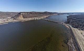
Lock and Dam No. 19 is a lock and dam located on the Upper Mississippi River near Keokuk, Iowa. In 1978, the Keokuk Lock and Dam was listed in the National Register of Historic Places, #78001234. In 2004, the facility was listed in the National Register of Historic Places as Lock and Dam No. 19 Historic District, #04000179 covering 1,605 acres (650 ha), 7 buildings, 12 structures, 1 object. The lock is owned and operated by the U.S. Army Corps of Engineers. The dam is owned and operated by Ameren Missouri.

Lock and Dam No. 20 is a lock and dam located on the Upper Mississippi River, the lock side in Canton, Missouri and the dam crossing to Meyer, Illinois.

Lock and Dam No. 21 is a lock and dam located at Quincy, Illinois on the Upper Mississippi River around river mile 324.9. The movable portion of the dam is 1,265 feet (385.6 m) long and consists of three roller gates and ten tainter gates. A 1,400 feet (426.7 m) long submersible dike continues to the Missouri shore. The main lock is 110 feet (33.5 m) wide by 600 feet (182.9 m) long and there is also an incomplete auxiliary lock. In 2004, the facility was listed in the National Register of Historic Places as Lock and Dam No. 21 Historic District, #04000181 covering 1,075 acres (4.4 km2), 1 building, 4 structures, 4 objects.

Lock and Dam No. 22 is a lock and dam located near Saverton, Missouri, on the Upper Mississippi River around river mile 301.2. The movable portion of the dam is 1,224 feet (373.1 m) long and consists of three roller gates and ten tainter gates. A 1,600 feet (487.7 m) long submersible earthen dike extends to a flood control levee on the Illinois shore. The main lock is 110 feet (33.5 m) wide by 600 feet (182.9 m) long; there is also an incomplete auxiliary lock. In 2004, the facility was listed in the National Register of Historic Places as Lock and Dam No. 22 Historic District, #04000182 covering 1,268 acres (5.1 km2), 1 building, 5 structures, 4 objects.

Lock and Dam No. 24 is a lock and dam located near Clarksville, Missouri around river mile 273.4 on the Upper Mississippi River. The main lock is 110 feet (33.5 m) wide and 600 feet (182.9 m) long with its bottom at an elevation of 430 feet. The auxiliary lock is not operational. Normal pool elevation behind the dam is 449 feet. The movable portion of the dam is 1,340 feet (408.4 m) long and consists of 15 submersible, elliptical, tainter gates. A 2,720 feet (829.1 m) submersible earthen dike extends from the movable dam to the Illinois shore. In 2004, the facility was listed in the National Register of Historic Places as Lock and Dam No. 24 Historic District, #04000183 covering 1,027 acres (4.2 km2), 3 buildings, 15 structures, 4 objects.

Lock and Dam No. 25 is a lock and dam located near Winfield, Missouri, on the Upper Mississippi River around river mile 241.4. The movable portion of the dam is 1,296 feet (395.0 m) long and consists of three roller gates and 14 tainter gates. A 2,566 feet (782.1 m) submersible dike extends to the Illinois shore. A 5 miles (8.0 km) long dike is part of the facility extending upstream on the Missouri side of the river. The main lock is 110 feet (33.5 m) wide by 600 feet (182.9 m) long. In 2004, the facility was listed in the National Register of Historic Places as Lock and Dam No. 25 Historic District, #04000184 covering 3,164 acres (12.8 km2), 2 buildings, 7 structures, 2 objects.

Starved Rock Lock and Dam, also known as Lock and Dam No. 6, is a lock and dam facility managed by the U.S. Army Corps of Engineers along the Illinois River, near Starved Rock. It is part of the Illinois Waterway and was constructed between 1926 and 1933. The lock and dam was added to the National Register of Historic Places as the Starved Rock Lock and Dam Historic District in 2004.


