McBride, Michigan

Last updated

McBride, Michigan
Montcalm County Michigan Incorporated and Unincorporated areas McBride Highlighted.svg
Location in Montcalm County and the state of Michigan
Coordinates: 43°21′07″N85°02′39″W / 43.35194°N 85.04417°W / 43.35194; -85.04417
Country United States
State Michigan
County Montcalm
Township Day
Area
[1]
  Total0.39 sq mi (1.00 km2)
  Land0.39 sq mi (1.00 km2)
  Water0.00 sq mi (0.00 km2)
Elevation
[2]
958 ft (292 m)
Population
 (2020) [3]
  Total189
  Density487.11/sq mi (188.28/km2)
Time zone UTC-5 (Eastern (EST))
  Summer (DST) UTC-4 (EDT)
ZIP code
48852
FIPS code 26-50000 [4]
GNIS feature ID2399284 [2]

McBride is a village in Montcalm County in the U.S. state of Michigan. The population was 189 at the 2020 census. [3] The village is located within Day Township. The post office for the village, with ZIP code 48852, is named "McBrides" and provides P.O. box service to the village. [5]

Contents

History

The village is named for Alexander B. McBride, a settler from Wayne County, New York, who built a sawmill there in 1874. A railroad station was named "McBride's Mill", while the post office named "McBrides" opened on March 26, 1878, with McBride as the first postmaster. The village was platted by D. L. Jacobs in 1877. An adjacent settlement was platted with the name "Custer" by Phipps Wado on April 2, 1878, but it became a part of McBride when that village was incorporated in 1883. [6]

Geography

McBride is in northeastern Montcalm County, 6 miles (10 km) by road northeast of Stanton, the county seat, and 4 miles (6 km) south of Edmore. According to the U.S. Census Bureau, the village has a total area of 0.39 square miles (1.01 km2), all land. [1]

Demographics

Historical population
CensusPop.Note
1890 333
1900 289−13.2%
1910 236−18.3%
1920 220−6.8%
1930 204−7.3%
1940 186−8.8%
1950 22319.9%
1960 26518.8%
1970 2722.6%
1980 252−7.4%
1990 236−6.3%
2000 232−1.7%
2010 205−11.6%
2020 189−7.8%
U.S. Decennial Census [7]

2010 census

As of the census [8] of 2010, there were 205 people, 83 households, and 52 families residing in the village. The population density was 539.5 inhabitants per square mile (208.3/km2). There were 97 housing units at an average density of 255.3 per square mile (98.6/km2). The racial makeup of the village was 98.0% White, 0.5% Asian, and 1.5% from two or more races. Hispanic or Latino of any race were 1.0% of the population.

There were 83 households, of which 32.5% had children under the age of 18 living with them, 49.4% were married couples living together, 9.6% had a female householder with no husband present, 3.6% had a male householder with no wife present, and 37.3% were non-families. 33.7% of all households were made up of individuals, and 14.4% had someone living alone who was 65 years of age or older. The average household size was 2.47 and the average family size was 3.02.

The median age in the village was 39.4 years. 28.8% of residents were under the age of 18; 8.4% were between the ages of 18 and 24; 23% were from 25 to 44; 24.9% were from 45 to 64; and 15.1% were 65 years of age or older. The gender makeup of the village was 50.7% male and 49.3% female.

2000 census

As of the census [4] of 2000, there were 232 people, 86 households, and 63 families residing in the village. The population density was 642.3 inhabitants per square mile (248.0/km2). There were 94 housing units at an average density of 260.3 per square mile (100.5/km2). The racial makeup of the village was 98.71% White, 0.43% Native American, and 0.86% from two or more races.

There were 86 households, out of which 37.2% had children under the age of 18 living with them, 58.1% were married couples living together, 11.6% had a female householder with no husband present, and 26.7% were non-families. 24.4% of all households were made up of individuals, and 11.6% had someone living alone who was 65 years of age or older. The average household size was 2.70 and the average family size was 3.11.

In the village, the population was spread out, with 25.0% under the age of 18, 9.9% from 18 to 24, 30.2% from 25 to 44, 20.7% from 45 to 64, and 14.2% who were 65 years of age or older. The median age was 34 years. For every 100 females, there were 87.1 males. For every 100 females age 18 and over, there were 83.2 males.

The median income for a household in the village was $30,568, and the median income for a family was $30,694. Males had a median income of $25,000 versus $18,214 for females. The per capita income for the village was $13,376. About 8.2% of families and 18.8% of the population were below the poverty line, including 18.3% of those under the age of eighteen and 28.0% of those 65 or over.

Related Research Articles

<span class="mw-page-title-main">Stevensville, Michigan</span> Village in Michigan, United States

Stevensville is a village in Berrien County in the U.S. state of Michigan. The village lies within Lincoln Township. The population was 1,147 at the 2020 census.

<span class="mw-page-title-main">Athens, Michigan</span> Village in Michigan, United States

Athens is a village in Calhoun County in the U.S. state of Michigan. The population was 936 at the 2020 census. The village is located in southern Athens Township, and is part of the Battle Creek, Michigan Metropolitan Statistical Area. It was settled in 1831.

<span class="mw-page-title-main">Tekonsha, Michigan</span> Village in Michigan, United States

Tekonsha is a village in Tekonsha Township, Calhoun County in the U.S. state of Michigan. It is part of the Battle Creek, Michigan Metropolitan Statistical Area. The population was 653 at the 2020 census.

<span class="mw-page-title-main">Eagle, Michigan</span> Village in Michigan, United States

Eagle is a village in southwest Clinton County in the U.S. state of Michigan. The population was 122 at the 2020 census. The village is within Eagle Township in the southwest corner of the county. It is near Interstate 96 about 15 miles (24 km) northwest of Lansing.

<span class="mw-page-title-main">Maple Rapids, Michigan</span> Village in Michigan, United States

Maple Rapids is a village in Clinton County in the U.S. state of Michigan. The population was 672 at the 2010 census. The village is located in Essex Township about 10 miles (16.1 km) northwest of St. Johns. A portion of the village is within the Maple River State Game Area.

<span class="mw-page-title-main">Pellston, Michigan</span> Village in Michigan, United States

Pellston is a village in Emmet County in the U.S. state of Michigan. The population was 822 at the 2010 census. The village is the home of Pellston Regional Airport.

<span class="mw-page-title-main">Camden, Michigan</span> Village in Michigan, United States

Camden is a village in Hillsdale County in the U.S. state of Michigan. The population was 496 at the 2020 census. The village is located within Camden Township.

<span class="mw-page-title-main">North Adams, Michigan</span> Village in Michigan, United States

North Adams is a village in Hillsdale County in the U.S. state of Michigan. The population was 452 at the 2020 census. The village is located within Adams Township.

<span class="mw-page-title-main">Copper City, Michigan</span> Village in Michigan, United States

Copper City is a village in Houghton County of the U.S. state of Michigan. The population was 187 at the 2020 census. The village is within Calumet Township. With an area of 0.08 square miles (0.21 km2), it is the second-smallest incorporated municipality by area in the state of Michigan after the nearby village of Ahmeek.

<span class="mw-page-title-main">Carson City, Michigan</span> City in Michigan, United States

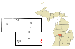
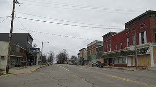
Carson City is a city in Montcalm County of the U.S. state of Michigan. The population was 1,120 at the 2020 census.

Cato Township is a civil township of Montcalm County in the U.S. state of Michigan. The population was 2,898 at the 2020 census.

Day Township is a civil township of Montcalm County in the U.S. state of Michigan. As of the 2020 census, the township population was 1,141.

<span class="mw-page-title-main">Lakeview, Michigan</span> Village in Michigan, United States

Lakeview is a village in Cato Township in Montcalm County of the U.S. state of Michigan. The population was 1,024 at the 2020 census.

<span class="mw-page-title-main">Pierson, Michigan</span> Village in Michigan, United States

Pierson is a village in Montcalm County of the U.S. state of Michigan. The population was 229 at the 2020 census, up from 172 in 2010. The village is within Pierson Township.

Pine Township is a civil township of Montcalm County in the U.S. state of Michigan. The population was 1,870 according to the 2020 census.

Reynolds Township is a civil township of Montcalm County in the U.S. state of Michigan. The population was 5,431 at the 2020 census.

<span class="mw-page-title-main">Spring Lake, Michigan</span> Village in Michigan, United States

Spring Lake is a village in Ottawa County in the U.S. state of Michigan. The population was 2,497 at the 2020 census. The village is located within Spring Lake Township; the two share a ZIP code.

<span class="mw-page-title-main">Melvin, Michigan</span> Village in Michigan, United States

Melvin is a village in Sanilac County in the U.S. state of Michigan. The population was 148 at the 2020 census. The village is within Speaker Township, and is located within the Thumb Region of Michigan.

<span class="mw-page-title-main">Vernon, Michigan</span> Village in Michigan, United States

Vernon is a village in Shiawassee County in the U.S. state of Michigan. The population was 783 at the 2010 census. The village is located within Vernon Township.

<span class="mw-page-title-main">Otter Lake, Michigan</span> Village in Michigan, United States

Otter Lake is a village in the U.S. state of Michigan. The village is split between Marathon Township in Lapeer County to the east and Forest Township in Genesee County to the west. The population was 426 at the 2020 census.

References

  1. 1 2 "2023 U.S. Gazetteer Files: Michigan". United States Census Bureau. Retrieved November 16, 2023.
  2. 1 2 U.S. Geological Survey Geographic Names Information System: McBride, Michigan
  3. 1 2 "P1. Race – McBride village, Michigan: 2020 DEC Redistricting Data (PL 94-171)". U.S. Census Bureau. Retrieved November 16, 2023.
  4. 1 2 "U.S. Census website". United States Census Bureau . Retrieved January 31, 2008.
  5. ZIP Code Lookup, United States Post Office
  6. Romig, Walter (1986) [1973]. Michigan Place Names. Detroit, Michigan: Wayne State University Press. ISBN   0-8143-1838-X.
  7. "Census of Population and Housing". Census.gov. Retrieved June 4, 2015.
  8. "U.S. Census website". United States Census Bureau . Retrieved November 25, 2012.