Milford, Illinois | |
---|---|
Coordinates: 40°37′42″N87°41′46″W / 40.62833°N 87.69611°W | |
Country | United States |
State | Illinois |
County | Iroquois |
Township | Milford |
Area | |
• Total | 0.67 sq mi (1.74 km2) |
• Land | 0.67 sq mi (1.74 km2) |
• Water | 0.00 sq mi (0.00 km2) |
Elevation | 669 ft (204 m) |
Population (2020) | |
• Total | 1,158 |
• Density | 1,725.78/sq mi (666.24/km2) |
ZIP code | 60953 |
Area code | 815 |
FIPS code | 17-49048 |
Website | https://www.villageofmilfordil.com/ |
Milford is a village in Milford Township, Iroquois County, Illinois, United States. The population was 1,306 at the 2010 census. [2] The village's name comes from its location, where the Old Hubbard Trail forded Sugar Creek and where a gristmill stood in 1836 ("the mill at the ford").
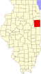
Milford is located in southeastern Iroquois County along Illinois Route 1, which leads north 12 miles (19 km) to Watseka, the county seat, and south the same distance to Hoopeston in Vermilion County. The Indiana border is 9 miles (14 km) east of Milford via county roads.
According to the 2010 census, Milford has a total area of 0.64 square miles (1.66 km2), all land. [3] Sugar Creek flows westward along the southern edge of the village, before turning north to flow to the Iroquois River near Watseka. It is part of the Kankakee River watershed.
Census | Pop. | Note | %± |
---|---|---|---|
1870 | 230 | — | |
1880 | 612 | 166.1% | |
1890 | 957 | 56.4% | |
1900 | 1,077 | 12.5% | |
1910 | 1,316 | 22.2% | |
1920 | 1,466 | 11.4% | |
1930 | 1,442 | −1.6% | |
1940 | 1,628 | 12.9% | |
1950 | 1,648 | 1.2% | |
1960 | 1,699 | 3.1% | |
1970 | 1,656 | −2.5% | |
1980 | 1,716 | 3.6% | |
1990 | 1,512 | −11.9% | |
2000 | 1,369 | −9.5% | |
2010 | 1,306 | −4.6% | |
2020 | 1,158 | −11.3% | |
U.S. Decennial Census [4] |
As of the census [5] of 2000, there were 1,369 people, 616 households, and 391 families residing in the village. The population density was 2,166.8 inhabitants per square mile (836.6/km2). There were 666 housing units at an average density of 1,054.1 units per square mile (407.0 units/km2). The racial makeup of the village was 99.20% White, 0.44% from other races, and 0.37% from two or more races. Hispanic or Latino of any race were 1.90% of the population.
There were 616 households, out of which 24.7% had children under the age of 18 living with them, 52.6% were married couples living together, 7.8% had a female householder with no husband present, and 36.4% were non-families. 32.3% of all households were made up of individuals, and 16.7% had someone living alone who was 65 years of age or older. The average household size was 2.22 and the average family size was 2.81.
In the village, the population was spread out, with 20.4% under the age of 18, 7.5% from 18 to 24, 25.8% from 25 to 44, 23.6% from 45 to 64, and 22.7% who were 65 years of age or older. The median age was 43 years. For every 100 females, there were 97.8 males. For every 100 females age 18 and over, there were 92.9 males.
The median income for a household in the village was $30,109, and the median income for a family was $40,750. Males had a median income of $29,583 versus $19,453 for females. The per capita income for the village was $19,078. About 4.1% of families and 7.2% of the population were below the poverty line, including 7.6% of those under age 18 and 8.7% of those age 65 or over.
Milford High School, which also brings in students from nearby communities of Stockland, Wellington and Sheldon, fields varsity level teams in; golf, baseball, softball, football, volleyball, cheer leading, and basketball. Teams play under the nickname "Bearcats" (boys) and "Lady Cats" (girls).
Football cooperative agreements: In the spring of 2009 it was announced that Cissna Park and Milford would form a high school football cooperative to become more competitive. Previously, the football program had co-oped with Sheldon (from 1993 through Sheldon's becoming part of the Milford school district) and Donovan (in 1997 and 1998).
Gymnasium: The school was also one of few nationally to feature a carpeted gym floor used for varsity level basketball and volleyball. The carpet was removed in the summer of 1997 and replaced by a plastic surface manufactured by Sport Court.
Night Football: The Bearcat football team took part in the first night football game in America. The contest took place on September 21, 1928, in Westville IL. Westville won the game 26–6. This is recognized by the Illinois High School Association as the first "modern" football game played under lights.
Iroquois County is a county located in the northeast part of the U.S. state of Illinois. According to the 2020 United States Census, it has a population of 27,077. It is the only county in the United States named Iroquois. The county seat is Watseka. The county is located along the border with Indiana.
Ashkum is a village in Ashkum Township, Iroquois County, Illinois, United States. The population was 761 at the 2010 census.
Beaverville is a village in Beaverville Township, Iroquois County, Illinois, United States. The population was 362 at the 2010 census.
Chebanse is a village in Iroquois and Kankakee counties in the U.S. state of Illinois. The population was 1,044 at the 2020 census. The Kankakee County portion of Chebanse is included in the Kankakee-Bradley, Illinois Metropolitan Statistical Area.
Cissna Park is a village in Pigeon Grove Township, Iroquois County, Illinois, United States. The population was 846 at the 2010 census.
Clifton is a village in Chebanse Township, Iroquois County, Illinois, United States. The population was 1,468 at the 2010 census, up from 1,317 at the 2000 census.
Crescent City is a village in Iroquois and Crescent townships, Iroquois County, Illinois, United States. The population was 615 at the 2010 census.
Donovan is a village in Beaver Township, Iroquois County, Illinois, United States. The population was 304 at the 2010 census.
Gilman is a city in Douglas Township, Iroquois County, Illinois, United States. The population was 1,738 at the 2020 census.
Iroquois is a village in Concord Township, Iroquois County, Illinois, United States, along the Iroquois River. As of the 2010 census the population was 154, down from 207 at the 2000 census.
Loda is a village in Loda Township, Iroquois County, Illinois, United States. As of the 2010 census its population was 407.
Martinton is a village in Martinton Township, Iroquois County, Illinois, United States. The population was 381 at the 2010 census.
Onarga is a village in Onarga Township, Iroquois County, Illinois, United States. The population was 1,368 at the 2010 census, down from 1,438 at the 2000 census.
Papineau is a village in Papineau Township, Iroquois County, Illinois, United States. The population was 171 at the 2010 census.
Sheldon is a village in Sheldon Township, Iroquois County, Illinois, United States. The population was 1,070 at the 2010 census, down from 1,232 at the 2000 census.
Thawville is a village in Ridgeland Township, Iroquois County, Illinois, United States. The population was 241 at the 2010 census. The town is 100 miles (160 km) south of Chicago.
Watseka is a city in and the county seat of Iroquois County, Illinois, United States. It is located approximately 15 miles (24 km) west of the Illinois-Indiana state line on U.S. Route 24.
Wellington is a village in Lovejoy Township, Iroquois County, Illinois, United States. The population was 242 at the 2010 census.
Woodland is a village in Belmont Township, Iroquois County, Illinois, United States. The population was 324 as of the 2010 census.
Westville is a village in Georgetown Township, Vermilion County, Illinois, United States. It is part of the Danville, Illinois Metropolitan Statistical Area. The population was 3,202 at the 2010 census, and 2,990 in 2018.