
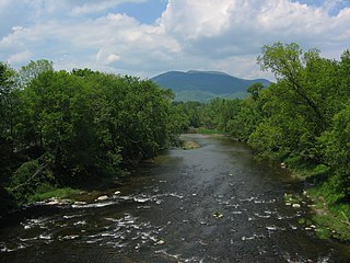
Wells is a town in Hamilton County, New York, United States. The population was 674 at the 2010 census. The town is named after Joshua Wells, a land agent, who built the first mills in the area. It is in the Adirondack Park and on the eastern border of the county. It is northwest of Schenectady.
Mount Ascutney is a monadnock located in southern Vermont. With a summit elevation of about 3144 feet, it is the second-highest peak in Windsor County, Vermont. Particularly noteworthy about Ascutney are its granite outcrops, one of which, near its peak, serves as a launching point for hang-gliders. The mountain is very steep, and its trails traverse a Vermont state forest.

Mount Foraker is a 17,400-foot (5,304 m) mountain in the central Alaska Range, in Denali National Park, 14 mi (23 km) southwest of Denali. It is the second highest peak in the Alaska Range, and the third highest peak in the United States. It rises almost directly above the standard base camp for Denali, on a fork of the Kahiltna Glacier also near Mount Hunter in the Alaska Range.

Mount Frissell, 2,454 feet (748 m), located on the border of southwest Massachusetts and northwest Connecticut, is a prominent peak of the Taconic Range.

Blue Ridge Mountain, also known as Blue Mountain, is the colloquial name of the westernmost ridge of the Blue Ridge Mountains in northern Virginia and the Eastern Panhandle of West Virginia. The Appalachian Trail traverses the entire length of the mountain along its western slope and crest.

Mount Duval, a large forested mountain of the New England Range, part of the Great Dividing Range, is located on the Northern Tablelands in the New England region of New South Wales, Australia.

Glencliff is an unincorporated community within the White Mountain National Forest in the town of Warren in Grafton County, New Hampshire, United States. The village consists of fewer than one hundred residents and some forty man-made structures, including the Willing Workers Hall, the Glencliff Community Chapel, the old firefighter's garage, the Glencliff Improvement Cooperative, the post office and the Glencliff Home for the Elderly.
Mount Gulaga, also Gulaga, and formerly known as Mount Dromedary, a mountain located in the south coast region of New South Wales, Australia, rises above the village of Central Tilba and is within the Gulaga National Park. At its highest point, it measures 806 metres (2,644 ft) above sea level.
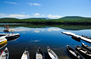
Lake Tarleton is a 334-acre (1.35 km2) water body located in Grafton County on the western edge of the White Mountains in New Hampshire, United States. The lake is located in the towns of Piermont and Warren. Water from Lake Tarleton flows via Eastman Brook west to the Connecticut River.

Mount Tomah is a locality and a mountain that is located in the Blue Mountains region of the state of New South Wales, Australia. The locality is known for the Blue Mountains Botanic Garden on the Bells Line of Road.

Mount Warren is located in the Wind River Range in the U.S. state of Wyoming. The peak is the third peak in the range and the fourth tallest in Wyoming. The summit is located in the Fitzpatrick Wilderness of Shoshone National Forest and rises above several glaciers, the best known being Dinwoody Glacier which is immediately north of the summit tower. The mountain abuts, but is not within, either Bridger National Forest or Sublette County, Wyoming.

Mount Odin is a mountain in Qikiqtaaluk, Nunavut, Canada. It is located in Auyuittuq National Park along the Akshayuk Pass, 46 km (29 mi) north of Pangnirtung and south of Mount Asgard. Mount Odin is the highest mountain on Baffin Island.

Alander Mountain, 2,239 feet (682 m), is a prominent peak of the south Taconic Mountains; it is located in southwest Massachusetts and adjacent New York. Part of the summit is grassy and open and part is covered with scrub oak and shrubs; the sides of the mountain are wooded with northern hardwood tree species. Views from the top include the southern Taconic Mountains, the Hudson River Valley including the Catskills. Several trails traverse Alander Mountain, most notably the 15.7 mi (25.3 km) South Taconic Trail, which passes just beneath the summit.

Mount Race, 2,365 feet (721 m), is a prominent peak in the south Taconic Mountains of Massachusetts. The mountain is known for its waterfalls, steep, eastern ridgeline cliff face and expansive views of the Housatonic River valley and Berkshires to the east and of fellow Taconics to the south, west and north and Catskills and Hudson River valley to the west, for the traverse of the said cliffline and the summit grounds by the Appalachian Trail and for its old growth pitch pine and scrub oak summit ecosystem.
Round Mountain, 2,296 feet (700 m), located on the border of southwest Massachusetts and northwest Connecticut, is a prominent peak of the Taconic Range. The peak and southern slopes of the mountain are within Connecticut; the northern slope lies within Massachusetts.
Mount Mohepinoke is a mountain in Warren County, New Jersey. The summit rises to 1,115 feet (340 m), and is located in Liberty Township, with lower levels extending into White Township. It is part of the New York–New Jersey Highlands of the Appalachian Mountains, although somewhat isolated to the west of the main body of the Highlands.

Mount Crawford is a locality in the Mount Lofty Ranges of South Australia. It is named after the mountain of the same name in its boundaries.

Mount Warren is a 3,362-metre (11,030-foot) mountain summit located at the southeast end of Maligne Lake in Jasper National Park, in the Canadian Rockies of Alberta, Canada. Mount Warren is often seen in the background of iconic calendar photos of Spirit Island and Maligne Lake. The mountain rises 1,690 metres (5,540 ft) in less than 4 kilometres (2.5 mi) from the lake giving it dramatic local relief. Mount Warren is situated at the northwest edge of the Brazeau Icefield, and its nearest higher peak is Mount Brazeau, 2.26 kilometres to the southeast. Monkhead is a lower secondary summit to the northwest of the true summit.


